Browsing: Difference between revisions
Harry Wood (talk | contribs) (→Linking to Maps: The layers are now populated along with other URL params when you click the 'view' tab) |
|||
| Line 28: | Line 28: | ||
===Linking to Maps=== |
===Linking to Maps=== |
||
You can link to any map display using a URL of the form: |
You can link to any map display using a URL of the form: |
||
<nowiki>http://www.openstreetmap.org/index.html?lat=</nowiki>''[Latitude]''&lon=''[Longitude]''&zoom=''[Zoom Level]''&layers=''[Layer code]'' |
|||
To get such a URL for the map you are looking at, just '''click the 'View' tab''' at the top. This populates your browser address bar with the URL, which you can then share with others by copying & pasting into emails, online forums/blog comments etc. |
To get such a URL for the map you are looking at, just '''click the 'View' tab''' at the top. This populates your browser address bar with the URL, which you can then share with others by copying & pasting into emails, online forums/blog comments etc. |
||
The URL form shown above will produce a map centred on the specified latitude and longitude. It is also possible to get a map that displays everything within a given bounding box: |
|||
<nowiki>http://www.openstreetmap.org/index.html?minlat=</nowiki>''[Min Latitude]''&maxlat=''[Max Latitude]''&minlon=''[Min Longitude]''&maxlon=''[Max Longitude]''&layers=''[Layer code]'' |
|||
===Adding a Marker=== |
===Adding a Marker=== |
||
Revision as of 11:40, 30 August 2007
The following is Help Documentation concerning basic browsing of OpenStreetMap
Browsing the Map
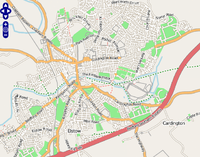
Browse OpenStreetMap on the openstreetmap.org homepage. This viewer allows you to zoom in and scroll around our world map.
To zoom in click the plus icon in the top-left corner. This will zoom towards the center of the currently displayed map. You can also zoom in with your mouse's scroll wheel, by double-clicking on the map or by holding down the shift key and dragging a box over the area you want to zoom in on.
To zoom out click the minus icon in the top-left corner or use your mouse's scroll wheel.
To pan and scroll around simply drag the map with your mouse.
You will see a general coastal layout of countries at high zoom levels, but as you zoom in, you can find roads which we have mapped out from GPS tracks. To jump straight to some of our more interesting/complete streetmaps see the 'Places' page.
Finding Places
Enter the name of a town/city/road in the search box appearing beside the map - see Search for more information.
You may find it more interesting/convenient to follow links to Places which we have mapped.
Mapnik / Osmarender Layers
You can switch between two different "layers" offering different views of the same mapping data. Do this by clicking the '+' icon in the top right.
The "Mapnik" layer is the default, "Osmarender" is an alternative. The styles look quite different. Which is better, is often a matter of personal preference. These views are rendered in very different ways. See renderer documentation on the Mapnik and Osmarender pages for more technical details. Note that because of the different rendering approaches, one layer may be more out-of-date compared to another (recently mapped roads not showing up)
Linking to Maps
You can link to any map display using a URL of the form:
http://www.openstreetmap.org/index.html?lat=[Latitude]&lon=[Longitude]&zoom=[Zoom Level]&layers=[Layer code]
To get such a URL for the map you are looking at, just click the 'View' tab at the top. This populates your browser address bar with the URL, which you can then share with others by copying & pasting into emails, online forums/blog comments etc.
The URL form shown above will produce a map centred on the specified latitude and longitude. It is also possible to get a map that displays everything within a given bounding box:
http://www.openstreetmap.org/index.html?minlat=[Min Latitude]&maxlat=[Max Latitude]&minlon=[Min Longitude]&maxlon=[Max Longitude]&layers=[Layer code]
Adding a Marker
Use mlat and mlon in the same way as above and a marker should appear. The map will be centred on the marker unless you have also specified the centre of the map with the lat and lon parameters.
What next?
Once you've looked around our maps, you may be interested in Editing them, or various other ways of Getting Involved
You may also be interested in Using OpenStreetMap data/images.
Browser Problems and alternative map browsing options
If the maps are not showing up on the openstreetmap.org homepage for you, there are a couple of alternatives.
There is a similar interface running at: http://informationfreeway.org/ This is offers different layer options. Because this is running a slightly different version of the slippy map software, you may find it runs better.
A more simplistic interface is running at : http://dev.openstreetmap.org/~ojw/Browse/ This has no advanced javascript/AJAX involved, and so is more likely to run trouble-free on less advanced browser (e.g. mobile devices) or behind restrictive firewalls.
Technical Details
Technical details about this map 'browsing' interface, are found on the "Slippy Map" page
