Sv:Map Features: Difference between revisions
| Line 181: | Line 181: | ||
{{Map_Features:tracktype |
{{Map_Features:tracktype |
||
|name= |
|name= |
||
|description=Används för att mer i detalj precisera landsvägar ({{Tag|highway|track}}) utanför tätbebyggt område. |
|description=Används för att mer i detalj precisera landsvägar ({{Tag|highway|track}}) utanför tätbebyggt område.<br /> |
||
För beskrivning av t.ex. skogsvägar rekommenderas {{Tag|highway|path}}. |
|||
|head:key=Nyckelord |
|head:key=Nyckelord |
||
|head:value=Värde |
|head:value=Värde |
||
Revision as of 18:30, 18 October 2009
Template:Language-Map Features
När kartorna på OpenStreetMap ritas specificerar man mer än bara hur världen ligger. För exempelvis vägar räcker det inte med vägens sträckning utan det måste också till information om vilken typ av väg det är. Om den är bara för hästar, cyklister eller om det går att köra bil och lastbil där. Eftersom kartorna sträcker sig över landsgränserna är det viktigt att den här extra informationen blir så likartad som möjligt. En motorväg i England har ju i mångt och mycket samma egenskaper som en i Sverige.
Den här informationen läggs på som så kallade attribut på noder, vägar och areor (se Sv:Elements). Det finns inga hårda regler om vilka attribut som skall användas, men för att det skall fungera som beskrivet ovan är det viktigt att använda vissa fastställda konventioner. Utöver dessa är det tillåtet att lägga till ytterligare information om man själv anser den relevant och viktig.
När man lägger till egen sådan information kan det dock vara bra att tänka på att informationen måste ha en rimlig livslängd. Att lägga in tidtabeller för bussar eller information om väglag är troligen en dålig idé. Däremot kan det vara bra att lägga in information om begränsningar i vikt för ett fordon eller information om att en isväg kan finnas under rätta väderbetingelser.
Nedan följer en beskrivning av attribut med svenska beskrivningar så att vi kan få en gemensam uppfattning om hur vägar skall märkas. En komplett version av denna information finns tills vidare endast på engelska på sidan Map Features.
Vägar
Svenska vägtyper och deras märkning
Följande tabell visar den minsta gemensamma märkningen som är lämplig för ett antal olika typer av vägar. Utöver de kombinationer av nyckel/värde som finns i tabellen finns ett stort antal andra, av vilka några beskrivs i tabeller längre ner på sidan. För övriga hänvisas till de engelska versionerna.
En väg märks efter hur viktig den är. Då det inte finns något exakt mått på vilka vägar som är "viktigast", så utgår man från att en europaväg är viktigare än en riksväg som är viktigare än en länsväg som i sin tur är viktigare än övriga vägar. Där man känner att just för den här vägen blir det alldeles för låg klass är det dock tillåtet att flytta upp den. Exempelvis vägen från E 4 in till kommunhuvudorten Robertsfors är inte ens länsväg, men då den förutom E 4 är en av de viktigaste vägarna i kommunen kan den därför ändå sättas till primary.
| Kategori | Svensk term | key=highway | key=name | key=ref |
|---|---|---|---|---|
| Väg mellan städer | ||||
| Motorväg | value=motorway | Europavägsnummer (v=E 18) | ||
| Europaväg | value=trunk | Ex. Blå vägen | Vägnummer (v=E 6) | |
| Riksväg | value=primary | Ex. Holmsundsvägen | Vägnummer (v=26) | |
| Länsväg | value=secondary | Ex. Ersmarksvägen | Vägnummer (v=186) | |
| Övrig allmän väg | value=tertiary | Länsbokstav+vägnummer (v=O500) | ||
| Enskild väg | value=unclassified | |||
| Väg i städer | ||||
| Mellan områden, genomfart | value=secondary | Vägnamn, (v=Söderled) | ||
| I bostadsområde | value=residential | Vägnamn, (v=Rostbrännarvägen) | ||
| I övriga områden | value=unclassified | Vägnamn, (v=Industrivägen) |
Anm. Gränsen mellan tertiary och unclassified diskuteras fortfarande.
Notera att en vägs beteckning anges med ref=* och är densamma längs hela vägen. Namnet anges med name=* och kan variera längs vägen. Exempelvis har E 12:an ref=E 12 från Norge till Ryssland men name=Obbolavägen i Holmsund, name=Västra esplanaden i Umeå och name=Blå vägen i Lycksele. Märk även att trots att vägverket blandar hejvilt så ska det enligt den internationella konventionen vara ett mellanrum mellan E och numret på en europaväg. Ex. E 6 eller E 18. Om en väg tillhör flera olika vägar avgränsas de med semikolon, exempelvis ref=E 4; E 12; 92.
Motortrafikleder, oavsett highway-klassificering, har tillägget motorroad=yes.
Redigerar man vägar som funnits med ett tag kan man se att attributet class används. Detta är ett gammalt system som är ersatt med highway. Passa också på att ta bort märkningen created_by=JOSM eller liknande eftersom det tar onödigt mycket plats i databasen och mest var till för att se om programmet gjorde något fel så man kunde spåra det eller ta bort allt med denna märkning. created_by har inget med vem som har ändrat i databasen, det sparas på annat sätt.
Vedertagna märkningar av vägar (highway)
| Key | Value | Element | Kommentar | Rendering carto | Foto | |
|---|---|---|---|---|---|---|
Vägar | ||||||
|
These are the principal tags for the road network. They range from the most to least important. | ||||||
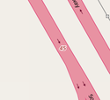
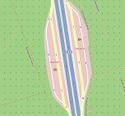
| highway | motorway | Motorvägar med två skilda körbanor med minst två filer på varje körbana och bred vägren. Körbanor ritas som två parallella vägar. | ||||
| highway | trunk | Europavägar och viktiga vägar som inte är motorvägar. Behöver dock inte nödvändigtvis ha två skilda körbanor. | ||||
| highway | primary | Riksvägar (vägnummer upp till 99). Stora och viktiga länsvägar och större genomfartsvägar som inte passar in på ovanstående alternativ. 2+1 väg ritas som två parallella vägar med märkningen oneway=yes och antalet filer för respektive körbana (lanes=2 respektive lanes=1) | ||||
| highway | secondary | Primära (skyltade 100-500) länsvägar och viktigare sekundära länsvägar. | ||||
| highway | tertiary | Anm: Gränsen mellan secondary-tertiary-unclassified diskuteras. På landsbygden: Allmänna vägar som inte passar in på något av ovanstående. Exempelvis smala landsvägar med endast en gemensam fil samt grusvägar som tillhör det allmänna vägnätet. Komplettera med information om beläggning: surface=paved/unpaved I tätorter: Övriga huvudgator |
||||
| highway | unclassified | Anm: Gränsen mellan secondary-tertiary-unclassified diskuteras. På landsbygden:Mindre väg utan större krav, enskilda vägar och skogsvägar som kanske har M skyltning för att underlätta möte I tätorter:Övriga vägar, dvs sådana som ej är genomfartsleder eller vägar i bostadsområden. Här omfattas t ex vägar i industriområden m m. Observera att denna märkning ej skall användas för vägar vars klassifiering är okänd, då används i stället highway=road. |
||||
| highway | residential | Väg med bostäder, vanligtvis ej för genomfartstrafik | ||||
Link roads | ||||||
| highway | motorway_link | På eller avfartsramp till motorväg | ||||
| highway | trunk_link | På eller avfartsramp till ovanstående | ||||
| highway | primary_link | På eller avfartsramp till ovanstående | ||||
| highway | secondary_link | The link roads (sliproads/ramps) leading to/from a secondary road from/to a secondary road or lower class highway. | ||||
| highway | tertiary_link | The link roads (sliproads/ramps) leading to/from a tertiary road from/to a tertiary road or lower class highway. | ||||
Special road types | ||||||
| highway | living_street | Gårdsgata | ||||
| highway | service | Uppfart, industriväg, väg till bakgård, för sophämtning eller ex. till en strand. Även vägar inne på en parkeringsplats med tillägget service=parking_aisle | ||||
| highway | pedestrian | Gågata, strög... Gata huvudsakligen avsedd för fotgängare. Används i butiksområden där människor använder gatan för att ta sig mellan butiker och där motortrafik (leveranser undantagna) är förbjuden. Används ej vid gång och cykelvägar. | ||||
| highway | track | Bruksvägar huvudsakligen för lantbruk, jordbruk och skogsbruk. Vanligtvis ej asfalterade. Se Stigtyper för detaljerad märkning. | ||||
| highway | bus_guideway | En bussväg som har styrande skenor och som inte är lämplig för annan trafik, se [1]. Finns troligtvis inte i Sverige. Observera: Detta är inte en normal bussfil, använd access=no, psv=yes istället! | ||||
| highway | escape | For runaway truck ramps, runaway truck lanes, emergency escape ramps, or truck arrester beds. It enables vehicles with braking failure to safely stop. | ||||
| highway | raceway | A course or track for (motor) racing | ||||
| highway | road | En väg vars klassifiering för tillfället är okänd. Detta är en tillfällig uppmärkning av en väg som ännu ej har tillfredsställande undersökts. Så fort som bättre information finns tillgänglig skall denna uppmärkning ersättas med lämpligt värde. | ||||
| highway | busway | A dedicated roadway for bus rapid transit systems | ||||
Stigar, leder och vägar ej primärt för fordonstrafik | ||||||
| highway | footway | Gångstig | ||||
| highway | bridleway | Större gångstig, tillåter hästar... | ||||
| highway | steps | Trappor som utgör del av gångstig eller gågata. | ||||
| highway | corridor | For a hallway inside of a building. | ||||
| highway | path | Övriga eller ospecifika spår och leder. Ex. skoterled highway=path, snowmobile=designated eller skidspår highway=path, ski=designated | ||||
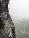
| highway | via_ferrata | A via ferrata is a route equipped with fixed cables, stemples, ladders, and bridges in order to increase ease and security for climbers. These via ferrata require equipment : climbing harness, shock absorber and two short lengths of rope, but do not require a long rope as for climbing. | ||||
When sidewalk/crosswalk is tagged as a separate way | ||||||
| footway | sidewalk | Sidewalk that runs typically along residential road. Use in combination with highway=footway or highway=path | ||||
| footway | crossing | Övergångsställe. Kan specificeras vidare med crossing=* | ||||
When sidewalk (or pavement) is tagged on the main roadway (see Sidewalks) | ||||||
| sidewalk | both | left | right | no | Specifies that the highways has sidewalks on both sides, on one side or no sidewalk at all | ||||
When cycleway is drawn as its own way (see Bicycle) | ||||||
| highway | cycleway | Cykelväg, kan även vara kombinerad med gångtrafik, s.k. GC-vägar. Se WikiProject Sweden/Cycle networks för märkning av svenska cykelnätverk | ||||
Cycleway tagged on the main roadway or lane (see Bicycle) | ||||||
| cycleway | lane | A lane is a route that lies within the roadway | ||||
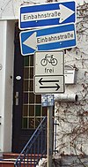
| cycleway | opposite | Used on ways with oneway=yes where it is legally permitted to cycle in both directions. Used together with oneway:bicycle=no. | ||||
| cycleway | opposite_lane | Used on ways with oneway=yes that have a cycling lane going the opposite direction of normal traffic flow (a "contraflow" lane). Used together with oneway:bicycle=no. | ||||
| cycleway | track | A track provides a route that is separated from traffic. In the United States, this term is often used to refer to bike lanes that are separated from lanes for cars by pavement buffers, bollards, parking lanes, and curbs. Note that a cycle track may alternatively be drawn as a separate way next to the road which is tagged as highway=cycleway. | ||||
| cycleway | opposite_track | Used on ways with oneway=yes that have a cycling track going the opposite direction of normal traffic flow. Used together with oneway:bicycle=no. | ||||
| cycleway | share_busway | There is a bus lane that cyclists are permitted to use. | ||||
| cycleway | opposite_share_busway | Used on ways with oneway=yes that have a bus lane that cyclists are also permitted to use, and which go in the opposite direction to normal traffic flow (a "contraflow" bus lane). Used together with oneway:bicycle=no. | ||||
| cycleway | shared_lane | Cyclists share a lane with motor vehicles, there are markings reminding about this. In some places these markings are known as "sharrows" ('sharing arrows') and this is the tag to use for those. | ||||
| busway | lane | Bus lane on both sides of the road. (See also: Parallel scheme for bus/psv lane tagging lanes:bus=* / lanes:psv=*) | ||||
Street parking tagged on the main roadway (see Street parking) | ||||||
| parking:left / :right / :both (hereafter: parking:side) |
lane | street_side | on_kerb | half_on_kerb | shoulder | no | separate | yes | Primary key to record parking along the street. Desribes the parking position of parked vehicles in the street. | ||||
| parking:sideorientation=* | parallel | diagonal | perpendicular | To specify the orientation of parked vehicles if there is street parking. | ||||
Lifecycle (see also lifecycle prefixes) | ||||||
| highway | proposed | For planned roads, use with proposed=* and a value of the proposed highway value. | ||||
| highway | construction | Väg under konstruktion. Använd tillsammans med construction=* | different colours | |||
Attributes | ||||||
| abutters | commercial | industrial | mixed | residential | retail etc. | See Key:abutters for more details. | ||||
| bicycle_road | yes | A bicycle road is a road designated for bicycles. If residential streets get the status of bicycle roads, normally, by special signs, motor traffic is admitted with limited speed, often only for residents. | ||||
| bus_bay | both | left | right | A bus bay outside the main carriageway for boarding/alighting | ||||
| change | yes | no | not_right | not_left | only_right | only_left | Specify the allowed/forbidden lane changes | ||||
| destination | <place name of destination> | Destination when following a linear feature | ||||
| embankment | yes | dyke | A dyke or a raised bank to carry a road, railway, or canal across a low-lying or wet area. | ||||
| embedded_rails | yes | <type of railway> | A highway on which non-railway traffic is also allowed has railway tracks embedded in it but the rails are mapped as separate ways. | ||||
| ford | yes | Vadställe. Vägen korsar ett vattendrag och man måste köra/gå genom vattnet. | ||||
| ice_road | yes | A highway is laid upon frozen water basin, definitely doesn't exist in summer. | ||||
| incline | Number % | ° | up | down | Incline steepness as percents ("5%") or degrees ("20°"). Positive/negative values indicate movement upward/downwards in the direction of the way. | ||||
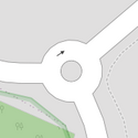
| junction | roundabout | Cirkulationsplats som är större än bara målad vägyta. "roundabout" betyder automatiskt att vägen är enkelriktad så tänk på att vägen ska vara ritad i rätt riktning. Är det en stor rondell taggas endast den inre cirkulationsringen med highway=roundabout och tillfartsvägarna som vanligt men med attributet oneway=yes. | ||||
| lanes | <number> | The number of traffic lanes for general purpose traffic, also for buses and other specific classes of vehicle. | ||||
| lane_markings | yes | no | Specifies if a highway has painted markings to indicate the position of the lanes. | ||||
| lit | yes | no | Street lighting | ||||
| maxspeed | <number> | Specifies the maximum legal speed limit on a road, railway or waterway. | ||||
| motorroad | yes | no | The motorroad tag is used to describe highways that have motorway-like access restrictions but that are not a motorway. | ||||
| mountain_pass | yes | The highest point of a mountain pass. | ||||
| mtb:scale | 0-6 | Applies to highway=path and highway=track. A classification scheme for mtb trails (few inclination and downhill). | ||||
| mtb:scale:uphill | 0-5 | A classification scheme for mtb trails for going uphill if there is significant inclination. | ||||
| mtb:scale:imba | 0-4 | The IMBA Trail Difficulty Rating System shall be used for bikeparks. It is adapted to mtb trails with artificial obstacles. | ||||
| mtb:description | Text | Applies to highway=path and highway=track. A key to input variable infos related to mtbiking on a way with human words | ||||
| oneway | yes | no | reversible | Oneway streets are streets where you are only allowed to drive in one direction. | ||||
| oneway:bicycle | yes | no | | Used on ways with oneway=yes where it is legally permitted to cycle in both directions. | ||||
| overtaking | yes | no | caution | both | forward | backward | Specifying sections of roads where overtaking is legally forbidden. Use overtaking:forward=yes/no/caution and overtaking:backward=yes/no/caution when it depends on driving direction. | ||||
| parallel | diagonal | perpendicular | marked | no_parking | no_stopping | fire_lane. | Deprecated variant to map parking along streets. See section on street parking above or the street parking page for more details. | |||||
| free | ticket | disc | residents | customers | private | Deprecated variant to map parking conditions along streets. See section on street parking above or the street parking page for more details. | |||||
| passing_places | yes | A way which has frequent passing places (See also: highway=passing_place) | ||||
| priority | forward | backward | Traffic priority for narrow parts of roads, e.g. narrow bridges. | ||||
| priority_road | designated | yes_unposted | end | Specifying roads signposted as priority roads. | ||||
| sac_scale | hiking | mountain_hiking | demanding_mountain_hiking | alpine_hiking | demanding_alpine_hiking | difficult_alpine_hiking | Applies to highway=path and highway=footway. A classification scheme for hiking trails. | ||||
| service | alley | driveway | parking_aisle etc. | See Key:service for more details. | ||||
| shoulder | no | yes | right | both | left | Presence of shoulder in highway | ||||
| smoothness | excellent | good | intermediate | bad | very_bad | horrible | very_horrible | impassable | Specifies the physical usability of a way for wheeled vehicles due to surface regularity/flatness. See Key:smoothness for more details. | ||||
| surface | paved | unpaved | asphalt | concrete | paving_stones | sett | cobblestone | metal | wood | compacted | fine_gravel | gravel | pebblestone | plastic | grass_paver | grass | dirt | earth | mud | sand | ground | See Key:surface for more details. | ||||
| tactile_paving | yes | no | A paving in the ground to be followed with a blindman's stick. | ||||
| tracktype | grade1 | grade2 | grade3 | grade4 | grade5 | To describe the quality of the surface. See Key:tracktype for more information. | ||||
| traffic_calming | bump | hump | table | island | cushion | yes | etc. | För att tagga något som har som funktion att minska hastigheten i bostadsområden. | ||||
| trail_visibility | excellent | good | intermediate | bad | horrible | no | Applies to highway=path, highway=footway, highway=cycleway and highway=bridleway. A classification for hiking trails visibility | ||||
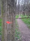
| trailblazed | yes | no | poles | cairns | symbols | Applies to highway=*. Describing trail blazing and marking. See Key:trailblazed for more information. | ||||
| trailblazed:visibility | excellent | good | intermediate | bad | horrible | no | Applies to trailblazed=*. A classification for visibility of trailblazing. See Key:trailblazed:visibility for more information. | ||||
| turn | left | slight_left | through | right | slight_right | merge_to_left | merge_to_right | reverse | The key turn can be used to specify the direction in which a way or a lane will lead. | ||||
| width | <number> | The width of a feature. | ||||
| winter_road | yes | A highway functions during winter, probably can't be driven in summer. | ||||
Övrigt | ||||||
| highway | bus_stop | Busshållplats. Används där bussen stannar till vid vägkanten för av- och påstigning. För busstationer används amenity=bus_station | ||||
| highway | crossing | A.k.a. crosswalk. Pedestrians can cross a street here; e.g., zebra crossing | ||||
| highway | cyclist_waiting_aid | Street furniture for cyclists that are intended to make waiting at esp. traffic lights more comfortable. | ||||
| highway | elevator | An elevator or lift, used to travel vertically, providing passenger and freight access between pathways at different floor levels. | ||||
| highway | emergency_bay | An area beside a highway where you can safely stop your car in case of breakdown or emergency. | ||||
| highway | emergency_access_point | Numrerad skylt som kan användas för att uppge var man är vid en olycka. Används med ref=NUMRET_PÅ_SKYLTEN | ||||
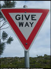
| highway | give_way | A "give way," or "Yield" sign | ||||
| emergency | phone | A calling device can be used to tell on your current position in case of an emergency. Use with ref=NUMBER_ON_THE_SIGN | ||||
| highway | ladder | A vertical or inclined set of steps or rungs intended for climbing or descending of a person with the help of hands. | ||||
| highway | milestone | Highway location marker | ||||
| highway | mini_roundabout | Liten cirkulationsplats, exempelvis en stolpe mitt i en korsning som ska rundas. Moturs om inte annat anges. Medurs (för länder med vänstertrafik) anges med direction=clockwise. | ||||
| highway | motorway_junction | Trafikplats (även kallat avfart eller mot) längs motorväg, eventuellt nummer anges med ref=* | ||||
| highway | passing_place | The location of a passing space | ||||
| highway | platform | A platform at a bus stop or station. | ||||
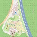
| highway | rest_area | Place where drivers can leave the road to rest, but not refuel. | ||||
| highway | services | Ett till svenska svåröversatt "serviceställe" oftast i direkt anslutning till motorvägar. Bensinstation, restaurang, parkeringsmöjligheter och toaletter är ett minimum. Ofta finns även en mindre affär samt möjlighet till dusch. | ||||
| highway | speed_camera | A fixed road-side or overhead speed camera. | ||||
| highway | stop | Stoppskylt | ||||
| highway | street_lamp | A street light, lamppost, street lamp, light standard, or lamp standard is a raised source of light on the edge of a road, which is turned on or lit at a certain time every night | ||||
| highway | toll_gantry | A toll gantry is a gantry suspended over a way, usually a motorway, as part of a system of electronic toll collection. For a toll booth with any kind of barrier or booth see: barrier=toll_booth | ||||
| highway | traffic_mirror | Mirror that reflects the traffic on one road when direct view is blocked. | ||||
| highway | traffic_signals | Trafikljus | ||||
| highway | trailhead | Designated place to start on a trail or route | ||||
| highway | turning_circle | Vändplats | ||||
| highway | turning_loop | A widened area of a highway with a non-traversable island for turning around, often circular and at the end of a road. | ||||
| highway | User Defined | All commonly used values according to Taginfo | ||||
Se även exempelsidan för hjälp om hur du taggar vägar i Sverige.
(Properties)
Restriktioner
This is used to define restrictions that apply to the associated element. See the page titled Restrictions for an introduction on its usage.
| Key | Value | Element | Kommentar | Foto | ||
|---|---|---|---|---|---|---|
| Vehicle types | ||||||
| access | agricultural delivery designated destination forestry no official permissive private yes |
Används för att ange vem som får använda vägen. Med 'permissive' avses att vägen är privat, men att ägaren medger tillträde för allmänheten medan 'private' anges på privata vägar där ägaren inte gjort sådant medgivande. | ||||
| agricultural | yes / no | Tillgänglighet för ex. traktorer | ||||
| atv | For values see access above | Access restricted to wheeled vehicles 1.27m (50 inches) or less in width, for example |
||||
| bdouble | For values see access above | Access permission for |
||||
| bicycle | For values see access above + dismount | Tillgänglighet för cykeltrafik | ||||
| boat | For values see access above | Tillgänglighet för båttrafik | ||||
| electric_bicycle | For values see access above | Access permission for electric bicycles (mostly defined as having a maximum speed of 25 km/h) | ||||
| emergency | yes | Access permission for emergency motor vehicles; e.g., ambulance, fire truck, police car | ||||
| foot | For values see access above | Tillgänglighet för fotgängare | ||||
| forestry | yes / no | Access permission for forestry vehicles, e.g. tractors. | ||||
| golf_cart | For values see access above | Access permission for golf carts and similar small, low-speed electric vehicles | ||||
| goods | For values see access above | Tillgänglighet för lätta lastbilar (upp till 3,5 ton) | ||||
| hazmat | For values see access above | Access permission for vehicles carrying hazardous materials. | ||||
| hgv | For values see access above | Tillgänglighet för tunga lastbilar (över 3,5 ton) | ||||
| horse | For values see access above | Tillgänglighet för ryttare | ||||
| inline_skates | yes / no | Access permission for |
||||
| lhv | For values see access above | Access permission for |
||||
| mofa | For values see access above | Access permission for |
||||
| moped | For values see access above | Access permission for |
||||
| motorboat | For values see access above | Tillgänglighet för motorbåtstrafik | ||||
| motorcar | For values see access above | Tillgänglighet för biltrafik | ||||
| motorcycle | For values see access above | Tillgänglighet för motorcykeltrafik | ||||
| motor_vehicle | For values see access above | Access permission for any motorized vehicle | ||||
| psv | For values see access above | Anger om vägbundet allmänt transportmedel som linjebussar o dyl får framföras på denna väg | ||||
| roadtrain | For values see access above | Access permission for |
||||
| ski | For values see access above | Access permission for |
||||
| speed_pedelec | For values see access above | Access permission for electric bicycles (mostly defined as having a maximum speed of 45 km/h) | ||||
| tank | For values see access above | Access permission for (military) tanks | ||||
| vehicle | For values see access above | Access permission for all vehicles | ||||
| 4wd_only | yes | A road signed as only suitable for 4WD (offroad) vehicles | ||||
| Other | ||||||
| alcohol | yes / no | Whether alcohol is allowed, or what type of alcohol may be served, at a location. | ||||
| dog | yes / no | Describes if dogs are allowed. | ||||
| drinking_water:legal | yes / no | Indication whether a feature is officially considered as a drinking water. | ||||
| female | yes | Female-only or gender segregated (with male=yes) feature | ||||
| male | yes | Male-only or gender segregated (with female=yes) feature | ||||
| max_age | age | The legal maximum age | ||||
| maxaxleload | Weight | The legal maximum axleload – units other than tonnes should be explicit | ||||
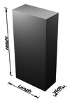
| maxheight | Height | Högsta tillåtna höjd i meter | ||||
| maxlength | Length | Längdbegränsning i meter | ||||
| maxspeed | Speed | Högsta tillåtna hastighet i km/h | ||||
| maxstay | Number | Längsta tid som man får uppehålla sig på vägen; ange tidsenhet (hour/hours/day/days). | ||||
| maxweight | Weight | Högsta tillåtna bruttovikt i ton | ||||
| maxwidth | Width | Breddbegränsning i meter | ||||
| min_age | age | The legal minimum age | ||||
| minspeed | Speed | Lägsta tillåtna hastighet i km/h | ||||
| noexit | yes | Återvändsgränd | ||||
| oneway | yes / no / -1 | Används för att markera enkelriktade gator, den tillåtna färdriktningen överensstämmer med ordningen av noderna inom vägen | ||||
| openfire | yes / no | This property specifies whether open fires are allowed at a feature. | ||||
| Relation:restriction | Used for a set of tags and members to represent a turn restriction. | |||||
| smoking | yes / no | For marking applicable smoking rules. However, if a law mandates a given smoking rule, that need not be mapped. | ||||
| toll | yes | Vägen är avfigtsbelagd. Se även highway=toll_booth | ||||
| traffic_sign | city_limit | Start/end sign of city limits, in most countries implies a specific "city maxspeed". | ||||
| unisex | yes | Unisex feature | ||||
This table is a wiki template with a default description in English. Editable here.
(Hinder)
(Cykelvägar)
Vägtyper
Används för att mer i detalj precisera landsvägar (highway=track) utanför tätbebyggt område.
För beskrivning av t.ex. skogsvägar rekommenderas highway=path.
| Nyckelord | Värde | Element | Kommentar | Kartsymbol | Bild |
|---|---|---|---|---|---|
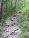
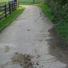
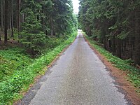
| tracktype | grade1 | Belagd med asfalt, oljegrus eller hårt/kompakt grus. | |||
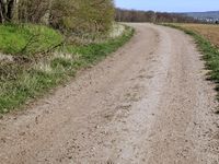
| tracktype | grade2 | Belagd med grus eller hårt packad jord/sand. | |||
| tracktype | grade3 | Obelagd; hårt packad yta med en blandning av hårda och mjuka material. | |||
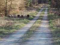
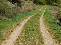
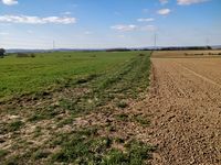
| tracktype | grade4 | Obelagd; hård yta av mjuka material. Kan ha hjulspår med beväxt mittensträng. | |||
| tracktype | grade5 | Obelagd; mjuk yta, bara svagt synlig i landskapet, eventuellt svaga hjulspår. | |||
| tracktype | <no value> | If no tracktype tag is present, the track is rendered with a dot-dash line style (as shown right). |
This table is a wiki template with a default description in English. Editable here.
Järnvägar, vattenvägar och flyg
Järnvägar
| Key | Value | Element | Comment | Rendering carto | Photo | |
|---|---|---|---|---|---|---|
Tracks | ||||||
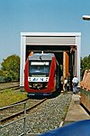
| railway | abandoned | Banvall - sträcka där tidigare funnits spår. Använd enbart detta värde om det inte finns någon lämpligare märkning som visar banvallens funktion i dag, t ex cykelväg. | ||||
| railway | construction | Railway under construction. | ||||
| railway | disused | Spår som ej längre används men som fortfarande ligger kvar | ||||
| railway | funicular | Cable driven inclined railways on a steep slope, with a pair of cars connected by one cable | ||||
| railway | light_rail | Spår för pendeltåg | ||||
| railway | miniature | Miniature railways are narrower than narrow gauge and carry passengers, frequently at an exact scale of "standard-sized" rail (for example "1/4 scale"). They can often be found in parks. | ||||
| railway | monorail | Monorail | ||||
| railway | narrow_gauge | Smalspår, ange t ex 891mm eller 1067mm med width=* | ||||
| Museijärnväg | ||||||
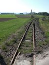
| railway | rail | Normalspår (1435mm) avsedd för reguljär passagerar- och godstrafik. | ||||
| railway | subway | Tunnelbana | ||||
| railway | tram | Spårväg | ||||
Additional track features or attributes | ||||||
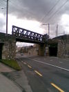
| bridge | yes | If the railway goes over a street, waterway or other railway on an elevated structure. | ||||
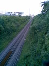
| cutting | yes | A section where the railway is significantly lower than ground level, but not underground. | ||||
| electrified | contact_line rail yes no |
contact_line: a power line over the train head rail: a third rail near the track supplying the train with power yes: electrified track, but no details available no: track with no power supply. |
||||
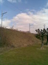
| embankment | yes | A section where the railway is raised significantly higher than ground level. | ||||
| embedded_rails | yes/<type of railway> | Specifies that a highway on which non-railway traffic is also allowed has railway tracks embedded in it but the rails are mapped as separate ways. | ||||
| frequency | number [Hz] | The frequency with which a line is electrified. Use 0 for DC. Also see the voltage tag. | ||||
| railway:track_ref | number | Track number | ||||
| service | crossover | Relatively short lengths of track which switch traffic from one parallel line to another | ||||
| service | siding | Sidospår | ||||
| service | spur | Stickspår | ||||
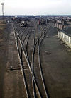
| service | yard | Bangård | ||||
| tunnel | yes | If the railway goes below ground. Most subways have this tag. | ||||
| tracks | number | Number of parallel tracks in close proximity when mapped as one single way representing all tracks. If not given means unknown and defaults to 1. In many parts of the world the tracks are being drawn out separately so that there is more detail, in which case this tag isn't used. | ||||
| usage | main branch industrial military tourism scientific test |
main line: heavy traffic branch line: connecting places with a mainline industrial: servicing large plants (iron, chemical etc.), surface mining, … military: servicing military area tourism: most mountain rails (rack-rails, funicular) and preserved railways scientific: rail transport at spaceports, large array telescopes, etc. test: track for testing new wheels, rails, tracks and rail technologies. |
||||
| voltage | number | The voltage with which a line is electrified. Also see the frequency tag. | ||||
Stations and stops | ||||||
| railway | halt | Hållplats | ||||
| public_transport | stop_position | The position on the railway track where the train (its centre) stops at a platform. This is useful for routing on long platforms where also short trains stop and on long platforms where multiple trains stop behind each other. See also public_transport=stop_area. | ||||
| public_transport | platform | This is parallel to the rail line for showing where the actual platforms are. It is also to know where you can change platform and enter the station, so use footpaths to connect them. This is really useful for routing too. Use only if the platform is served by public transport. | ||||
| railway | platform | This is parallel to the rail line for showing where the actual platforms are. It is also to know where you can change platform and enter the station, so use footpaths to connect them. This is really useful for routing too. Use in addition to public_transport=platform. | ||||
| public_transport | station | Railway passenger-only station. | ||||
| railway | station | Järnvägstation (med åtminstone en växel) | ||||
| railway | subway_entrance | Tunnelbaneingång | ||||
| railway | tram_stop | Spårvagnshållplats | ||||
Other railways | ||||||
| railway | buffer_stop | Stops the train at the end of a track. See buffer stop. | ||||
| railway | derail | A device used to prevent fouling of a rail track by unauthorized movements of trains or unattended rolling stock. See Derail (railroad). | ||||
| railway | crossing | Järnvägsövergång - plats där fotgängare kan passera järnvägen i samma plan | ||||
| railway | level_crossing | Plankorsning - korsning mellan landsvägstrafik och spårbunden trafik i samma plan | ||||
| railway | tram_level_crossing | A point where trams and roads cross. | ||||
| railway | signal | Any kind of railway signal. | ||||
| railway | switch | Full connections between railways (aka 'points'). | ||||
| railway | railway_crossing | Crossing rails with no interconnection. | ||||
| landuse | railway | Ground used around railways and railway-stations. | 
|
|||
| railway | turntable | Vändskiva | ||||
| railway | roundhouse | A semicircular building with many stalls for servicing engines. | ||||
| railway | traverser | These are used for changing trains between railways. Also known as transfer table. | ||||
| railway | wash | A railroad carriage/car wash | ||||
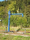
| railway | water_crane | A structure to deliver water to steam locomotives | ||||
| railway | ventilation_shaft | A structure that allows ventilation in underground tunnels | ||||
| railway | user defined | se Tagwatch för ytterligare värden. | ||||
This table is a wiki template with a default description in English. Editable here.
(Vattenvägar)
(Flyg)
(Övrigt / Aerialway)
Markanvändning
Markområden
Märkning av större markytor, t.ex. skogar, åkrar och industriområden.
| Nyckelord | Värde | Element | Kommentar | Kartsymbol | Bild | |
|---|---|---|---|---|---|---|
Common landuse key values - developed land | ||||||
| landuse | commercial | Område med i huvudsak kontor och liknande. | ||||
| landuse | construction | A site which is under active development and construction of a building or structure, including any purposeful alteration to the land or vegetation upon it. Abandoned construction projects and sites should not use this tag. | ||||
| landuse | education | An area predominately used for educational purposes/facilities. | ||||
| landuse | fairground | A site where a fair takes place | ||||
| landuse | industrial | Industriområde med t.ex.fabriker och/eller lagerlokaler. | ||||
| landuse | residential | Bostadsområden med villor, bostadsrätter och/eller hyreshus. | ||||
| landuse | retail | Område med i huvudsak affärer, t.ex stora köpcentra. | ||||
| landuse | institutional | Land used for institutional purposes, see The meaning of this tag is ambiguous and unclear. Consider using another tag that better describes the object. For instance landuse=commercial. See talk page for discussion. |
||||
| Nyckelord | Värde | Element | Kommentar | Kartsymbol | Bild | |
Common landuse key values - rural and agricultural land | ||||||
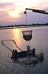
| landuse | aquaculture | Warning: currently, there is no convention on the exact meaning of this tag. Therefore, it makes sense to treat it like "boundary of aquaculture" (without implication of water body), which means, water body should be tagged by its own, using natural=water etc. |
||||
| landuse | allotments | Kolonilotter, med eller utan stugor. | ||||
| landuse | farmland | An area of farmland used for tillage (cereals, vegetables, oil plants, flowers). | ||||
| landuse | farmyard | An area of land with farm buildings like farmhouse, dwellings, farmsteads, sheds, stables, barns, equipment sheds, feed bunkers, etc. plus the open space in between them and the shrubbery/trees around them. | ||||
| landuse | paddy | An area of land where the surface and shape of the land is made suitable for growing rice. | ||||
| landuse | animal_keeping | An area of land that is used to keep animals, particularly horses and livestock. | ||||
| landuse | flowerbed | An area designated for flowers | ||||
| landuse | forest | Managed forest or woodland plantation (Other languages). Some use this to map an area of trees rather than the use of the land. See Forest. | ||||
| landuse | greenhouse_horticulture | Area used for growing plants in greenhouses | ||||
| landuse | meadow | A meadow or pasture: land primarily vegetated by grass and non-woody plants, mainly used for hay or grazing | ||||
| landuse | orchard | intentional planting of trees or shrubs maintained for food production | ||||
| landuse | plant_nursery | intentional planting of plants maintaining for the production of new plants | ||||
| landuse | vineyard | A piece of land where grapes are grown. | ||||
| Nyckelord | Värde | Element | Kommentar | Kartsymbol | Bild | |
Common landuse key values - waterbody | ||||||
| landuse | basin | An area artificially graded to hold water.
Together with basin=* for stormwater/rainwater infiltration/detention/retention basins. |
||||
| A reservoir on Wikipedia. Deprecated variant of natural=water + water=reservoir. See Proposed features/Reservoir for details. | ||||||
| landuse | salt_pond | A place where salt (saline) water is evaporated to extract its salt. | ||||
| Nyckelord | Värde | Element | Kommentar | Kartsymbol | Bild | |
Other landuse key values | ||||||
| landuse | brownfield | Describes land scheduled for new development where old buildings have been demolished and cleared | ||||
| landuse | cemetery | Begravningsplats / kyrkogård. Du kan även ange religion=* (se detaljer på sidan place of worship page). Mindre platser (t.ex. bara runt kyrkan) kan använda amenity=grave_yard istället. | ||||
| Protected areas (deprecated) Alternate tagging of same thing: boundary=protected_area, protected_area=* | ||||||
| landuse | depot | An area used as a depot for e.g. vehicles (trains, buses or trams). Consider using rather standard landuse tags like landuse=railway, landuse=commercial, landuse=industrial, with subtag like industrial=depot. | ||||
| landuse | garages | One level buildings with boxes commonly for cars, usually made of brick and metal. Usually this area belong to garage cooperative with own name, chairman, budget, rules, security, etc. | ||||
| landuse | grass | An area of mown and managed grass not otherwise covered by a more specific tag. Some view this as not a landuse, see the main page landuse=grass for discussion. | ||||
| landuse | greenfield | Describes land scheduled for new development where there have been no buildings before. A greenfield is scheduled to turn into a construction site |
| |||
| landuse | landfill | Place where waste is dumped. | ||||
| landuse | military | For land areas owned/used by the military for whatever purpose | ||||
| landuse | port | coastal industrial area where commercial traffic is handled. Consider using landuse=industrial + industrial=port for this type of industrial area. | ||||
| landuse | quarry | Surface mineral extraction | ||||
| landuse | railway | Area for railway use, generally off-limits to the general public | ||||
| landuse | recreation_ground | An open green space for general recreation, which may include pitches, nets and so on, usually municipal but possibly also private to colleges or companies | ||||
| landuse | religious | An area used for religious purposes | ||||
| landuse | village_green | A village green is a distinctive area of grassy public land in a village centre. Not a generic tag for urban greenery. It is a typical English term – defined separately from 'common land' under the Commons Registration Act 1965 and the Commons Act 2006. | ||||
| landuse | winter_sports | An area dedicated to winter sports (e.g. skiing) | ||||
| landuse | user defined | All commonly used values according to Taginfo | ||||
This table is a wiki template with a default description in English. Editable here.
(Byggnader)
(Nöje & fritid)
(Kraft)
(Militär)
(Natur)
Platser
(Amenity)
(Affärer)
(Sport)
(Turism)
(Historiskt)
Geografiska namn på kartan
Även när ett namn skall placeras ut på kartan gäller att det finns en minsta gemensamma mängd identifierare som bör användas. Det är sedan renderarens jobb att bestämma om och i så fall hur ett namn skall placeras på kartan. För en sjö bör exempelvis vattenytans nivå placeras under namnet medan det för ett berg inte bara skall placeras ut en etikett utan troligen också en prick och en höjdangivelse.
Denna tabell är under arbete
| Objekttyp | Element | Identifierare | name=* (exempel) | is_in=* (exempel) | Övrigt |
|---|---|---|---|---|---|
| Landsdel | boundary=administrative admin_level=3 | Svealand | Sweden | ||
| Län | boundary=administrative admin_level=4 | Örebro län | Sweden | ||
| Landskap | boundary=administrative admin_level=5 | Värmland | Sweden | ||
| Kommun | boundary=administrative admin_level=7 | Bergs kommun | Jämtland; Jämtlands Län; Sweden | ||
| Ort | place=* beroende på storlek, se tabell nedan | Svenstavik | Bergs kommun; Jämtland; Jämtlands Län; Sweden | population=* - invånarantal | |
| Berg / Fjäll | natural=peak | Klimtatjakka | - | ele=* - höjd över havet | |
| Myr | natural=wetland, wetland=* | Pottemyren | - | - | |
| Sjö | natural=water | Mälaren | - | ele=* - medelvattenstånd. För regleringsmagasin saknas något sätt att ange övre och undre dämningsgräns. |
Observera att om en tag har flera attribut ska de vara separerade med semikolon och inget annat.
I vissa fall kan man hitta noder som använder attributet "place_name"; detta skall enbart användas på areor. Dessa genererar felrapporter i map_lint så troligen är det bäst att ta bort detta attribut.
Platser
Administratively declared places
This table is a wiki template with a default description in English. Editable here.
Populated settlements, urban
This table is a wiki template with a default description in English. Editable here.
Populated settlements, urban and rural
This table is a wiki template with a default description in English. Editable here.
Other places
This table is a wiki template with a default description in English. Editable here.
Additional attributes
This table is a wiki template with a default description in English. Editable here.
Vattendrag
This is used to described different types of waterways. When mapping the way of a river, stream, drain, canal, etc. these need to be aligned in the direction of the water flow. See the page titled Waterways for an introduction on its usage.
Natural watercourses
This table is a wiki template with a default description in English. Editable here.
Man-made waterways
This table is a wiki template with a default description in English. Editable here.
Facilities
This table is a wiki template with a default description in English. Editable here.
Barriers on waterways
This table is a wiki template with a default description in English. Editable here.
Other features on waterways
This table is a wiki template with a default description in English. Editable here.
Namngivning
The name=* tag is the primary tag used for mapping the name of an element. See the page titled Names for an introduction on its usage.
| Key | Value | Element | Comment | ||||||||||
|---|---|---|---|---|---|---|---|---|---|---|---|---|---|
| name | User defined | Platsens vanliga namn; ortnamnet på det lokalt mest använda språket | |||||||||||
| name:<xx> | User defined | Ortnamnet på övriga i området förekommande språk anges med name=Göteborg name:en=Gothenburg et.c. Bokstäverna efter name: hämtas från språkkoderna i ISO639-1. För mer information se Bilingual street names Följande tabell listar några av de vanligt förekommande språken på svenska delen av OpenStreetMaps kartor.
| |||||||||||
| name:left[:<xx>], name:right[:<xx>] | User defined | Used when a way has different names for different sides (e.g., a street that's forming the boundary between two municipalities). | |||||||||||
| int_name[:<xx>] | User defined | Internationellt namn | |||||||||||
| loc_name[:<xx>] | User defined | Lokalt namn | |||||||||||
| nat_name[:<xx>] | User defined | Nationellt namn | |||||||||||
| official_name[:<xx>] | User defined | Official name. Useful where there is some elaborate official name, while a different one is a common name typically used. Example: official_name=Principat d'Andorra (where "name" is name=Andorra). | |||||||||||
| old_name[:<xx>] | User defined | Historiskt namn | |||||||||||
| ref_name[:<xx>] | User defined | Unique, human-readable name of this object in an external data management system. | |||||||||||
| reg_name[:<xx>] | User defined | Regionalt namn | |||||||||||
| short_name[:<xx>] | User defined | Should be a recognizable commonly-used short version of the name, not a nickname (use alt_name for that), useful for searching (recognized by Nominatim). | |||||||||||
| sorting_name[:<xx>] | User defined | Name, used for correct sorting of names — This is only needed when sorting names cannot be based only on their orthography (using the Unicode Collation Algorithm with collation tables tailored by language and script, or when sorted lists of names are including names written in multiple languages and/or scripts) but requires ignoring some parts such as:
all of them being ignored at the primary sort level and not easily inferable by a preprocessing algorithm. | |||||||||||
| alt_name[:<xx>] | User defined | Alternative name by which the feature is known. If there is a name that does not fit in any of the above keys, alt_name can be used; e.g., name=Field Fare Road and alt_name=Fieldfare Road, or name=University Centre and alt_name=Grad Pad. In rare cases, the key is used for multiple semicolon-separated names; e.g. alt_name=name1;name2;name3, but this usage is not preferred. | |||||||||||
| nickname[:<xx>] | User defined | Nickname (e.g. "Warschauer Allee" for BAB 2 in Germany 3140168 | |||||||||||
| Do not use this tag, suffixed name tagging for multiple values is deprecated. |
This table is a wiki template with a default description in English. Editable here.


