Tag:highway=steps: Difference between revisions
(→How to map: alternative unofficial way to mark direction=up or direction=down) |
|||
| Line 19: | Line 19: | ||
[[Image:ElementWay.png|left]] |
[[Image:ElementWay.png|left]] |
||
To map steps nothing else than a simple way ({{IconWay}}) is required. Add the {{Tag|highway|steps}} tag to it. |
To map steps nothing else than a simple way ({{IconWay}}) is required. Add the {{Tag|highway|steps}} tag to it. |
||
On the [[Talk:Tag:highway=steps|talk page]] we should decide whether the '''direction of the way''' should point uphill or downhill. However discussion as to which of the two is best, is so far inconclusive. |
On the [[Talk:Tag:highway=steps|talk page]] we should decide whether the '''direction of the way''' should point uphill or downhill. However discussion as to which of the two is best, is so far inconclusive. An alternative unofficial way has been to use {{Tag|direction|up}} or {{Tag|direction|down}} until a consensus and/or conclusion has been made. |
||
Revision as of 06:49, 7 May 2009
| Description |
|---|
| For flights of steps on footways. |
| Rendering in OSM Carto |

|
| Group: highways |
| Used on these elements |
| Implies |
| Useful combination |
| See also |
| Status: de facto |
| Tools for this tag |
|
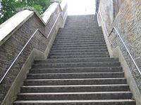
For flights of steps on footways.
How to map
To map steps nothing else than a simple way (![]() ) is required. Add the highway=steps tag to it.
On the talk page we should decide whether the direction of the way should point uphill or downhill. However discussion as to which of the two is best, is so far inconclusive. An alternative unofficial way has been to use direction=up or direction=down until a consensus and/or conclusion has been made.
) is required. Add the highway=steps tag to it.
On the talk page we should decide whether the direction of the way should point uphill or downhill. However discussion as to which of the two is best, is so far inconclusive. An alternative unofficial way has been to use direction=up or direction=down until a consensus and/or conclusion has been made.
Add a name=* if the steps have a special name.
Extended usage
highway=steps escalator=yes/parallel/(no) escalator_dir=up/down/dynamic/skywalk
highway=steps step_count=NumberOfSteps
highway=steps width=WidthInMeters
tactile_paving=yes/(no)/irritating if there is a paving on both ends of the steps that can be found with a blindman's stick.
highway=steps handrail=yes/(no)
See also
Examples
| Picture/Description | Tags | Mapnik | Osmarender |
|---|---|---|---|

|

|

|
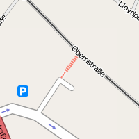
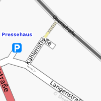
See Bremen for reference.
