Windows Mobile: Difference between revisions
m (→Port splitting) |
No edit summary |
||
| Line 1: | Line 1: | ||
{{Merge|Making_Tracks_with_Homebrew-ware}} |
|||
This page will aim to collect any useful information about using a Windows mobile PDA for OpenStreetMap purposes. |
This page will aim to collect any useful information about using a Windows mobile PDA for OpenStreetMap purposes. |
||
== Port splitting == |
== Port splitting == |
||
Revision as of 00:36, 1 September 2008
This page will aim to collect any useful information about using a Windows mobile PDA for OpenStreetMap purposes.
Port splitting
If you want to run more than one application that need access to your gps you might need a port splitter software.
GPS Intermediate Driver Built-in solution for WM5 and up.
GPSGate Share one GPS port between several GPS applications running at the same time.
Port Splitter Alternative to split com port on your PDA.
HandyGeocaching Porter CZ - HandyGeocaching Porter, freeware, but beta
Data Logging
A number of programs are available for collecting GPS tracks :
Free Software/Open Source
- Roadmap Development has started again and merged some of the features from RoadMap Editor. Support for OSM is ongoing, no route planning yet (GPL >=v2 license)
- RoadMap Editor - based on Roadmap sources, still in development by Ehud Shabtai, available for Linux/GTK2 ,Windows mobile, Windows XP and J2ME devices, localization possible through plain-text language file, route planning, built in map editor. (GPL >=v2 license)
- gpsVP garmin and raster (including OSM) maps support, windows smartphone, pda and desktop support, track logs. (BSD license)
- NaviPOWM Displays current position on a OSM based map. Records track data in NMEA format. (GPL)
- Bluemapia Mobile Windows Mobile (PDA and Smartphone) free and open source client for bluemapia.com. GPS Chart Navigator for outdoor activities supporting several maps including OSM. Records track data in NMEA and GPX format. (GPL)
- OSMtracker (GPLv3)
Noncommercial
- Mobile OSM Editor to be announced.
Freeware
- BSGPSPDA (out now and contributing to the map)
- VisualGPSce form VisualGPS llc. save datas as nmea logs.
- NoniGPSPlot website in french, program available in english.
- odgps GPX track logging, Waypoint navigation and Statistics. Also german manual.
- I have quite good experience with this program. Only after 60 to 90 min., the memory fills up, so I save, restart and go on. Works
well with 240x240 screen resolution. --Georg 07:09, 28 April 2007 (BST)
- Turbo GPS Fast all in one GPS tool. Moving maps custom or online, tracks, waypoint, there is a PC and Windows Mobile Version. Check the Features on the website.
- PTGMAP Moving / Rotating Map / Tracklog, GPS Navigation. By using Mkgmap you can create an .img file and load it to PTGMAP. You can define Hardware Buttons to create a waypoint at the current position. This is really helpful for OSM tracking.
Commercial
- Glopus 3D map, track log etc., only german (Shareware, 20 €)
- GPS Data Logger 2005 from geoaps. (commercial, $ 70)
- GPSGate will record a GPS log, and will also allow you to share one GPS between several GPS applications running at the same time. (commercial, US$ 30)
- BeeLine GPS Also has a log recording function. (Shareware, US $ 30)
- GPSDash (Shareware, 23 € ~ 27.6 $)
- Navio (Shareware, 23 € ~ 24.9 $) I have found it quite practical and reliable for OSM tracking (on an iPaq 6915). Logs are in NMEA format. You have to buy a licence to make logs. Waymarking facilities are poor. Can display position on a downloaded PDF or JPEG map image but I haven't tested that.
- CartoType (cartotype.com) - Available now for Windows, Windows Mobile, Symbian OS, and Palm OS 5. CartoType is owned and developed by Graham Asher of Cartography Ltd
- Run.GPS (Shareware, 25.95 € ~ 33.99 $) is a software for Windows Mobile Pocket PCs and Smartphones that can sync multiple tracks directly to OSM through WiFi, GPRS or UMTS
- GPS Tuner ( $34 - With one-year free upgrade ) Can download directly OSM maps or use the free Map Calibrator.
Further details can be found on Making_Tracks_with_Homebrew-ware#Windows_Mobile.
The GPS recordings will be in NMEA format and will need converting to a GPX file before uploading to OSM. GPSBabel will do this.
Using OSM data
BSGPSPDA Freeware - tracks you position on downloaded Osmarender tiles (zoom 10 to 17). See instantly missing ways/POI's etc. Records tracks in GPX and voice recorded waypoint/PIO descriptions.
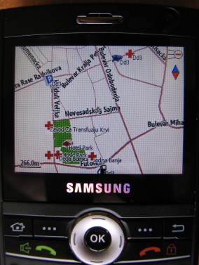
PocketMV is a shareware program which will display Garmin img files on a Windows Mobile device, and then if you have a GPS connected will display your position on the map. It features a search facility allowing you to search for roads and points of interest. Suitable img files can be created using Mkgmap. The following image shows a screen shot from an HP Ipaq in the area of Ryde, Isle of Wight .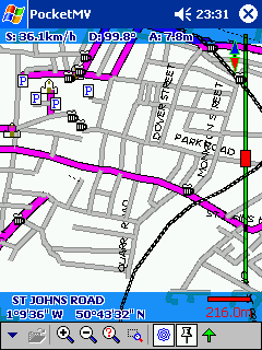
You can also use the OZIexplorerCE, see Oziexplorer for details.
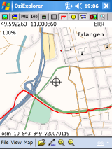
gpsVP is an open-source (BSD license) that supports using Garmin .img map format files and shows online OSM maps on Windows Mobile devices (smartphone or PDA) and also on Windows Desktop computers. By using Mkgmap you can create an .img file and load it to gpsVP.
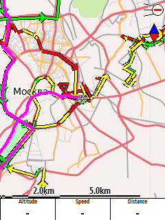
Run.GPS is a shareware program that can display OSM data and load map tiles on demand through a cell phone internet connection (GPRS, UMTS):
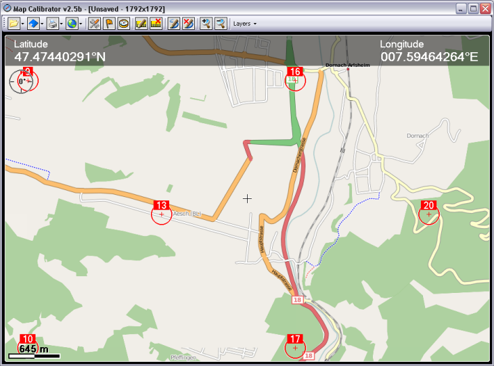
Use the free Map Calibrator to create OSM maps. I use them in the GPS Tuner and in the Turbo GPS on my WinPDA.
Audio Logging
BSGPSPDA (freeware, out now and contributing to the map)
See PDA Voice Recording for information on using your Windows Mobile device to record audio whilst you are mapping.
