2010 Alagoas Flooding
Alagoas is a small state in the northeastern region of Brazil. Due to heavy rains, it is suffering major flood in several cities.
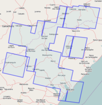
Most affected cities: Quebrangulo, Santana do Mundaú, Joaquim Gomes, São José da Laje, União dos Palmares, Branquinha, Paulo Jacinto, Murici, Rio Largo, Viçosa, Atalaia, Cajueiro, Capela, Jacuípe e Satuba.
How to help?
- Find imagery for the area;
- Establish contact with relief agencies;
- Map accesses to affected cities;
Communication
The actions are being coordinated on IRC and mailing list:
- IRC (Brazilian OSM channel (english and portuguese)): irc://irc.oftc.net #osm-br
- Mailing list (english and portuguese): talk-br
To-do list
- Download CBERS 2B HRC images of affected region [[1]]
- Geo-reference each image;
- Build a WMS server with sattelite images;
- Map the affected regions;
- The Landsat WMS server can be used to map roads, rivers and georeference CBERS images;
Maps to print
Many streets in many cities, are already mapped. If you want to print the maps of these cities (along with an index of streets), follow the links below. Maps are available in PNG, SVG and PDF.
Note: to see the most up-to-date maps, click in the "recreate map" button.
- Quebrangulo: [2]
- Branquinha: [3]
- União dos Palmares: [4]
- Satuba: [5]
- Atalaia: [6]
- Cajueiro: [7]
- Santana do Mundaú: [8]
- São José da Laje: [9]
What map?
- Bridges and overpasses (collapsed or not);
- obstacles such as landslides, rock, falling trees, etc;
- Healthcare equipment;
- Schools;
- Airports;
- Helipads;
- Storage depots for humanitarian aid.
Affected cities
Alagoas:
Servers
- Copy this link in Potlatch for a custom background (Options / Personalized):
http://osm.arkemie.org/cgi-bin/tiles/1.0.0/cbers/!/!/!
or launch directly in Potlatch: [10]
- Copy this link in JOSM with wmsplugin (WMS / Rectified image / Custom WMS link):
http://osm.arkemie.org/cgi-bin/cbers_osm_wms?map=/mapsite/cbers/cbers.map&service=wms&request=getmap&version=1.1.1&format=jpeg&layers=maceio_20091009_warp,atalaia20081020,riolargo20081115,saojosedalaje20090923,cajueiro20090923,santanadomundau20080418,uniaodospalmares20080921,saojoao_20090103_hrc_warp,branquinha_20081020,jacuipe20091009,palmares20090622,catende_20091001_warp,quebrangulo20090103,joaquimgomes20090622&
To access individual images in separate layers, copy the link in the "Imagens CBERS" column in the Cidades table into JOSM as WMS.
(You can alter the layer's order, or remove some, to compare).
For a list of layers currently available, as well as correspondence with the file names of INPE (in the layer's title), see: http://osm.arkemie.org/cgi-bin/cbers_osm_wms?map=/mapsite/cbers/cbers.map&service=wms&version=1.0.0&request=GetCapabilities
CBERS Imagery
Please, help us to complete the info. in this table.
| Image group | Boundaries | How to use in JOSM | how to use in Potlatch |
|---|---|---|---|
| CBERS
Date: ??-??-???? Use the tag: source=CBERS, INPE, dd-mm-yyyy (the date is part of the layer name; see the next table.) |
 See the imagery boundaries here |
Use this URL in the WMS plugin (how to configure):
http://osm.arkemie.org/cgi-bin/cbers_osm_wms?map=/mapsite/cbers/cbers.map&service=wms&request=getmap&version=1.1.1&format=jpeg&layers=maceio_20091009_warp,atalaia20081020,riolargo20081115,saojosedalaje20090923,cajueiro20090923,santanadomundau20080418,uniaodospalmares20080921,saojoao_20090103_hrc_warp,branquinha_20081020,jacuipe20091009,palmares20090622,catende_20091001_warp,quebrangulo20090103,joaquimgomes20090622& |
http://osm.arkemie.org/cgi-bin/tiles/1.0.0/cbers/!/!/! |
Mapeando com Imagens PDFs do IBGE
- To use the pdfs maps donated by IBGE, use this wms server link:
http://osm.arkemie.org/cgi-bin/cbers_osm_wms?map=/mapsite/cbers/cbers.map&service=wms&request=getmap&version=1.1.1&format=jpeg&layers=maceio_parte12_mapa,riolargomapa,branquinhamapa,uniao21mapa,uniao22mapa,uniao23mapa,uniao24mapa,jacuipemapa,joaquimgomesmapa,muricimapa&
- or this tile server link for Potlatch:
http://osm.arkemie.org/cgi-bin/tiles/1.0.0/ibgemapas/!/!/!
or launch directly in Potlatch: [12]
Individual maps available:
| Town | Direct link (Edit with Potlatch) | Copy link for Potlatch background option | Copy link for JOSM WMS option |
|---|---|---|---|
| Branquinha | [13] | [14] | [15] |
| Jacuípe | [16] | [17] | [18] |
| Joaquim Gomes | [19] | [20] | [21] |
| Murici | [22] | [23] | [24] |
| Rio Largo | [25] | [26] | [27] |
| União dos Palmares | Uniao2-Folha1 |
Uniao2-Folha1 |
Uniao2-Folha1 |
When there is a shift between one of these maps and a CBERS satellite image, it is advisable to adjust the satellite image to the map. (Only the georeferencing for the Rio Largo CBERS satellite image has been revised to take into account ground control points from the IBGE map. CBERS satellite images georeferencing was based on GPS tracks, when available, or Landsat mosaic).
The projection/datum parameters "+proj=utm +zone=24 +south +ellps=GRS67 +towgs84=-66.87,4.37,-38.52" or "+proj=utm +zone=25 +south +ellps=GRS67 +towgs84=-66.87,4.37,-38.52" (depending on the UTM zone) have been used to interpret the metric coordinates from the IBGE maps. (Based on [28] and [29]).
Image Date
These are the dates of CBERS images, released in the table above.
| County | Date |
|---|---|
| Maceió | 09-10-2009 |
| Quebrangulo | 03-01-2009 |
| Rio Largo | 15-11-2008 |
| São José da Laje | 23-09-2009 |
| União dos Palmares | 21-09-2008 |
| São João | 03-01-2009 |
| Branquinha | 20-10-2008 |
| Catende | 01-10-2009 |
| Palmares | 22-06-2009 |


