2013 Sudan floods
| Information about this intervention |
|
Early August 2013, Khartoum, the Capital city of Sudan, experienced extremely heavy rains that have turned into floods, houses falling, areas drowning, victims. This also causes problems of drinking water supply and sanitation. You can follow the current situation on this Crowdmap. The Humanitarian Response is led on the field by nafeersudan.com (Facebook NafeerInitiative). On mid-September, MapAction, member of the Digital Humanitarian Network like HOT, has deployed two HIM experts in Khartoum to support the information management in the recovery phase. Having direct partners in the field, users of the OSM data, is a real opportunity to get better understanding about the needs of baseline data provided by OSM. Map of the affected zone (uMAP). This wiki page is to coordinate remote mapping for HOT contributors around the world. |
Highlights
The humanitarian information about Sudan can be found on ReliefWeb
- Humanitarian Mapping Project (HMP) for Sudan, August 10, 2013, HOT contributors are starting this action to map the disaster zones.
- Extent of the floodings ReliefWeb publishes various maps and documents that show the extent of the flooding. Georeferenced post-disaster images should be available soon. This will help us to identify other areas to map.
- Floods analysis UNOSAT Maps for Sudan made from various imagery (MODIS, Radarsat, Formosat 2..)
- Overview of floods in City of Khartoum, Khartoum State, Sudan published by UNITAR on August 12
- Sudan: Flash Update August 12, 2013 (issue # 4) by UNOCHA
- Sudan: Flash Floods (13 Aug 2013) published on August 13 by UNOCHA
- Sudan: Flash Update August, August 19, 2013 (issue # 5) by UNOCHA
- Update 2: Flood Waters Over Khartoum State, Sudan published by UNOSAT on August 20
- Humanitarian Bulletin Sudan Issue 38 | 16 – 22 September 2013
Coordinator of this action : Séverin Ménard
For more information : contact the HOT Support Team at info@hotosm.org or on this OFTC IRC channel: #hot-floods-sudan (English, French, Spanish, Italian and Portuguese spoken)
Mapping Priorities
Remote Mapping, Khartoum
There are several Tasking Manager jobs which provide micro-tasks to mapping contributors.
First tasks have been made from Areas of Interest identified by the Dartmouth University (see the umap):
New tasks have been made from a check between the Formosat 2 August 8 &9 analysis made by UNOSAT, and NextView Digital Globe WorldView-2 imagery from August 8 and 11. This imagery is available through the TM jobs, once agreed the License Aknowledgement. Offset have been informed in the offset DB pluging for JOSM so please use it:
Areas to be mapped are popular, remote neighborhoods. Please map all the streets and buildings in the task area in order to show the pre-crisis situation, on which damage analysis will be done.
Identification of priorities and local facilities to support displaced people
If you are in contact with local NGO, or you have knowledge of the area, you can contribute to geolocate and describe various public facilities and shelters. Please report any established priorities expressed by the local NGOs to the HOT Discussion list. This will facilitate the coordination with the HOT contributors.
HOT & OSM Data Exports and Services available
- OSM data for Khartoum is available using HOT Export Service, Job 4233.
Log in and click on Start on new run to get a new extract to be downloaded.
This service provides the Data in various formats. The Shp files can be imported in GIS Softwares for Spatial analysis. The gmapsup.img file can be imported on a Garmin GPS including car navigation devices such as Nüvi. See See Instructions on how to install on your Garmin
- Map rendering
- OSM base map layer, Khartoum
- HOT HDDM layer, Khartoum : This is particularly useful to locate various humanitarian objects on the map. Note that this is a prototype and that the response time is sometimes slow
Local mapping information
If anyone can report on which bridges are out and other road connections effected, please be in Contact the OSM community or dive in and edit the map!
Other tasks to do
bing coverage of the area and potential to add and refine mapping of...
- Town details.
Town/City mapping
This section is to add specific mapping task
| Area | Description of task | Comments |
|---|---|---|
| area ... | task ... | comment ... |
River mapping
Other information
The OSM tools and services to support mapping
For the people that are less familiar with OSM tools and services, this section shows what is available to map remotely, export and analyze the OSM DATA. HOT also offers tools and tutorials specific to the Field Data Collection.
- Map rendering
- OSM base map layer
- HOT HDDM layer : This is particularly useful to locate various humanitarian objects on the map.
- Export Data for GIS spatial analysis
- HOT-Export The data can be downloaded from the HOT Export Service, Job 4233
- Example of an Overpass-turbo.eu Query that extracts all village places tags of Uttarakhand state, India
- Remote Mapping : Create an OSM account to access the Task Manager and to upload data to the OSM Database using the OSM editors
- HOT Task Manager : Microtasks for Khartoum
- JOSM Editor (Advanced editor to be installed)
- ID Online Editor (Lightweight web editor)
- LearnOsm.org Tutorials
- Field Data collection Support
- With Walking Papers / Field Papers, we collect the data using a map print of the area to cover
- Android App like OsmAnd and OsmTracker are also very useful for data collection
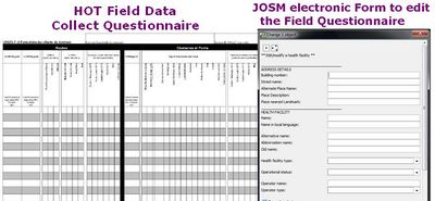
- HOT HDDM Questionnaires for Field Data Collection
- JOSM Editor : HOT HDDM Data Model (Preset) for Field Data Collection
- LearnOsm.org Tutorials
Bing Aerial Imagery Analyser for OpenStreetMap is used to validate if Bing high-res imagery is available in the area to study.


