Ayr
Jump to navigation
Jump to search
| V・T・E |
| latitude: 43.2860, longitude: -80.4529 |
| Browse map of Ayr,_Ontario 43°17′09.60″ N, 80°27′10.44″ W |
| Edit map |

|
|
External links:
|
| Use this template for your locality |
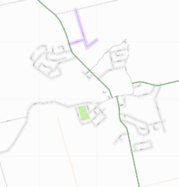
Ayr,_Ontario is a village in Ontario, Canada at latitude 43°17′09.60″ North, longitude 80°27′10.44″ West.
This map is an initial effort to OpenStreetMap the village of Ayr, in Ontario, Canada. This map is created from gps tracks collected in two days of driving, over about four hours. The street map is over 95% complete. A few known missing segments are to be added shortly.
The park area shown for Victoria Park is a rough guesstimate of the park boundaries, and will be adjusted.