Bengawan Solo Mapping
BackgroundBengawan Solo river is the biggest, longest, and Behind the unique phenomenon of its reversal flow due to tectonic activities two million years ago, nowadays Bengawan Solo become a nightmare for 300.000 people live along this river due to the flood every year. Last flood in January 2013 inundate about 26.229 hectares area and the lost estimated about 47 billion. Respond to the fact that the flood will be happen every year, Regional Disaster Management Agency (BPBD) of East Java , in collaboration with United Nations Office for the Coordination of Humanitarian Affairs (UN - OCHA) and Australia - Indonesia Facility for Disaster Reduction (AIFDR) have agreed to make ”Bengawan Solo flood” contingency plan as one of disaster risk reduction effort. Contingency plan is a document that states what we should do if a contingency condition (such as disaster) is happening, what we must prepare and how much it is. Thus, detail and up to date data are needed to make a good contingency plan. That is why OSM join this project, as a tool to collect data –which is very easy to use and to be updated. |
||||
ActivitiesThere are three main activities -related to OSM TrainingThe training was purposed to train the scouts –our volunteer partner in this project, to collect data either graphic data (by digitizing imagery) or attribute data (by field survey and then input it through JOSM). It was a very short training since the training was just held for three days only, with a limited material:
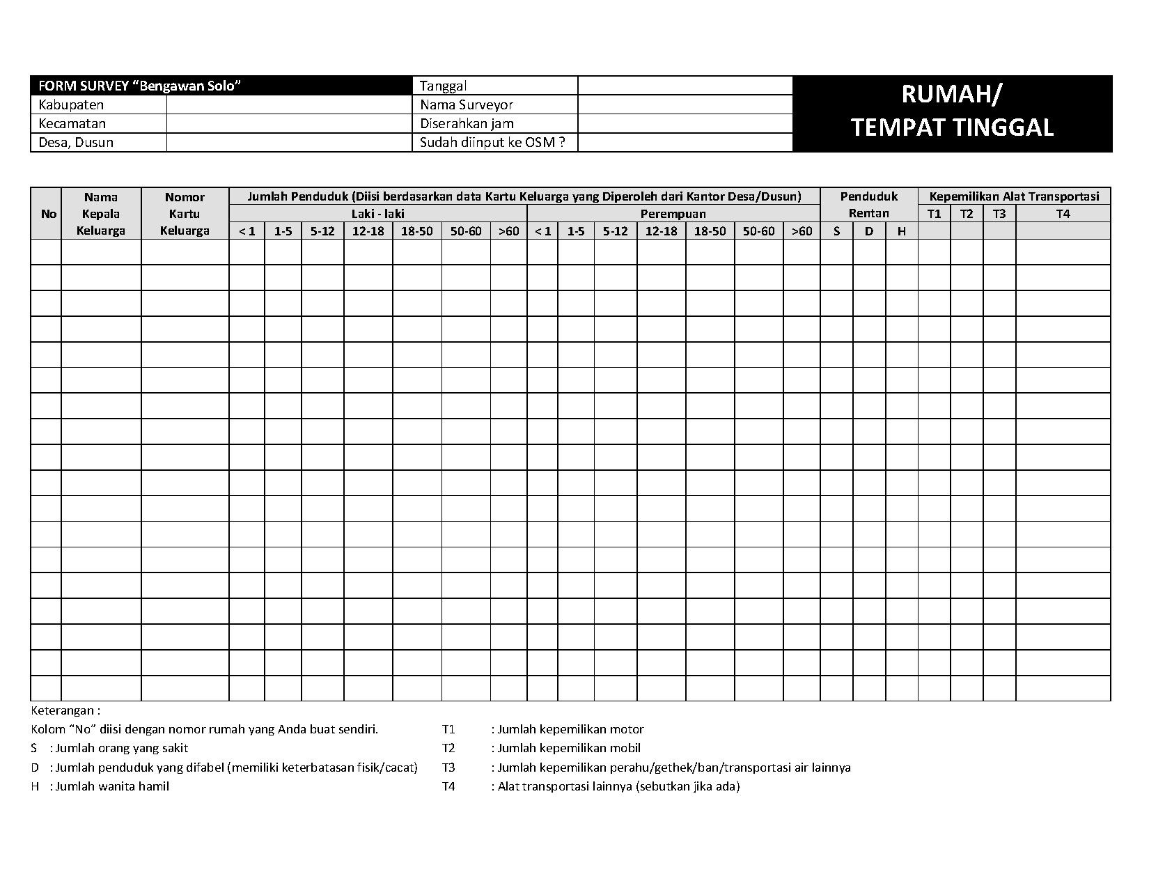
SurveyTo meet the need of contingency plan, we were collecting various of data, some of them very specific, consist of vulnerability data (such as is there any disable man, sick man, or pregnant woman in a house) and capacity data (such as how many vehicle they have; and is there any electricity, water supply, toilets, and communication facilities in a public building). Here is our survey form |
|
|||
ResultAbout 35.000’s building have been mapped. About 35.000's building have been mapped.Thanks to everyone who have helped us digitized buildings in a part of Bengawan Solo riverbank through tasking manager. About 35.000’s building have been mapped within two weeks. Flood impact analysis through InaSAFE have done wellAfter data collection was completed, the data then brought into Quantum GIS for further analysis using InaSAFE plugin. InaSAFE is a plugin that is developed by AIFDR in collaboration with National Disaster Management Agency (BNPB), with main function to do a disaster impact analysis. By adding hazard layer –provided by BPBD– and exposure layer –which is from OSM– in shapefile format, InaSAFE will calculate how many buildings and people might be affected by Bengawan Solo flood. As the result of the analysis, then we got the number; if the same flood as April 2013 flood happen, there are about 20.064 buildings might be flooded, including 22 schools. Thanks to everyone who had involved and contribute actively during this project. Hopefully, everyone especially scouts of East Java continue mapping, so we can improve the data and produce the better analysis. |
||||