Coventry 2012 Cake
Jump to navigation
Jump to search
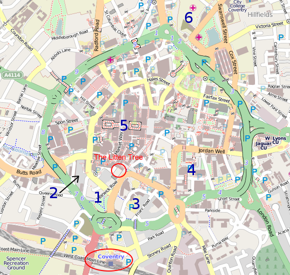
A guest 'cake' post for Coventry city centre. I've added the hospital as I believe this area is being redeveloped into a smaller medical centre (with many of the older buildings knocked down). If tracing buildings from Bing be aware of skyscrapers as the Bing imagery is not perfectly top down - making it harder to trace the buildings footprint.
If you have a bit more time to venture further away from the train station, let me know and I will try to provide a few more ideas. Otherwise the quality assurance tools can be used to find fixme=* tags.
| Coventry Cake June 7th 2012 | Taken By | Comments |
| 1 Mainly retail (lots of estate agents) | ||
| 2 Residential Area | miked29 | slow walk for me. Will try Walking Papers for the first time! |
| 3 Mixed use | ||
| 4 Civic centre (many bridges between buildings) | ||
| 5 Main shopping area | ||
| 6 Cov & Warwick Hospital |
