DE:Featured images/Apr-Jun 2009
Jump to navigation
Jump to search


Hier sind die vorgestellten Bilder zu sehen. Die Bilder wurden als Vorzeigebeispiele des OpenStreetMap-Projektes auserwählt.
Wenn du ein Bild hast, welches als Bild der Woche sein könnte, dann kannst du es hier auf der (en) Vorschläge des ausgewählten Bildes-Seite vorschlagen.
| ← von Januar bis März 2009 | von Juli bis September 2009 → | von April bis Juni 2010 → |
Galerie der vorgestellten Bilder, von April bis Juni 2009
2009, Woche 14
2009, Woche 15
2009, Woche 16
2009, Woche 17
2009, Woche 18
2009, Woche 19
2009, Woche 20
2009, Woche 21
2009, Woche 22
2009, Woche 23
2009, Woche 24
2009, Woche 25

2009, Woche 26
Details und Beschriftungen
Woche 14 (von Montag, 30. März 2009 bis Sonntag, 5. April 2009) [Edit]

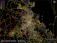
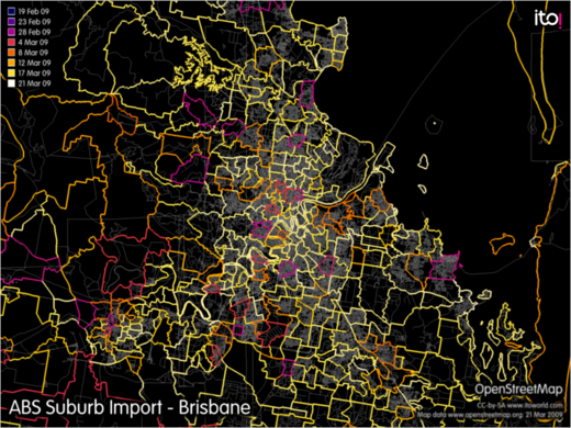
- English : With the recently finished ABS Import of suburb boundary data, all of Australia has relatively up-to-date suburb boundary information. Image shows progress of import in Brisbane area, created using OSM Mapper.
- Deutsch : Mit dem jüngst abgeschlossenen Import von Daten der australischen Statistikbehörde gibt es nun für ganz Australien recht aktuelle Informationen über die Grenzen der Vorstädte. Das Bild zeigt den Fortschritt des Datenimports in der Gegend von Brisbane, erstellt mit dem OSM Mapper.
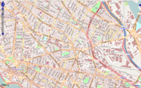
Woche 15 (von Montag, 6. April 2009 bis Sonntag, 12. April 2009) [Edit]

Woche 16 (von Montag, 13. April 2009 bis Sonntag, 19. April 2009) [Edit]

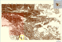
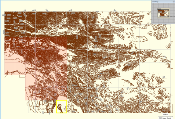
- English : GroundTruth-generated relief contours map for Garmin GPS units. The elevation data source is SRTM. This is a MapSource screenshot of map tiles. See here for more info.
- Deutsch : Mit GroundTruth erzeugte Konturreliefkarten für Garmin GPS-Geräte. Die Höhendaten stammen aus der Shuttle-Mission SRMT. Das Bild zeigt den Bildschirm von MapSource. Weitere Info gibt es hier.
Woche 17 (von Montag, 20. April 2009 bis Sonntag, 26. April 2009) [Edit]

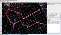
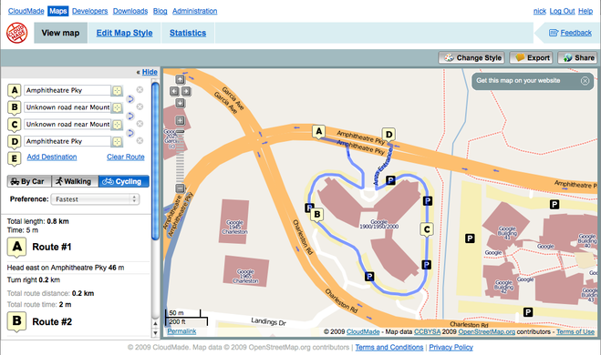
- English : CloudMade's routing API gives turn-by-turn directions for vehicles, bicycles and pedestrians - all powered by OSM data (shown: route around Googleplex)
Woche 18 (von Montag, 27. April 2009 bis Sonntag, 3. Mai 2009) [Edit]

- English : The building and open space layers from MassGIS for large swathes of Massachusetts have been imported thanks to effort by User:crschmidt and others in the region. [1]
Woche 19 (von Montag, 4. Mai 2009 bis Sonntag, 10. Mai 2009) [Edit]

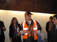
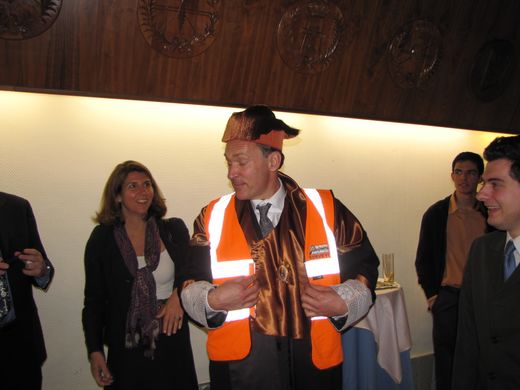
- English : Sir Tim Berners-Lee recently received both a doctor honoris causa award (for his outstanding contributions to the WWW [2][3]) and a hi-viz vest (for his outstanding mentions of OSM [4])
Woche 20 (von Montag, 11. Mai 2009 bis Sonntag, 17. Mai 2009) [Edit]

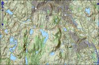
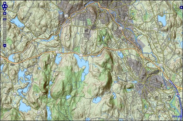
- English : TopOSM is a topographic view of OSM data
Woche 21 (von Montag, 18. Mai 2009 bis Sonntag, 24. Mai 2009) [Edit]

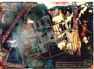
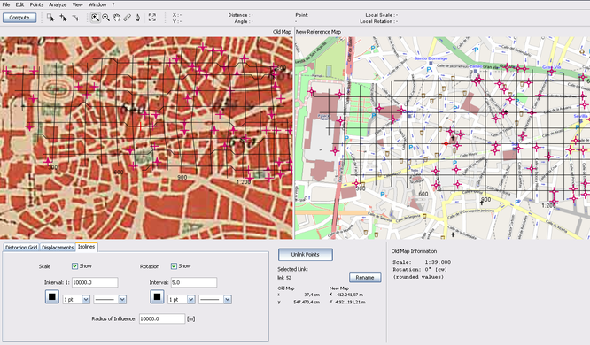
- English : MapAnalyst is an open source tool for distortion analysis in old maps, that uses OSM as a the default reference cartography. (Shown here: 1:50k map of Madrid dated from 1875)
Woche 22 (von Montag, 25. Mai 2009 bis Sonntag, 31. Mai 2009) [Edit]

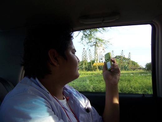
- English : The first GPS device donated by the OSM Foundation's GPStogo scheme at the mapping party and conference in Neiva Colombia
Woche 23 (von Montag, 1. Juni 2009 bis Sonntag, 7. Juni 2009) [Edit]

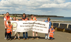
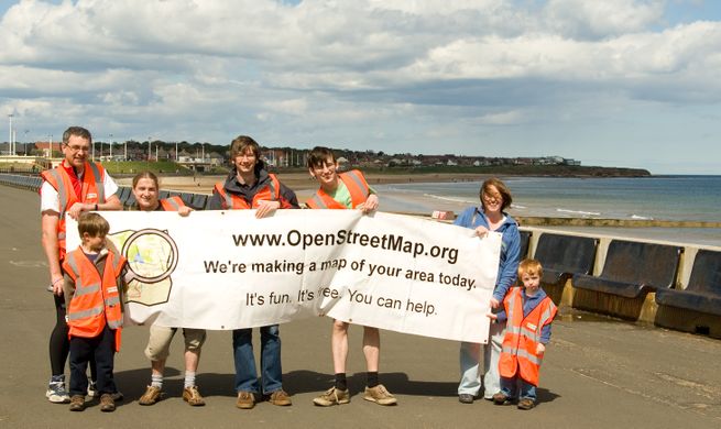
- English : The Sunderland Mapping Party being an example of the successful Mapping parties idea. Sunderland was chosen from the UK Mapping Priorities list.
Woche 24 (von Montag, 8. Juni 2009 bis Sonntag, 14. Juni 2009) [Edit]

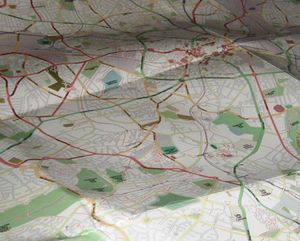
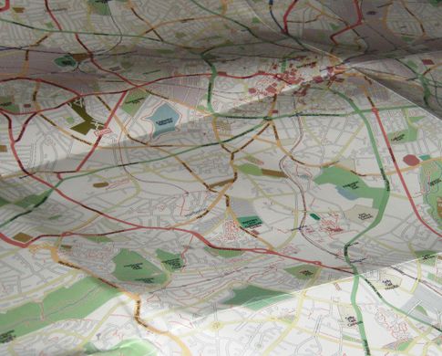
- English : A printed map of Birmingham is available thanks to the Mappa Mercia subproject
- Deutsch : Dank des Mappa Mercia-Unterprojekts ist eine gedruckte Karte von Birmingham erhältlich.
Woche 25 (von Montag, 15. Juni 2009 bis Sonntag, 21. Juni 2009) [Edit]

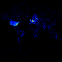
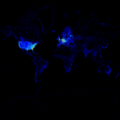
- English : A "heat-map" of OpenStreetMap complexity worldwide (Tah-heatmap)
- Deutsch : Eine Heat-Map der OpenStreetMap-Komplexität (Tah-heatmap).
Woche 26 (von Montag, 22. Juni 2009 bis Sonntag, 28. Juni 2009) [Edit]

- English : The HaptoRender project has created the first tactile map using OpenStreetMap data.
- Deutsch : Das HaptoRender-Projekt hat die erste taktile Karte aus OpenStreetMap-Daten erzeugt.