DE:Taho
| Das massenhafte Herunterladen von Tiles von einem öffentlich nutzbaren Tileserver führt zu hoher Last auf diesem und ist i.d.R. durch die Nutzungsbedingungen des jeweiligen Tileservers für unerwünscht erklärt oder verboten worden. Diese Nutzungsbedinungen werden oft durch automatische Sperrmechanismen durchgesetzt. Zieh stattdessen besser die Nutzung von Offline-Vektor-Kartendaten und deren Apps in Betracht. |
Einführung
Es gibt zwei Versionen von TAHO: taho.pl: ein perl script das unter praktisch jedem Betriebssystem laufen sollte taho.exe: Ein Windows Programm
Beide können Karten verschiedener Größe (1024*1024 to 8192*8192) für ein Gebiet beliebiger Größe laden. Für jede dieser Karten wird zusätzlich ein Kalibrationsfile in einem der folgenden Formate erstellt:
- *.bat für Pathaway
- *.cal für TTQV
- *.jpr für Fugawi
- *.kal für Glopus
- *.map für Oziexplorer oder PTGMAP
- *.inf für UI-View wird bisher nur von taho.exe unterstützt.
- *.gmi für GPSTuner wird bisher nur von taho.exe unterstützt.
- ohne Kalibrationsfile für TurboGPS
Beide Versionen erzeugen praktisch das gleiche Resultat, allerdings ist das Windowsprogramm einfacher zu nutzen. Beide sind Opensource Programe unter der GPL.
Programm Information
Taho.pl
Dies ist die ursprüngliche taho-Version. Dieses perl Skript benutzt Tiles und erzeugt daraus Pixelkarten von 1024*1024 bis 8192*8192 Pixel inkl. Kalibrationsfiles. Als Eingabe dienen die Namen der Tiles oder Koordinaten. Das Ergebnis sind ein oder mehrere PNG-Bilder und die Kalibrationsdateien (s.o.). Hier die englische Hilfe aus dem Skript:
usage: D:\PROGRAMME\josm\taho.pl [-tilename=Z,x,y] [-coord=Z,lat,lon] [-coord2=l
at2,lon2] [-tilesource=source] [-proxy=proxyname] [-size=size] [-neighbormaps=ne
ighbormaps] [-ext=ext] [-cache=cache] [-turbogps=yes] [-output=outputDir]
This script downloads the tiles from the openstreetmap server and glue them toge
ther,
after that, it generates calibration files for Ozi, TTQV, Pathaway, Fugawi and G
lopus.

Z: Zoom 1..11

x,y: slippy map tilenames

lat,lon: :-)

source:
      - http://tah.openstreetmap.org/Tiles/tile
      - http://dev.openstreetmap.org/~ojw/Tiles/maplint.php
      - http://tile.openstreetmap.org

proxyname:
proxy and port number

size:
this parameter gives the count of glowed tiles. The parameter itself is the expo
nent to the basis of 2. eg size=2 mean a map of4x4 tiles, size of 5 means a map
of 32x32 tiles. The default is 2.

neighbormaps:
is the recursion count, it count the also generated maps in x and y direction. e
g. neighbortiles=2 is in sum 5x5 maps (5=1+2x2), neighbortiles=4 is in sum 9x9 m
aps (9=1+2x4)). The default is 0. This parameter can cause extrem traffic. PLEAS
E USE THIS PARAMETER WITH CARE. Do not use araund 180 deg longitude!

lat2,lon2:
alternative to neighbormaps. The whole area between lat,lat2, lon, lon2 will be
downloaded. This parameter can cause extrem traffic. PLEASE USE THIS PARAMETER W
ITH CARE. Do not use araund 180 deg longitude!

cache:
this parameter control the usage of the local cache, the default is 1

ext:
jpg or png, default is png

turbogps=yes:
altenative output name with calibration in the filename

 ------------------------------------------------------------------------------
 GNU General Public license, version 2 or later
 ------------------------------------------------------------------------------

example 1, part of germany : D:\PROGRAMME\josm\taho.pl -tilename="7,67,42" -tile
source="http://tile.openstreetmap.org"
example 2, Erlangen        : D:\PROGRAMME\josm\taho.pl -coord="11,49.58,11.00" -
proxy="http://proxy:3128"
example 3, Erlangen. Glopus: D:\PROGRAMME\josm\taho.pl -coord="13,49.58,11.00" -
size=3 -neighbormaps=2
example 4, Pathaway        : D:\PROGRAMME\josm\taho.pl -coord="14,49.58,11.00" -
size=2 -neighbormaps=3
example 5, Munich          : D:\PROGRAMME\josm\taho.pl -coord="11,48.15,11.58" -
tilesource="http://dev.openstreetmap.org/~ojw/Tiles/tile.php"
example 6, Sao Paulo       : D:\PROGRAMME\josm\taho.pl -coord="11,-23.6681,-46.7
520" -tilesource="http://dev.openstreetmap.org/~ojw/Tiles/tile.php"
example 7, Aachen          : D:\PROGRAMME\josm\taho.pl -coord="13,50.8,6.02" -co
ord2="50.73,6.17" -output="AC/"
example 8, Cyclemap        : D:\PROGRAMME\josm\taho.pl -coord="11,49.58,11.00" -
tilesource="http://c.andy.sandbox.cloudmade.com/tiles/cycle"

for more help please refer to http://wiki.openstreetmap.org/index.php/Oziexplore
r
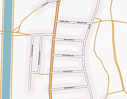
Die Karten sehen so aus:
Hilfe für Windows-Nutzer zur Installation von Perl, GD.pm und taho.exe:
- Lade und installiere perl von http://www.activestate.com/Products/ActivePerl/.
- Nach der Installation starte den "perl package manager" (start->programs->activeperl->perl package manager).
- Öffne "edit->preferences".
- Füge eine neue package location hinzu "name:uwinnipeg.ca location:http://theoryx5.uwinnipeg.ca/ppms/".
- Danach klicke auf "show all package icons".
- Markiere und installiere das GD Packet.
Hilfe für Linux-Nutzer zur Installation von Perl und GD.pm :
Du brauchst libgd-gd2-perl.
- Unter Debian: aptitude install libgd-gd2-perl
Taho.exe
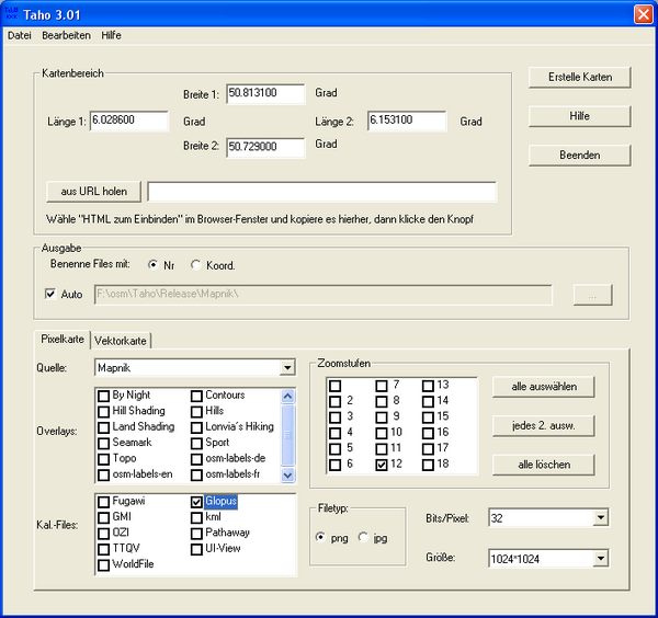
Dies ist ein Windows-Programm. Um eine Gebiet auszuwählen nutzt es die OSM-Export-Seite, aber man kann die Koordinaten auch per Hand eintragen. Seit taho.exe Version 2 wird taho.pl und somit auch perl nicht mehr benötigt.
Eine detaillierte Anleitung für die Benutzung mit UI-View steht hier
Quellen für Tiles
siehe Tile_servers
bei allen URLs die mit "http://a." bzw "https://a." starten kann das 'a' durch 'b' oder 'c' ersetzt werden. Die Liste im taho-Format [[1]]
Verfügbarkeit
Die Skripts und taho.exe gibt es auf: [2]
Falls Ihr Fehler findet kantaktiert einen von uns über die Discussionsseite oder per E-mail an
- waschbaer42@gmx.de für taho.pl.
- --DimitriJunker 12:10, 19 November 2009 (UTC) für beide Versionen

