Simple online↙ editor in browser
- Summary
- Online editor.
- Pros
-
- It is currently the pre-set editor for www.openstreetmap.org's 'Edit' tab, and runs in your web browser
- It has a 'walkthrough' feature and has been designed to be an easy introduction for brand new OSM contributors
- Development is active and ongoing, with a lot of attention paid to user experience
- Unlike Potlatch, this doesn't require a flash plugin. It's all JavaScript and should work in most modern web browsers
- Wiki help can be displayed directly in editor when editing tags
- You can use custom aerial imagery
- Very active development
- mapillary photos directly available in editor
- Strava Slide iD fork gives OSM editors access to billions of GPS tracks recorded by Strava users and allows for very precise mapping of twisted roads and trails
- Cons
-
- It's not intended for power users (who are already excellently served by JOSM) or those who want the speed of a desktop client
- Consumes most processing power (compared with Potlatch 2 and JOSM), so if the CPU/browser is slow, lags may occur
- Zooming and panning prompts a map fetch (not as fluid)
- The interface departs from normal OpenStreetMap terminology ("point", "line" and "area" instead of "node", "way" and "relation"), which can cause confusion, and editing accidents
- It is not possible to work offline
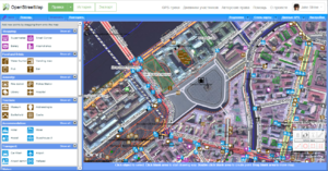 Potlatch 2 screenshot. Showing OSM data and background imagery - Summary
- Flash online editor.
- Pros
-
- Available via the 'Edit' tab's drop-down arrow
- As the precursor to iD (above) Potlatch was also designed for beginners and is great for quick easy immediate editing
- Displaying of GPS traces in a separate layer
- Some advanced features including vector backgrounds and a merging/conflation functionality for specialists
- Several aerial imagery backgrounds preconfigured and option for custom TMS imagery (please check the permissions)
- Cons
-
- Requires a flash plugin in the browser (in Microsoft's Edge browser enable Flash in settings)
- As with iD, it's not intended for power users
- not as fast and fluid as a desktop client
- does not work offline
Desktop↙ and offline↙
- Summary
- JOSM offers a large set of features and useful tools for a wide range of editing styles: It will either read in GPX tracks from your hard disk, or download them from OSM. Aerial imagery can easily be downloaded as a background for tracing. JOSM also supports photo mapping and audio mapping. Once you have completed your edits, you can upload them to OSM.
- Pros
-
- Fast fluid panning and zooming. Near-infinite zooming for super-precise mapping.
- Highly configurable and extendible via plugins, Map Styles, Presets or Validator Rules .
- Advanced editing functionality e.g. changeset reverting.
- A big selection of aerial imagery and third-party GPS traces immediately available as backgrounds for tracing. Custom TMS, WMS and WMTS aerial imagery can be added too (please check the permissions).
- Built in validator, which checks for common mapping errors before data upload
- Can work offline using downloaded data files, and can work with local photo and GPX files
- Tags are shown to user directly. Many tags are recognized by the "presets" which then show description, a translated/localized form and links to the OSM wiki page about a tag for more info.
- Very active development. Bugs are often fixed fast and a new stable version with new features appears usually every month.
- Cons
-
- The finer points of the interface take a while to learn.
- You have to download the software to run it, unlike the following online options (although there is a "Java Web Start" option)
- It requires Java 8 to work (not a big problem for most people).
- No help text when editing tags
- Summary
- Merkaartor is a fully featured editor for OpenStreetMap available under the GNU General Public License and developed using the Qt toolkit.
- Pros
-
- Has some unique features like transparent display of map features like roads and true curved roads.
- Intuitive user interface
- Binaries for Windows, Mac OS X and some Linux platforms are available. Source for the rest.
- Easy to set up satellite imagery from Bing or any other WMS/TMS source.
- Tag styles can be customized
- Save rendered maps as SVG or bitmap graphic
- Cons
-
- Merkaartor development is a bit slow, which makes bugfixes and new features available only by grabbing the source.
- Small userbase. Developer community is tiny.
- Slow on large number of loaded gps points.
Mobile
- Summary
- Vespucci is the only full OpenStreetMap editor for Android. It is also the first one, having been available and developed since 2009.
- Pros
- mobility
- a full editor for OpenStreetMap that works both on small (phones) and large (tablet) screen Android devices
- supports editing with keyboard and mouse if available
- create/edit nodes, ways, tags, and relations, with all the usual geometry related operations
- built-in support for Imagery Offset Database
- all editing can be done on the ground - no need to rely on memory
- helpful lead developer who is considerate of users' input
- useful display of all the changes you have made, down to a tag- and relation-level diff
- support for offline editing with pre-downloaded dataset in progress
- Cons
- UI can sometimes be a little dated-looking, and clumsy/cryptic to use
- Not currently ideal for editing of large relations (e.g. routes)
- No built-in object history at the moment (opens osm.org history in browser)
- Bad mobile data coverage will bring your mobile survey-edit session to a halt (unless you downloaded the area in advance; see also Pro #9)
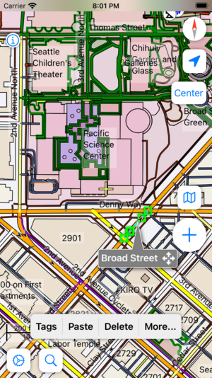 Go Map!! - way object selected - Summary
- Go Map!! is an iOS app that lets you create and edit information in OpenStreetMap. Go Map!! supports editing nodes and ways and arbitrary tagging.
- Pros
-
- Mobile
- Clean but powerful UI
- Filterable objects to improve load speeds
- Utilizes the preset library from iD
- User friendly Turn Restriction editing GUI
- Ability to clear caches for imagery, OSM data, GPX Traces and more
- Continuous OSM data download
- Cons
-
- Can be resource intensive when cache gets large
- Clunky workflow to edit most relation types
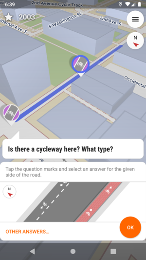 StreetComplete - question about a missing street name - Summary
- StreetComplete is a specialized editor of OpenStreetMap data. It allows to easily add some specific information.
- Pros
-
- Mobility.
- Very easy to add predefined data - user is asked simple questions, easy to verify for somebody near object, app handles entirety of tagging and making edit
- allows to create notes
- Ability to edit without Internet connection - quests and map may be cached
- Cons
-
- Is not intended as a general purpose editor, only adding of predefined data and answering notes is available
- Summary
- Navigation app that allows you to add, delete or change POIs.
- Pros
-
- Fully offline
- Relatively simple user interface
- Also supports Notes
- Cons
-
- Node and closed way edits only (and only for common tag combinations)
- Offline means time lag: downloaded map might be old, might take some time for user to upload changes
- Editing on a mapview, not a dataview. So you might add things that are there but not rendered.
- Usually no sat pic background, so POIs might be some distance from real location.
GIS
- Summary
- ESRI has released a plugin for editing OSM data.
- Pros
-
- Industry standard GIS Program
- Very comprehensive GIS capabilities
- Cons
-
- Proprietary
- "ArcGIS for Home Use" will cost you 100$/year
- Works only with ArcGIS 10
- Editing relations are not supported
See also
|


