FR:Featured images/Jan-Mar 2009
Jump to navigation
Jump to search


Voici quelques images remarquables, ce qui veut dire qu’elles ont été sélectionnées comme étant parmi les meilleurs exemples de cartographie basée sur les données d’OpenStreetMap, ou qu’elles apportent une illustration utile du projet OpenStreetmap.
Si vous avez une image répondant à cette définition, vous pouvez la proposer sur la page des Propositions d’image remarquable (en).
| d’avril à juin 2009 → | de janvier à mars 2010 → |
Galerie des images remarquables de janvier à mars 2009
2009, semaine 1
2009, semaine 2

2009, semaine 3
2009, semaine 4
2009, semaine 5
2009, semaine 6
2009, semaine 7
2009, semaine 8
2009, semaine 9
2009, semaine 10

2009, semaine 11
2009, semaine 12
2009, semaine 13
Détails et descriptions
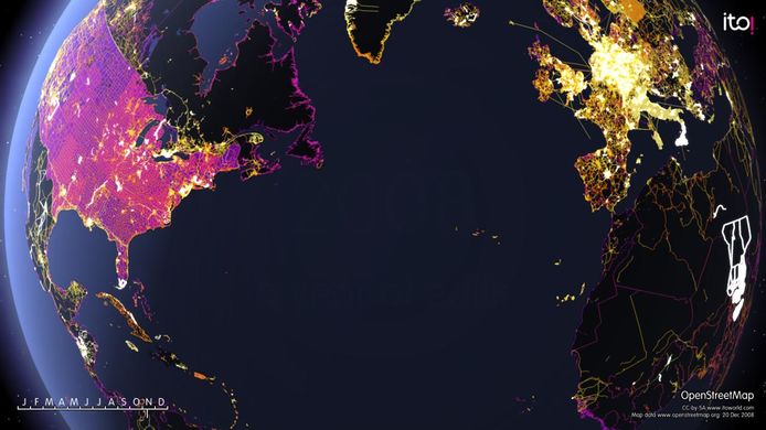
Semaine 1 (du lundi 29 décembre 2008 au dimanche 4 janvier 2009) [Edit]

- English : A frame from 'OSM 2008 - A year of edits'. Other stills available on Flickr. Animation on the ITO Vimeo site from midnight (Australia time) on Dec 31st.
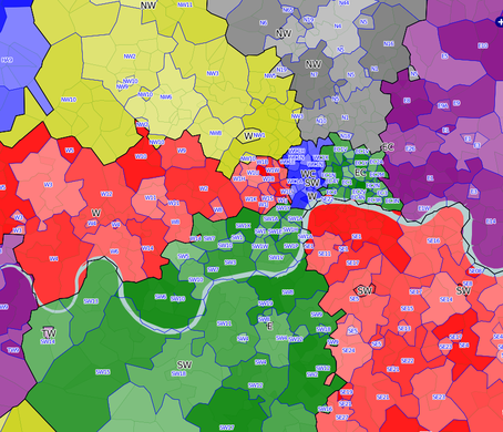
Semaine 2 (du lundi 5 janvier 2009 au dimanche 11 janvier 2009) [Edit]

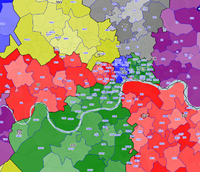
- English : Postcodes in London, as displayed on the postcode map
Semaine 3 (du lundi 12 janvier 2009 au dimanche 18 janvier 2009) [Edit]

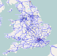
- English : Railways in the UK are now available on OpenTrainMap and on OSM UK rail network map
Semaine 4 (du lundi 19 janvier 2009 au dimanche 25 janvier 2009) [Edit]

- English : The Naga City GIS released their data to public domain and is now imported to OSM. All roads, railways, rivers and buildings.
Semaine 5 (du lundi 26 janvier 2009 au dimanche 1 février 2009) [Edit]

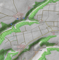
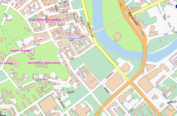
- English : Map of Tartu, the green University town in Estonia were contributed by the City Government
Semaine 6 (du lundi 2 février 2009 au dimanche 8 février 2009) [Edit]

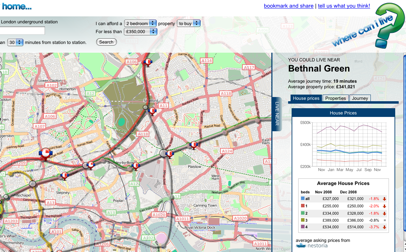
- English : Where-can-i-live uses OSM maps to display houses within a certain commute time of work
Semaine 7 (du lundi 9 février 2009 au dimanche 15 février 2009) [Edit]

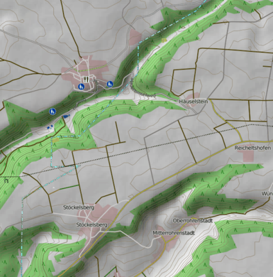
- English : A hiking map is available, showing the relief and contours of the landscape, and highlighting paths and trails (Note: Now seems to be described at DE:OSMC Reitkarte)
Semaine 8 (du lundi 16 février 2009 au dimanche 22 février 2009) [Edit]

- English : osmdiff is a program to visualize and report changes in an area (e.g. see osmdiff reports)
Semaine 9 (du lundi 23 février 2009 au dimanche 1 mars 2009) [Edit]

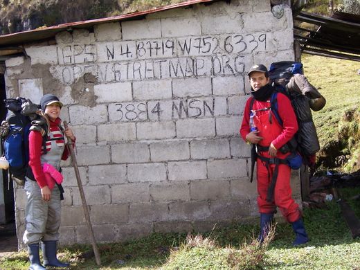
- English : Colombian mappers in the Ruiz Volcano (view map)
Semaine 10 (du lundi 2 mars 2009 au dimanche 8 mars 2009) [Edit]

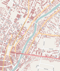
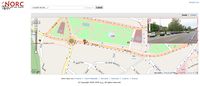
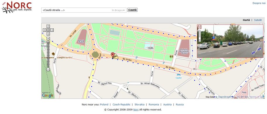
- English : http://www.norc.ro is a service similar to Google StreetView, offered by a Romanian company. They are using OpenStreetMap as an overlay to display the panoramas (only for Romania at higher zoom levels for now). They also donated 16 GB of GPS logs and gave us permission to derive data from their images.
Semaine 11 (du lundi 9 mars 2009 au dimanche 15 mars 2009) [Edit]

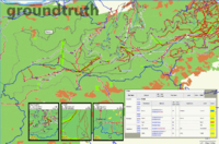
- English : GroundTruth is a new mapmaking tool for converting OSM data into Garmin maps. This featured image is a collage of various screenshots taken from MapSource, a Garmin unit and from Wiki pages containing rendering rules.
Semaine 12 (du lundi 16 mars 2009 au dimanche 22 mars 2009) [Edit]

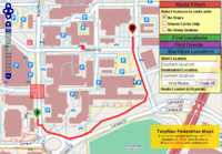
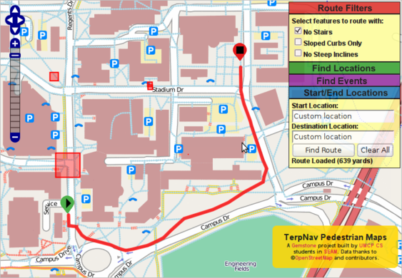
- English : Computer Science students at the University of Maryland have created a pedestrian routing map based on OpenStreetMap data. Support is even included for wheel friendly routing, and avoiding certain areas.
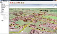
Semaine 13 (du lundi 23 mars 2009 au dimanche 29 mars 2009) [Edit]

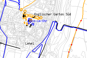
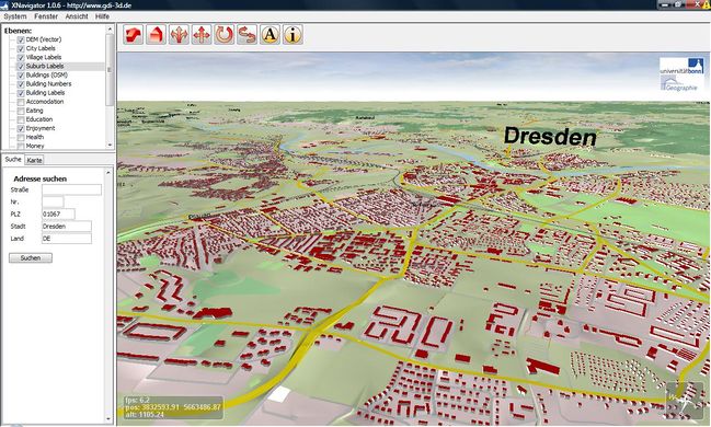
- English : OSM-3D view of Dresden from a Java 3D Map at http://www.geographie.uni-bonn.de/karto/osm-3d/screenshots.en.htm