Facilities in Surabaya Import
In this wiki we will:
- present the general import rules in OSM, then the data itself, the tool set to make the import, and the extra data that will be added as a useful complement.
- describe step-by-step a workflow to make the import, with screenshots and tips.
About
Infrastructure Features in Surabaya
Our project is to import the infrastructure features data in Surabaya into OpenStreetMap. These data was collected from BPBD (Regional Disaster Management Agency) East Java, based on UTM 49S. The original dataset consists of 4.915 infrastructure features nodes. The infrastructure features including buildings, place of worship (mosque, vihara/temple, and church), school, hospital, government offices, cementry, marketplace, monument, tower, communication tower, post office, and manufacturer.
During the import we will put changeset tags that indicate the source. Nonetheless, it is useful to keep the source tag for each object as the changeset information is not forcefully got from any OSM extract tool and the BPBD East Java could be disappointed not to be mentioned for this data + the metadata can disappear easily once the information is shared and shared, and the source can be a very useful information for people who will work with these data.
This is the permission letter by BPBD East Java.
Import Rules in OSM
The data from the Uganda Bureau Of Statistics, considering its high quality, is to be imported into OSM and consequently, needs to follow the guidelines of any to-be-imported dataset.
The dataset has been analyzed, the attributes have been converted into tags, presented and validated to the imports mailing list.
Any import must be done through a specific OSM user account. So the advice is to create a new OSM user account (eg the usual name with _import at the end) from a secondary email address.
An import through the Tasking Manager
Rather than a single, blind import, it has been decided to import the data with a control check of each object. An specific HOT Tasking Manager project has been created for this purpose.
They all share the same grid and a specific feature: they propose to load in JOSM the extract of the data to be imported over the area of each task (square). Consequently, the normal OSM layer is loaded from the Tasking Manager + one layer containing only the Infrastructure Features in Surabaya.
Import Line Outline
The quick references all steps here:
- The attribute data facilities will manage and prepare in QGIS.
- The data will prepare for manual insertion into Open Street Map
- Using JOSM to import the data after reviewing each data point.
- The facilities data will be modified to use the same tags as are already defined in OpenStreetMap
Schedule
The import has been launched at the end of September 2016.
Workflow
The workflow will show:
- first the common steps to start
- second, we will show how to check and import the infrastructure features
Load Data in QGIS
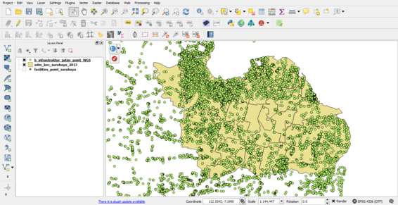
- Open QGIS, and load the infrastructure features data.
- The region infrastructure features data available in East Java, we just need data facilities in Surabaya. We must clip the data only in Surabaya.
- Then we will change the data projection to WGS 84
- Filter the infrastructure features in accordance with the Prioritise LifeLine Infrastructure Features in Surabaya
The priorities lifeline available in datasets are :
- School
- Place of worship
- Hospital
- Government Office
- Public Facilities
- Communication Infrastructure
- Emergency Service
- Marketplace
Import Data in JOSM
- Open JOSM, and check you have installed the UtilsPlugin2 JOSM plugins.
- Load the data modified by QGIS, and export data to .osm using JOSM.
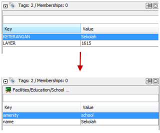
- We will be modified to use the same tags as are already defined in OpenStreetMap
- Go to the import Infrastructure Features project, choose a task, click on Start mapping...
- and then click on Edit with JOSM button...
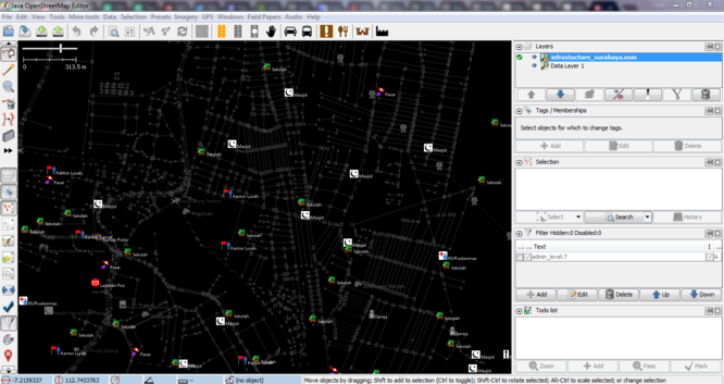
- Once the OSM data is loaded, you need to load the UBOS education facilities into a second layer. Open the infrastructures_surabaya.osm from the computer.


