List of featured images/2007
< List of featured images(Redirected from Featured Images/2007)
Jump to navigation
Jump to search
These are featured images, which have been identified as the best examples of OpenStreetMap mapping, or as useful illustrations of the OpenStreetMap project.
If you know another image of similar quality, you can nominate it on Featured image proposals.
- See also: List of featured images/2006 and List of featured images/2008
| December 2007 | |||
| 29th | 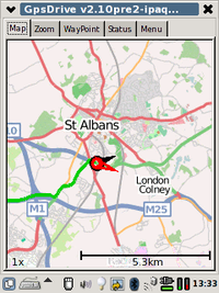
|
GPSDrive for IPAQ | |
| 22nd | 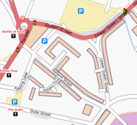
|
Building outlines starting to appear near Sutton Coldfield | |
| 15th | 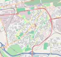
|
Pinelands, Cape Town | |
| 8th | 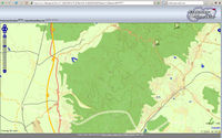
|
Contour lines of OSM project freemap.sk were created from http://gps-maps.info. Rendering z12-z16 took 1 week. | |
| 1st | 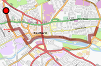
|
Pyroute in cycle mode, avoiding big roads and giving a quiet cycle route through back-streets and cycle paths. See a video of it working | |
| November 2007 | |||
| 24th | 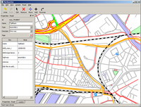
|
Merkaartor edit session of Rotterdam West, showing off WYSIWYG map editing. | |
| 17th | 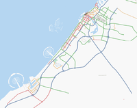
|
The Palm Islands (wiki page) and the unfinished World Islands were traced from NASA landsat imagery using the map rectifier. Although "The World" is not finished the imagery gave OSM the possibility to be the first to contain partial map data from this megastructure. | |
| 10th | 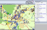
|
Dynamic POI layer on freemap.sk. Slovak subproject of OSM developed customizable POI layer, visitors by selecting checkboxes can choose which POI will be visible on the map. Many thanks to Dodi for a lot of jscript modifications in OpenLayers. | |
| 3rd | 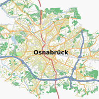
|
In 2003, the city of Osnabrück was the first city in Germany to make free geodata available, in a project named Frida. The data has now been dual-licensed (originally GPL) and incorporated into OSM by its creators, Intevation GmbH. | |
| October 2007 | |||
| 27th | 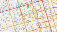
|
Toronto city centre, rendered using Mapnik | |
| 20th | 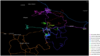
|
The Party renderer can display all your traces from a mapping weekend, as an image or video. Just give it a directory of GPX files | |
| 13th | 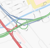
|
Complex multi-layered junctions can be mapped using the layer and bridge tags. Example shown is the start of Britain's M1 in London | |
| 6th | 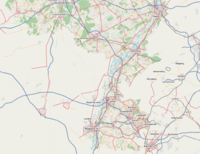
|
Imported AND data in Netherlands (to top of picture) showing comparison with Belgium mapping (to bottom/left). view the area | |
| September 2007 | |||
| 29th | 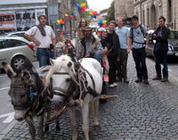
|
Not all mapping parties need to be on bicycle. Participants of the 1st Ljubljana Mapping Party used a carriage to prove the proper use of horses=yes tag. | |
| 22nd | 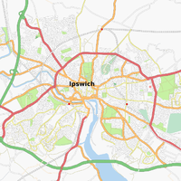
|
Ipswich town centre, typical example of a well-mapped town | |
| 15th | 
|
Bratislava town - Even there are just four members in Slovakia actively developing and contributing to OpenStreetMap project, they are in some details far beyond. On picture you can see relief overlay from Shuttle Radar Topography Mission. | |
| 8th | 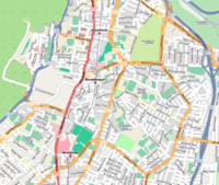
|
Adrian Frith's map of Cape Town | |
| 1st | 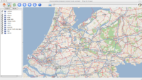
|
Automotive Navigation Data (AND) donated a whole country's worth of streetmap data to the project (blog post). | |
| August 2007 | |||
| 25th | 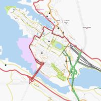
|
Bergen city centre, easier to read now that the coast is rendered | |
| 18th | 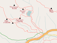
|
The Langdale Pikes (in Lake District, UK), mapped at recent Lakes mapping party, showing road, track, bridleway, footpaths, peaks and water features | |
| 11th | 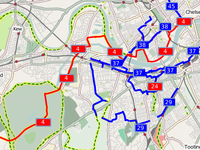
|
The OSM Cycle Map uses OSM data to create a map dedicated to the needs of cyclists, showing cycle routes and emphasising cycle paths over main roads. | |
| 4th | 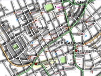
|
Experimenting with shadows. The SVG output of Osmarender can be tweaked to apply a 'drop shadow' effect to streetmaps, as demonstrated by Dotbaz at SOTM | |
| July 2007 | |||
| 28th | 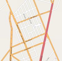
|
Urban one-way street systems can be tagged using oneway=yes. Turn on direction arrows in JOSM to see which way they go | |
| 21st | 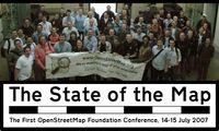
|
At the State Of The Map 2007 conference, OSM people discussed everything from routing software to mobile maps, animations, and 'Real' Cartography. You can download the audio and slides | |
| 14th | 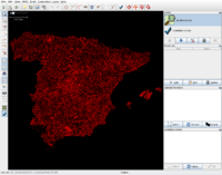
|
Spanish OSMers got permission to import goverment data into OSM. The first task has been importing the "ROI" geodesy network; supposedly this is the first time that data from a National Mapping Agency is imported directly into OSM. "ROI" stands for "Red de Orden Inferior", or "Lesser Order Network". | |
| 7th | 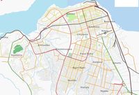
|
Kinshasa, centre of 3rd largest city in Africa | |
| June 2007 | |||
| 30th | 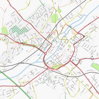
|
Canterbury centre, results from the South East Tip mapping party | |
| 23rd | 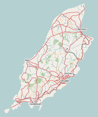
|
OpenStreetMap now has an excellent free map of the Isle of Man, thanks to data contributed by the Isle of Man Department for Local Government and the Environment, also by local mappers. | |
| 16th | 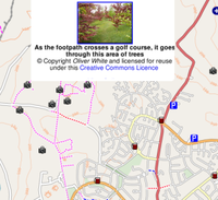
|
Freemap, showing Bedford, with a Geograph photo open to show what the footpath looks like at ground level | |
| 9th | 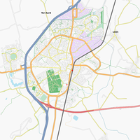
|
Assen is the capital city of the province of Drenthe. It's the first city in the Netherlands which has (near) 100% coverage in OSM. | |
| 2nd | 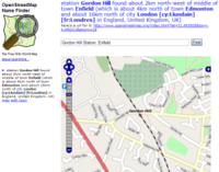
|
David Earl's Name Finder application in use. Try it out with a search... | |
| May 2007 | |||
| 26th | 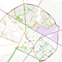
|
Bicester is a moderately-sized town in the UK, which has recently appeared in OSM and its data has quickly grown from a dot on the landscape to what we see now. | |
| 19th | 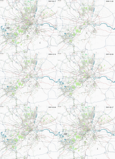
|
A lot of progress has been made in mapping London. OpenStreetMap's coverage has more than doubled in just the last six months. | |
| 12th | 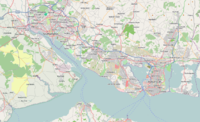
|
The Solent, southern UK, from the tiles@home layer showing filled sea areas for Southampton Water, Portsmouth, Langstone & Chichester harbours, and the Solent. | |
| 5th | 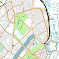
|
Østerbro, a suburb of København | |
| April 2007 | |||
| 28th | 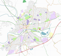
|
Map of the Bedford area. But what do all the colours mean? | |
| 21st | 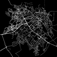
|
Raw tracklogs detailing the structure of Loughborough, UK. | |
| 14th | 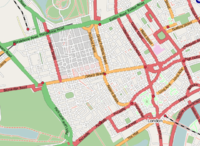
|
Central London, showing the detail now available there | |
| 7th | 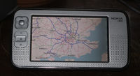
|
London and southeast England, on a MaemoMapper handheld display. | |
| March 2007 | |||
| 31st | 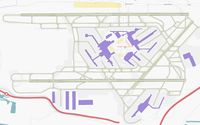
|
Runways and taxiways of Heathrow airport | |
| 24th | 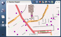
|
Helsinki city centre on MaemoMapper, a mapping application for the Nokia 770 series of wireless internet tablets | |
| 17th | 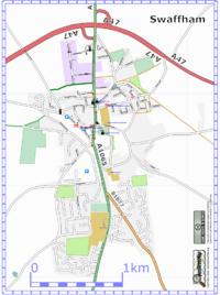
|
Swaffham | |
| 10th | 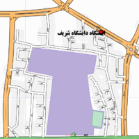
|
OpenStreetMap is an international project, and street names can be accepted in multiple languages. This map is of the area surrounding Sharif University of Technology in Tehran – the Iran/Tagging rules page shows how to edit maps in this area. | |
| 3rd | 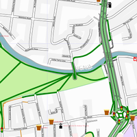
|
Butt's Green in Cambridge, rendered with the new curve smoothing algorithms in Osmarender. | |
| February 2007 | |||
| 24th | 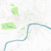
|
London, as seen after about 40 people mapped the place in a weekend | |
| 17th | 
|
Osmarender 4 will add support for bridges and tunnels - see Key:bridge for how to tag them | |
| 10th | 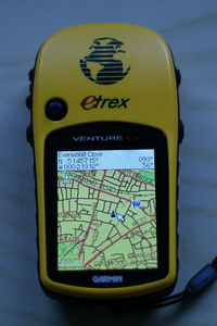
|
A Garmin GPS is used to display OpenStreetMap's map of Putney, London | |
| 3rd | 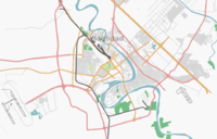
|
While most of us can't reach Baghdad with our GPS units, Yahoo! have provided aerial photos of it (and other cities around the world) to create maps from. Why not pick a city from Yahoo!_Aerial_Imagery which is not currently being mapped, and start mapping it today? | |
| January 2007 | |||
| 27th | 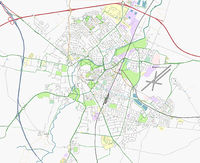
|
Thanks to the efforts of David Earl and others, the city of Cambridge (UK) is now completely mapped. Posters to follow... | |
| 20th | 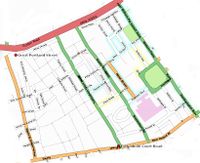
|
The London mapping party will try to use aerial photography to create a map of London, rather than the traditional GPS units | |
| 13th | 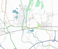
|
Map of Taplow (South Buckinghamshire, UK), rendered using Osmarender | |
| 6th | 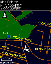
|
OpenStreetMap data can be used on mobile devices, thanks to tools such as Mkgmap and OSMGarminMap (shown: map of Hammersmith) | |
