Featured images/Jul-Sep 2013
< Featured images(Redirected from Featured Images/Jul-Sep 2013)
Jump to navigation
Jump to search

These are featured images, which have been identified as the best examples of OpenStreetMap mapping, or as useful illustrations of the OpenStreetMap project.
If you know another image of similar quality, you can nominate it on Featured image proposals.
| ← from July to September 2012 | ← from April to June 2013 | from October to December 2013 → | from July to September 2014 → |
Gallery of featured images, from July to September 2013
2013, week 27
2013, week 28
2013, week 29
2013, week 30
2013, week 31
2013, week 32

2013, week 33
2013, week 34
2013, week 35
2013, week 36
2013, week 37
2013, week 38
2013, week 39
Details and captions
Week 27 (from Monday 1 July 2013 to Sunday 7 July 2013) [Edit]

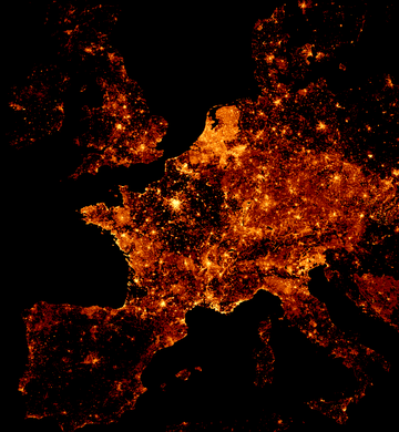
- English : No volcanic eruptions, no wildfires, but burning passion of OpenStreetMap volunteers – represented by a map showing the colourised node density of OpenStreetMap data. Alternative views: full world as slippy map, full world as single image (67 Mpx, 1 MiB); full world scaled down, more info how this was created.
Week 28 (from Monday 8 July 2013 to Sunday 14 July 2013) [Edit]

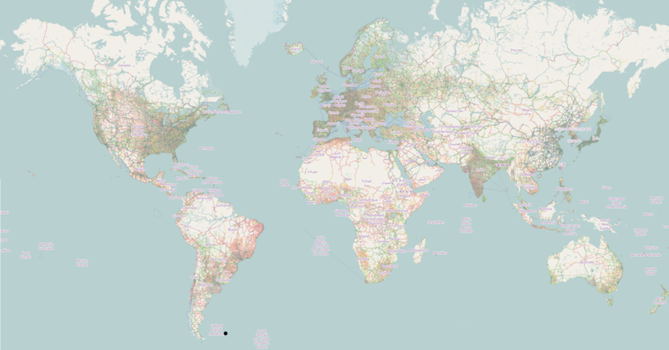
- English : A modified 'standard' view of OpenStreetMap to reveal coverage worldwide on low zoom levels. Those (0–8) have essentially been created from scaling down tiles (slightly modified and without labels) of zoom level 9 and adding the labels afterwards. This experiment by Frederik Ramm can be viewed as a zoomable map (comparison via “+” on the right); more details of the technical approach.
Week 29 (from Monday 15 July 2013 to Sunday 21 July 2013) [Edit]

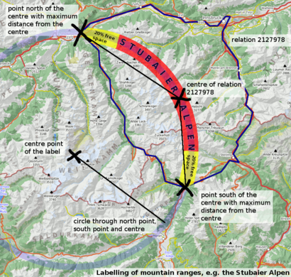
- English : Large curved labels on a mountain range (Stubaier Alpen
 Stubaier Alpen shown here). The diagram illustrates how this cartographic effect could be achieved in an automated rendering process based on OpenStreetMap's raw geospatial data. Shown position on a slippy map, process description.
Week 30 (from Monday 22 July 2013 to Sunday 28 July 2013) [Edit]

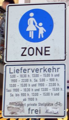
- English : Overly complicated access restrictions (delivery, taxi at specific times and bicycle) to a pedestrianised area demonstrate that making a map is sometimes not simple but often funny.
Week 31 (from Monday 29 July 2013 to Sunday 4 August 2013) [Edit]

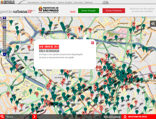
- English : A project of Brazil's biggest city São Paulo is using OpenStreetMap! “Mapeamento Colaborativo - Gestão Urbana SP” (Collaborative Mapping - Urban Management SP) allows the residents to locate urban problems and suggest solutions.
Week 32 (from Monday 5 August 2013 to Sunday 11 August 2013) [Edit]

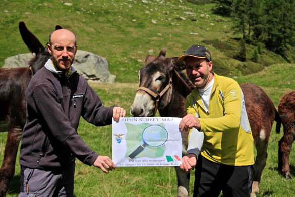
- English : "Dal gps alla montagna" mapping party, an event in the mountains of Trentino, Italy. About 70 people attended, including Trentino Alpine Club who have announced that they release their hiking network data (page in Italian) under the ODbL.
Week 33 (from Monday 12 August 2013 to Sunday 18 August 2013) [Edit]

- English : All around the world we celebrated the OpenStreetMap 9th Anniversary Birthday party. In Japan they kept up their run of interesting cakes, with a fruity one this year!
Week 34 (from Monday 19 August 2013 to Sunday 25 August 2013) [Edit]

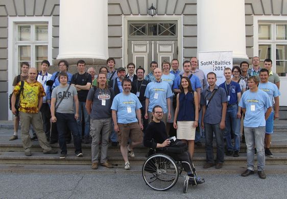
- English : Mappers, users and developers from Baltic States, Russia, Finland and other countries gathered at the SOTM Baltics 2013 OSM local conference in Tartu, Estonia
Week 35 (from Monday 26 August 2013 to Sunday 1 September 2013) [Edit]

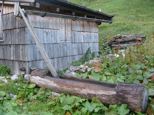
- English : While out mapping the world OSM mappers come across some curious things. Shown here: a wooden trough fed by water from the rain gutter of a hut. Possibly it is a watering place for animals.
Week 36 (from Monday 2 September 2013 to Sunday 8 September 2013) [Edit]

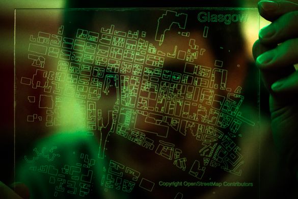
- English : OSM contributor Hawkeye admiring his laser-etched acrylic map (bounding box at OSM.org) of OpenStreetMap buildings in central Glasgow, made at the MAKLab
 MAKLab in The Lighthouse, Glasgow.
Week 37 (from Monday 9 September 2013 to Sunday 15 September 2013) [Edit]

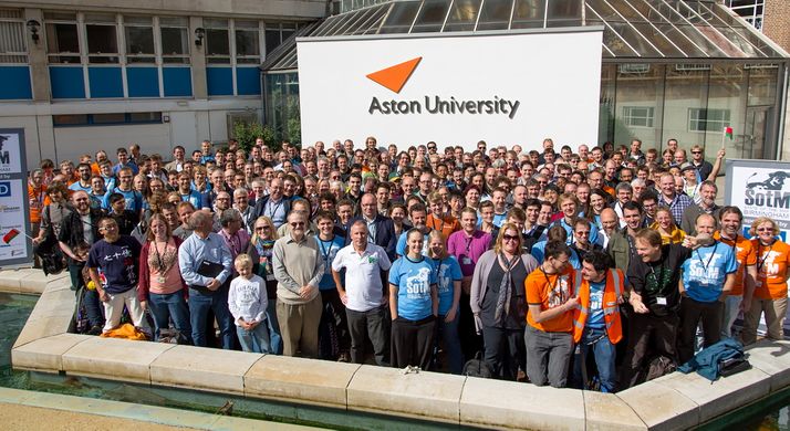
- English : State Of The Map 2013, the annual OpenStreetMap conference, was held in Birmingham, England, from 6th to 8th September 2013.
Week 38 (from Monday 16 September 2013 to Sunday 22 September 2013) [Edit]

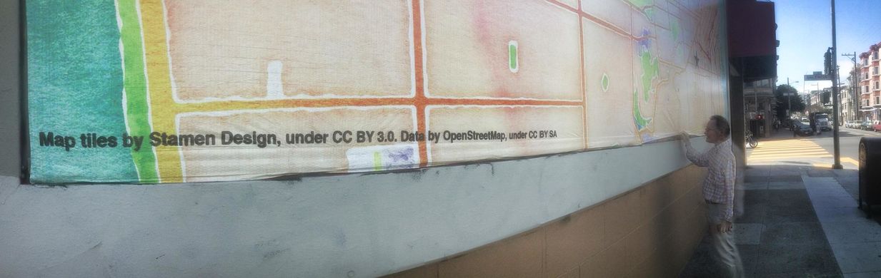
- English : Stamen have produced a map on a billboard using their watercolour style and OpenStreetMap data. Perhaps the largest OSM map ever
Week 39 (from Monday 23 September 2013 to Sunday 29 September 2013) [Edit]

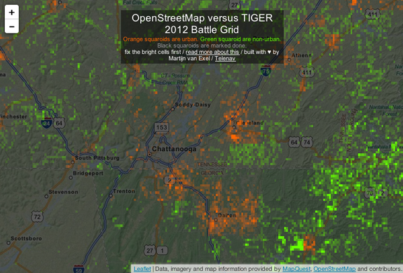
- English : The TIGER Battlegrid map shows colourful grid squares (orange for urban, green for countryside) for parts of the U.S. where more TIGER fixup work is needed by comparing with the newer TIGER 2012 data. Read more on this blog post