Featured images/Jan-Mar 2011
Jump to navigation
Jump to search


These are featured images, which have been identified as the best examples of OpenStreetMap mapping, or as useful illustrations of the OpenStreetMap project.
If you know another image of similar quality, you can nominate it on Featured image proposals.
| ← from January to March 2010 | ← from October to December 2010 | from April to June 2011 → | from January to March 2012 → |
Gallery of featured images, from January to March 2011

2011, week 1

2011, week 2

2011, week 3
2011, week 4
2011, week 5
2011, week 6

2011, week 7

2011, week 8
2011, week 9

2011, week 10
2011, week 11
2011, week 12
2011, week 13
Details and captions
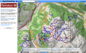
Week 1 (from Monday 3 January 2011 to Sunday 9 January 2011) [Edit]

- English : Snowsports maps from openpistemap.org with contours and hillshading. Hitting the slopes this winter? Check out WikiProject Piste Maps.
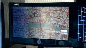
Week 2 (from Monday 10 January 2011 to Sunday 16 January 2011) [Edit]

- English : OpenStreetMap on British TV (episode The Bounty Hunter in series K-9).
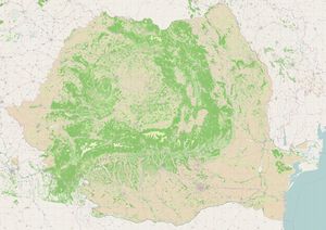
Week 3 (from Monday 17 January 2011 to Sunday 23 January 2011) [Edit]

- English : Romanian landuse – data from EEA comprises 100K polygons, imported to OSM December 2010
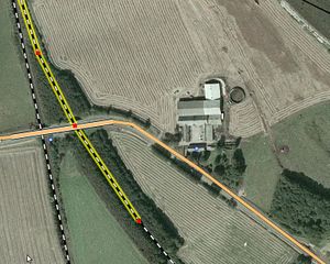
Week 4 (from Monday 24 January 2011 to Sunday 30 January 2011) [Edit]

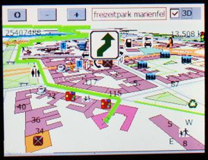
- English : Fugro has shared their 40 cm Danish photography with OpenStreetMap [Thanks to Peter Brodersen and Jonas Häggqvist for making this happen]. See the project page for instructions on tracing it with JOSM/Potlatch2.
Week 5 (from Monday 31 January 2011 to Sunday 6 February 2011) [Edit]

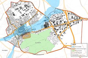
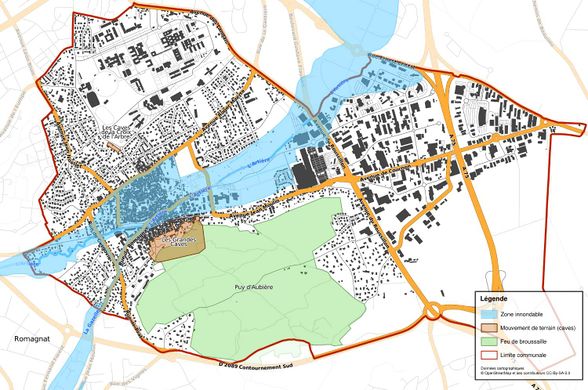
- English : Municipality council using Nicolas Dumoulin's map of potential flood, fire, cave-in hazards in a town.
Week 6 (from Monday 7 February 2011 to Sunday 13 February 2011) [Edit]

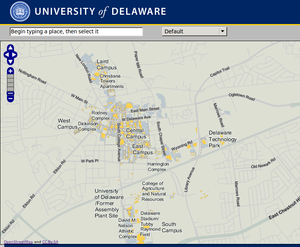
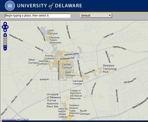
- English : Campus map uploaded to OSM by University of Delaware (and see the selectable vector buildings on their website!)
Week 7 (from Monday 14 February 2011 to Sunday 20 February 2011) [Edit]

- English : glosm is a hardware-accelerated OpenGL-based OpenStreetMap renderer, producing 3D renderings like this one of an area of Moscow
Week 8 (from Monday 21 February 2011 to Sunday 27 February 2011) [Edit]

Week 9 (from Monday 28 February 2011 to Sunday 6 March 2011) [Edit]

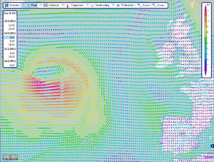
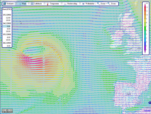
- English : OpenSeaMap showing a storm in the North Atlantic. Data provided by US and rendered by bluewater-info.net.
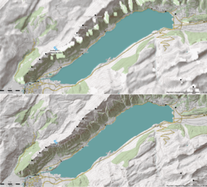
Week 10 (from Monday 7 March 2011 to Sunday 13 March 2011) [Edit]

- English : Maperitive's custom DEM support showing detail of Viewfinder's Alps SRTM1 DEM compared to SRTM, for Lake Brienz area. (also visible on [1] [2] [3] topo maps)
Week 11 (from Monday 14 March 2011 to Sunday 20 March 2011) [Edit]

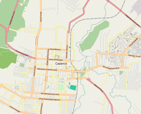
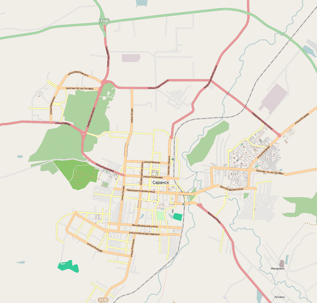
- English : City of Saransk was mapped in only 50 hours. User osmisto has organized the first Russian online mapping party: it's still cold outside, so almost everyone attended. The pie, animation (4 MB), forum.
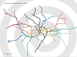
Week 12 (from Monday 21 March 2011 to Sunday 27 March 2011) [Edit]

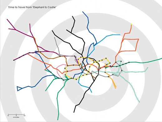
- English : Tom Carden's Travel Time Tube Map creates isochronic maps of the London Underground
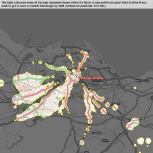
Week 13 (from Monday 28 March 2011 to Sunday 3 April 2011) [Edit]

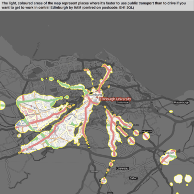
- English : Example of mySociety's travel maps, showing start-locations from which one type of transport beats another (in this case, public-transport vs car)