File:1-Dymaxion-OSM-Land-2970px.jpg

Original file (2,970 × 2,100 pixels, file size: 613 KB, MIME type: image/jpeg)
Summary
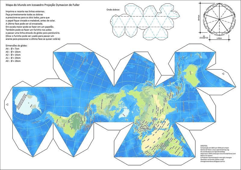
OSM Kirigamiː Cut-fold-and-glue artwork for kids (and not so young).
OSM World View Zoom Level 3 TF-Landscape Rendering in Dymaxion Projection.
Composed in QGIS by OSMuser:smaprs
Country names: www.openstreetmap.org © OpenStreetMap contributors
Base Map: OSM Landscape www.thunderforest.com
Ocean Floor Relief: Global Map Projector Equirectangular www.giss.nasa.gov
Dymaxion python script at: emergentweirdness.blogspot.com.br
Licensing
Image free for copy, transform and share CC-BY-SA 2.0
| Contains map data © OpenStreetMap contributors, made available under the terms of the Open Database License (ODbL).
The ODbL does not require any particular license for maps produced from ODbL data, produced maps may be subject also to other licences. |
File history
Click on a date/time to view the file as it appeared at that time.
| Date/Time | Thumbnail | Dimensions | User | Comment | |
|---|---|---|---|---|---|
| current | 19:36, 10 November 2016 | | 2,970 × 2,100 (613 KB) | SergioAJV (talk | contribs) | Reverted to version as of 12:03, 5 November 2016 |
| 18:12, 10 November 2016 | 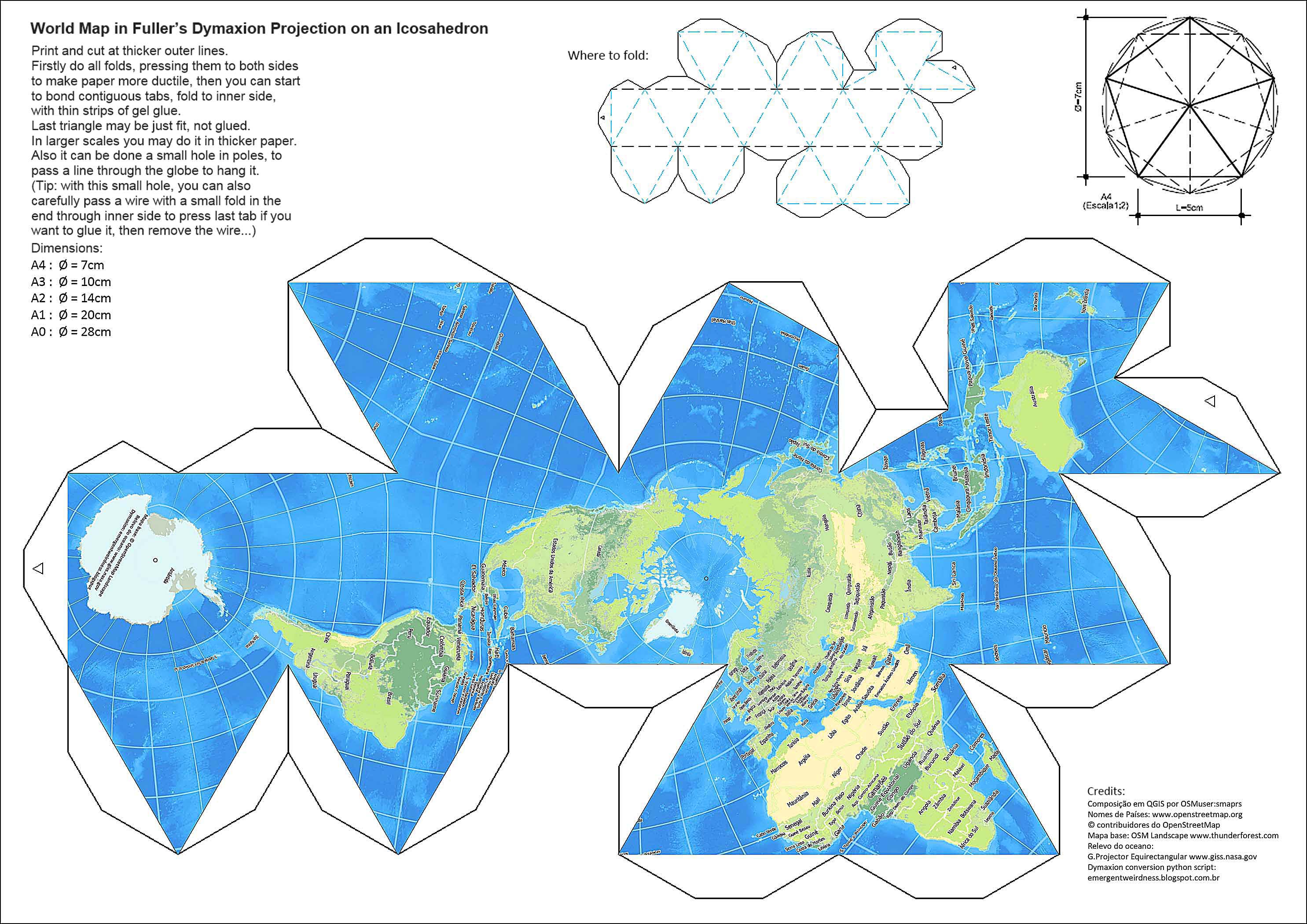 | 2,970 × 2,100 (596 KB) | SergioAJV (talk | contribs) | Instructions in english | |
| 12:03, 5 November 2016 | 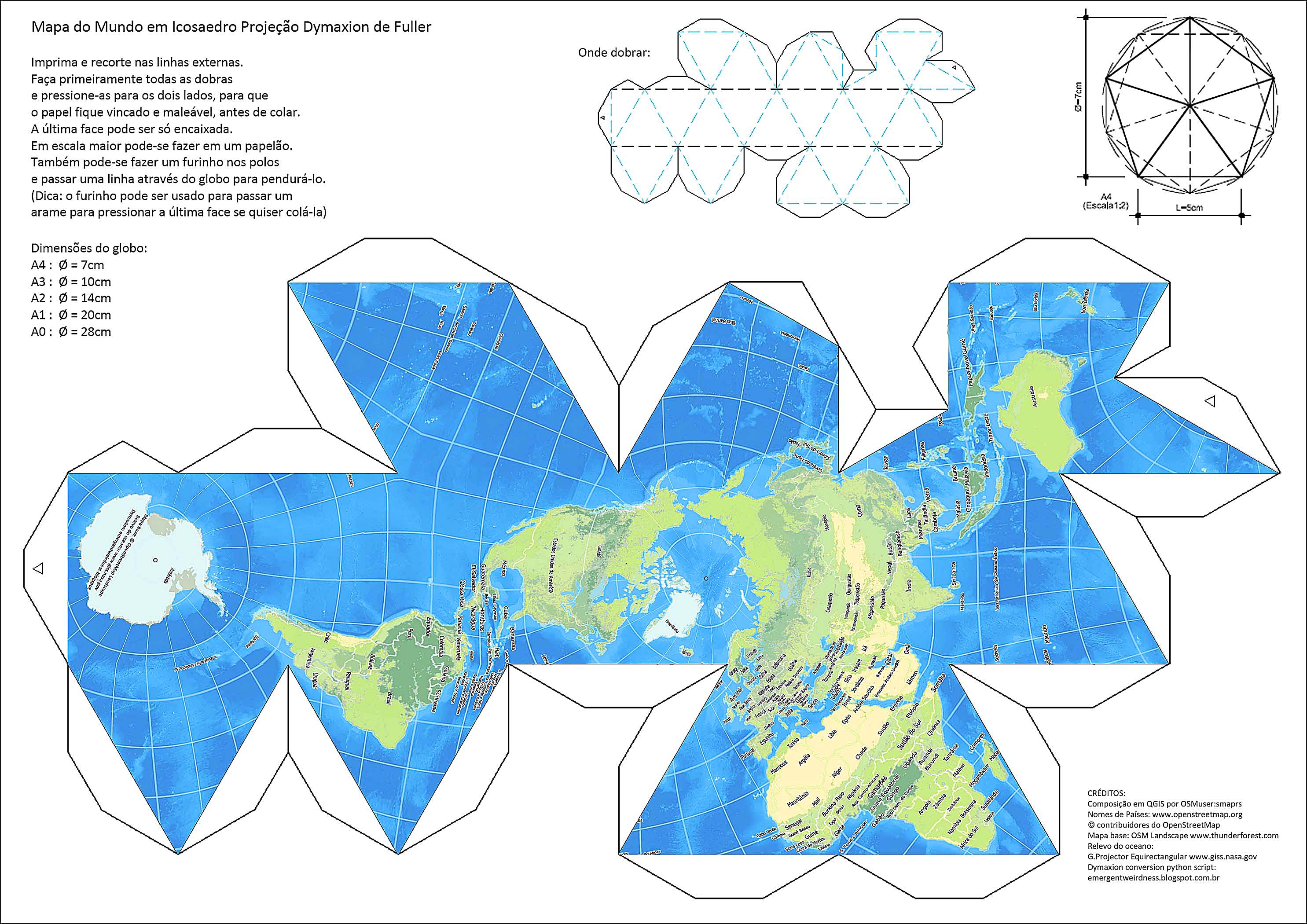 | 2,970 × 2,100 (613 KB) | SergioAJV (talk | contribs) | OSM Kirigamiː Cut-fold-and-glue artwork for kids (and not so young). OSM World View Zoom Level 3 TF-Landscape Rendering in Dymaxion Projection. |
You cannot overwrite this file.
File usage
The following page uses this file: