File:United States System of Highways Adopted for Uniform Marking by the American Association of State Highway Officials.jpg
Jump to navigation
Jump to search


Size of this preview: 800 × 522 pixels. Other resolutions: 320 × 209 pixels | 640 × 417 pixels | 1,024 × 668 pixels | 1,280 × 835 pixels | 2,560 × 1,669 pixels | 8,972 × 5,851 pixels.
Original file (8,972 × 5,851 pixels, file size: 18.59 MB, MIME type: image/jpeg)
This file and its description are from Wikimedia Commons.
| Description |
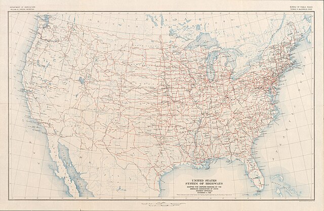
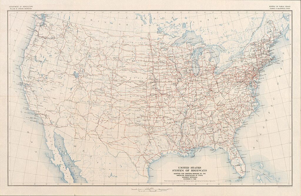
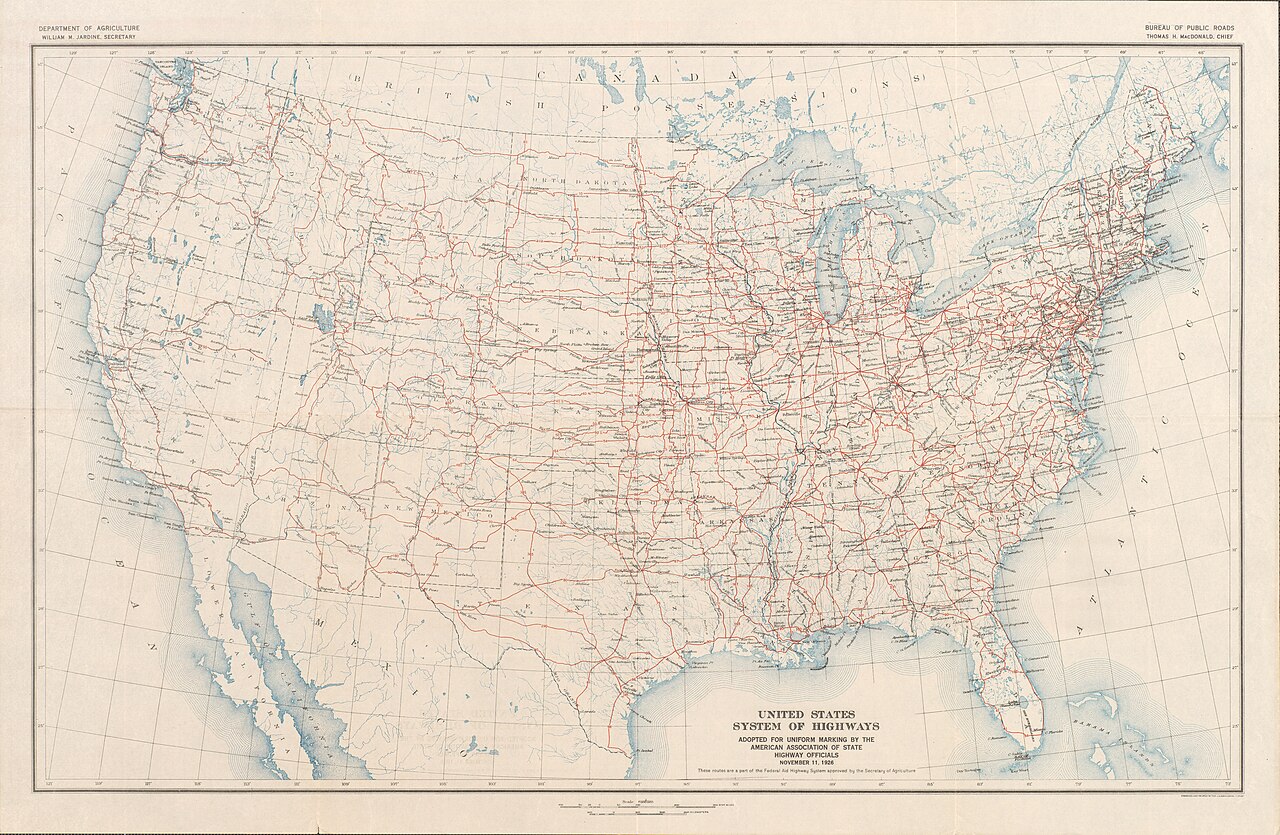
English: Map of the final U.S. Highway system as approved November 11, 1926
Français : Carte du système final US Highway comme approuvé en 11 Novembre 1926
日本語: 最終的な米ハイウェイシステムの地図は、1926年11月11日承認されました |
||||
| Date | |||||
| Source | Bureau of Public Roads & American Association of State Highway Officials (November 11, 1926). United States System of Highways Adopted for Uniform Marking by the American Association of State Highway Officials (Map). 1:7,000,000. Washington, DC: United States Geological Survey. OCLC 32889555. Retrieved November 7, 2013 – via University of North Texas Libraries. | ||||
| Author |
|
||||
| Permission (Reusing this file) |
|


File history
Click on a date/time to view the file as it appeared at that time.
| Date/Time | Thumbnail | Dimensions | User | Comment | |
|---|---|---|---|---|---|
| current | 00:18, 16 November 2013 | | 8,972 × 5,851 (18.59 MB) | wikimediacommons>Imzadi1979 | replacing with higher quality scan that shows the full map |
File usage
The following page uses this file: