File:AiO Garmin Screenshots Haiti.png
Jump to navigation
Jump to search

No higher resolution available.
AiO_Garmin_Screenshots_Haiti.png (320 × 480 pixels, file size: 44 KB, MIME type: image/png)
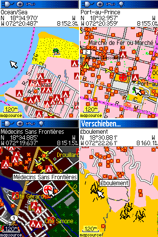
Example screenshots of the All in one Garmin Map of Haiti showing some features of the damage layer.
File history
Click on a date/time to view the file as it appeared at that time.
| Date/Time | Thumbnail | Dimensions | User | Comment | |
|---|---|---|---|---|---|
| current | 14:27, 28 January 2010 | | 320 × 480 (44 KB) | Master (talk | contribs) | Example screenshots of the All in one Garmin Map of Haiti showing some features of the damage layer. |
You cannot overwrite this file.
File usage
The following 2 pages use this file: