File:AlaskaAir.PNG
Jump to navigation
Jump to search

Size of this preview: 338 × 600 pixels. Other resolutions: 135 × 240 pixels | 270 × 480 pixels | 640 × 1,136 pixels.
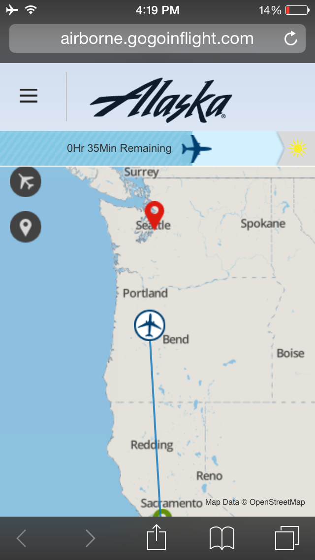
Original file (640 × 1,136 pixels, file size: 201 KB, MIME type: image/png)
This is a Featured image, which means that it has been identified as one of the best examples of OpenStreetMap mapping, or that it provides a useful illustration of the OpenStreetMap project. If you know another image of similar quality, you can nominate it on Featured image proposals.
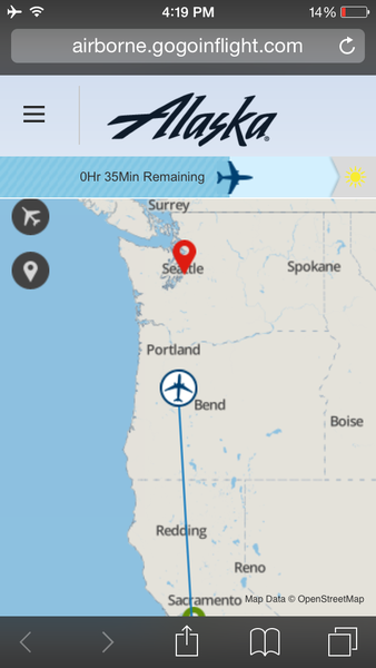
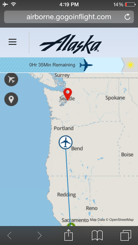
Front-page image for week 2 of 2015 (5–11 Jan.).
- Image descriptions
- English : On Alaska Airlines, passengers can visualize the progress of their flight on their devices via Gogo WiFi inflight internet service
- italiano : Sui voli Alaska Airlines, i passeggeri possono visualizzare il progresso del proprio volo sui loro dispositivi tramite il servizio internet di bordo Gogo WiFi.
- русский : Пассажиры Аляскинских авиалиний могут наблюдать за процессом полёта на собственных мобильных устройствах, подключенных к вай-фаю Гоу-гоу. Географическая карта, показывающая маршрут, основана на ОпенСтритМапе.
- 中文(繁體) : 在阿拉斯加航空的飛機上,乘客可以藉由機上的網路連線服務 Gogo WiFi,在自己的裝置上看到飛行狀況示意圖。
File history
Click on a date/time to view the file as it appeared at that time.
| Date/Time | Thumbnail | Dimensions | User | Comment | |
|---|---|---|---|---|---|
| current | 16:26, 2 December 2014 | | 640 × 1,136 (201 KB) | SP!KE (talk | contribs) |
You cannot overwrite this file.