File:Atlantic bathymetry.jpg
Jump to navigation
Jump to search

Size of this preview: 480 × 600 pixels. Other resolutions: 192 × 240 pixels | 384 × 480 pixels | 614 × 768 pixels | 819 × 1,024 pixels | 1,638 × 2,048 pixels | 4,000 × 5,000 pixels.
Original file (4,000 × 5,000 pixels, file size: 9.12 MB, MIME type: image/jpeg)
This file and its description are from Wikimedia Commons.
| Description |
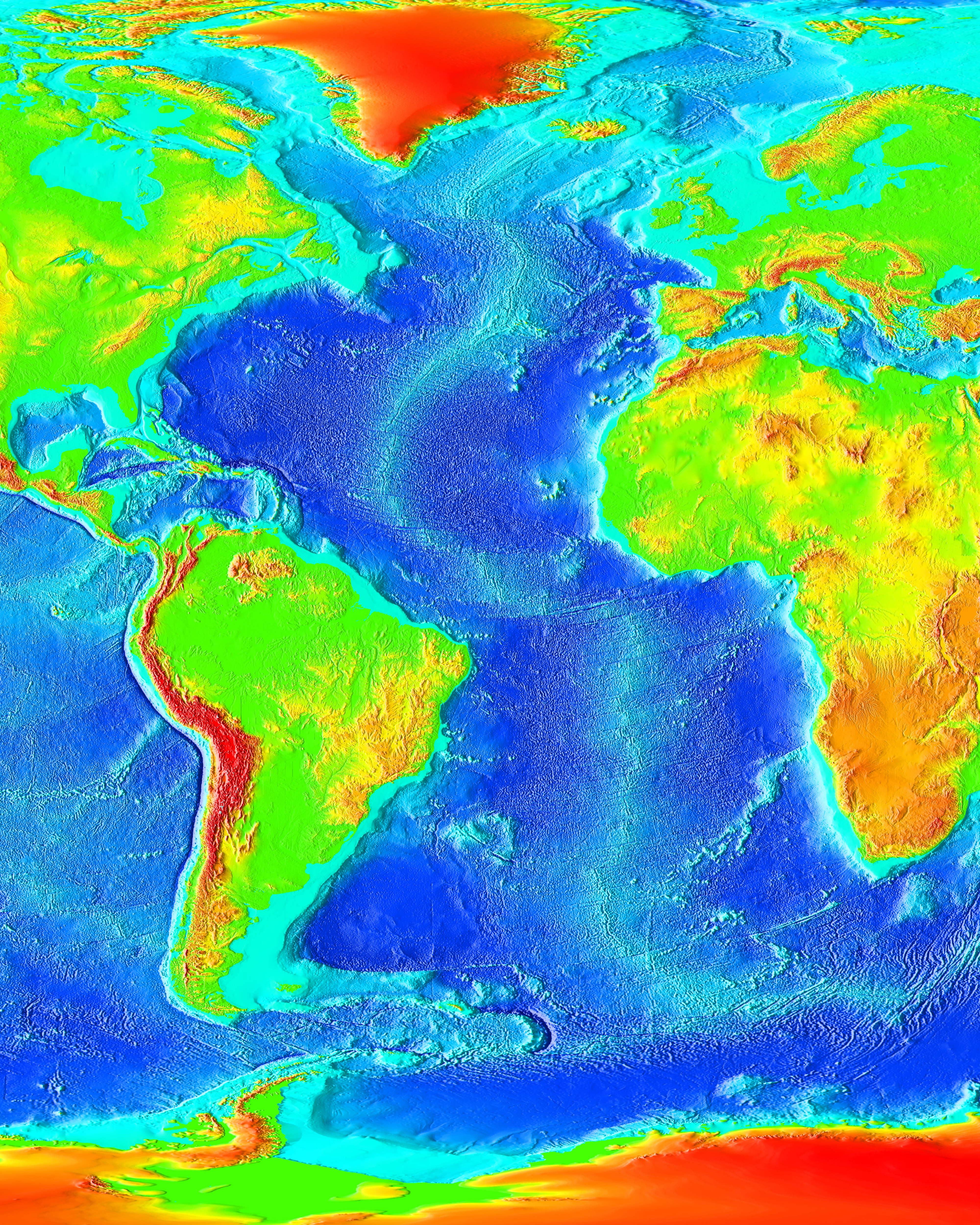
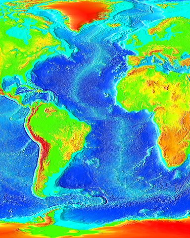
English: The Atlantic Ocean. |
| Source | http://www.ngdc.noaa.gov/mgg/image/2minrelief.html |
| Author | NOAA |
This image is in the public domain because it contains materials that originally came from the U.S. National Oceanic and Atmospheric Administration, taken or made as part of an employee's official duties.
|
File history
Click on a date/time to view the file as it appeared at that time.
| Date/Time | Thumbnail | Dimensions | User | Comment | |
|---|---|---|---|---|---|
| current | 19:55, 19 August 2023 | | 4,000 × 5,000 (9.12 MB) | wikimediacommons>Kersti Nebelsiek | higher resolution |
File usage
The following page uses this file: