File:BCC Sandwell.jpg
Jump to navigation
Jump to search

Size of this preview: 601 × 599 pixels. Other resolutions: 241 × 240 pixels | 481 × 480 pixels | 770 × 768 pixels | 1,027 × 1,024 pixels | 1,994 × 1,988 pixels.
Original file (1,994 × 1,988 pixels, file size: 1.62 MB, MIME type: image/jpeg)
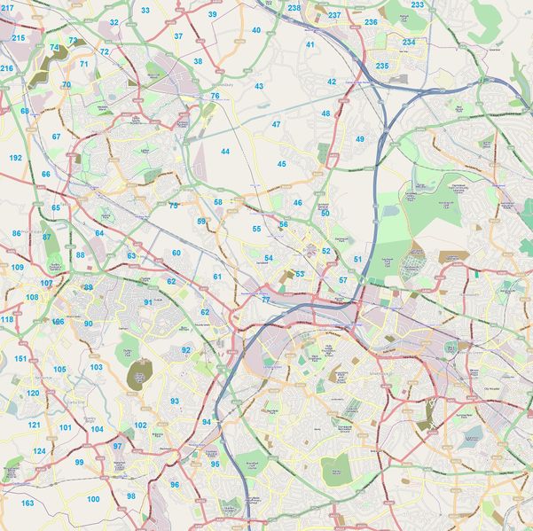
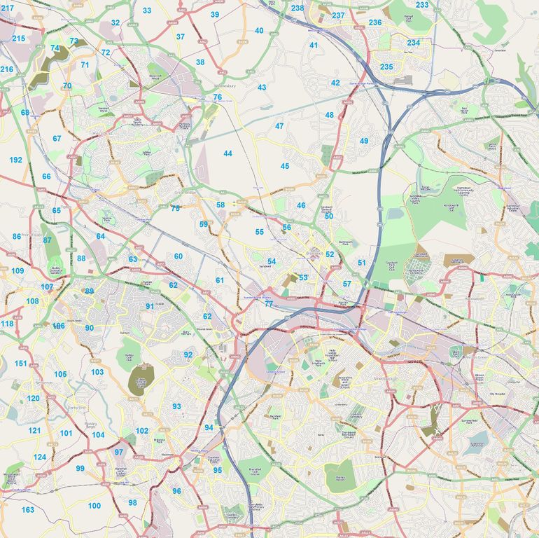
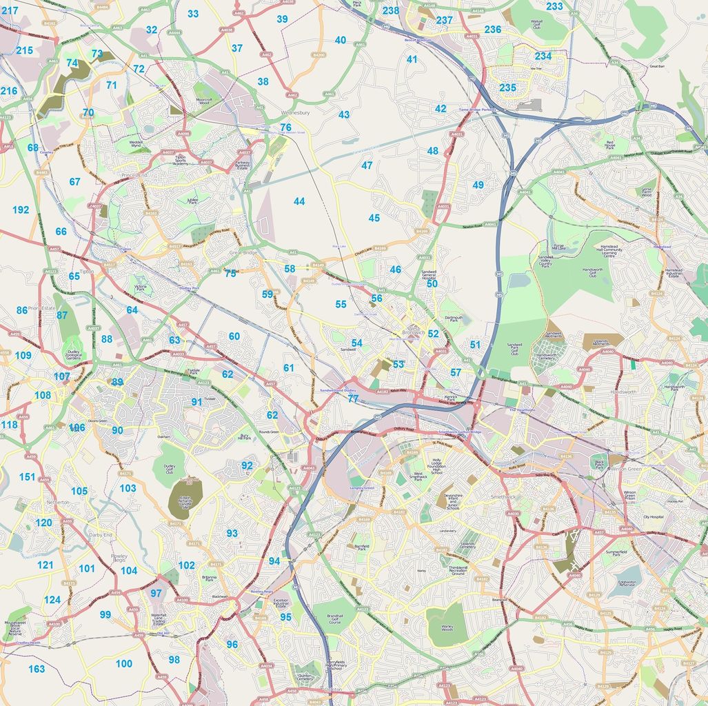
Black Country Cake - Sandwell council area
Licensing
![]()
![]()
![]()
This screenshot contains OpenStreetMap Carto rendering.
The OpenStreetMap Carto map style is made available under the Creative Commons CC-0 1.0 Universal Public Domain Dedication.
- Attribution to the map data:
![]()
Contains map data © OpenStreetMap contributors, made available under the terms of the Creative Commons Attribution-ShareAlike 2.0 (CC-BY-SA-2.0).
File history
Click on a date/time to view the file as it appeared at that time.
| Date/Time | Thumbnail | Dimensions | User | Comment | |
|---|---|---|---|---|---|
| current | 20:11, 13 October 2009 | | 1,994 × 1,988 (1.62 MB) | EdLoach (talk | contribs) | Black Country Cake - Sandwell area |
| 20:09, 13 October 2009 | 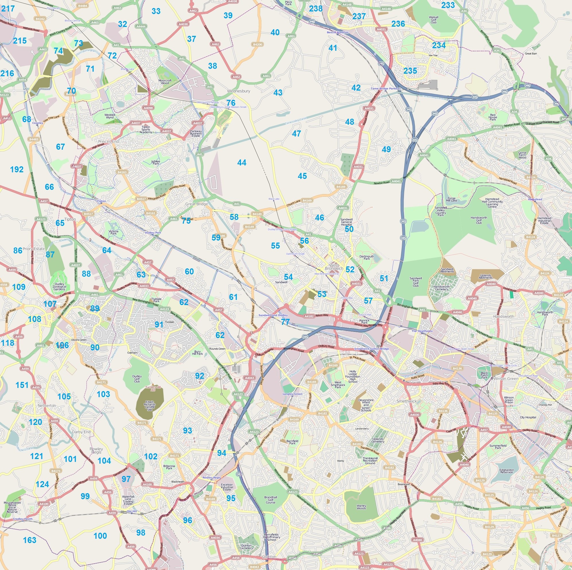 | 1,994 × 1,988 (1.62 MB) | EdLoach (talk | contribs) | Black Country Cake - Sandwell area. First version omitted the number 56. | |
| 18:48, 13 October 2009 | 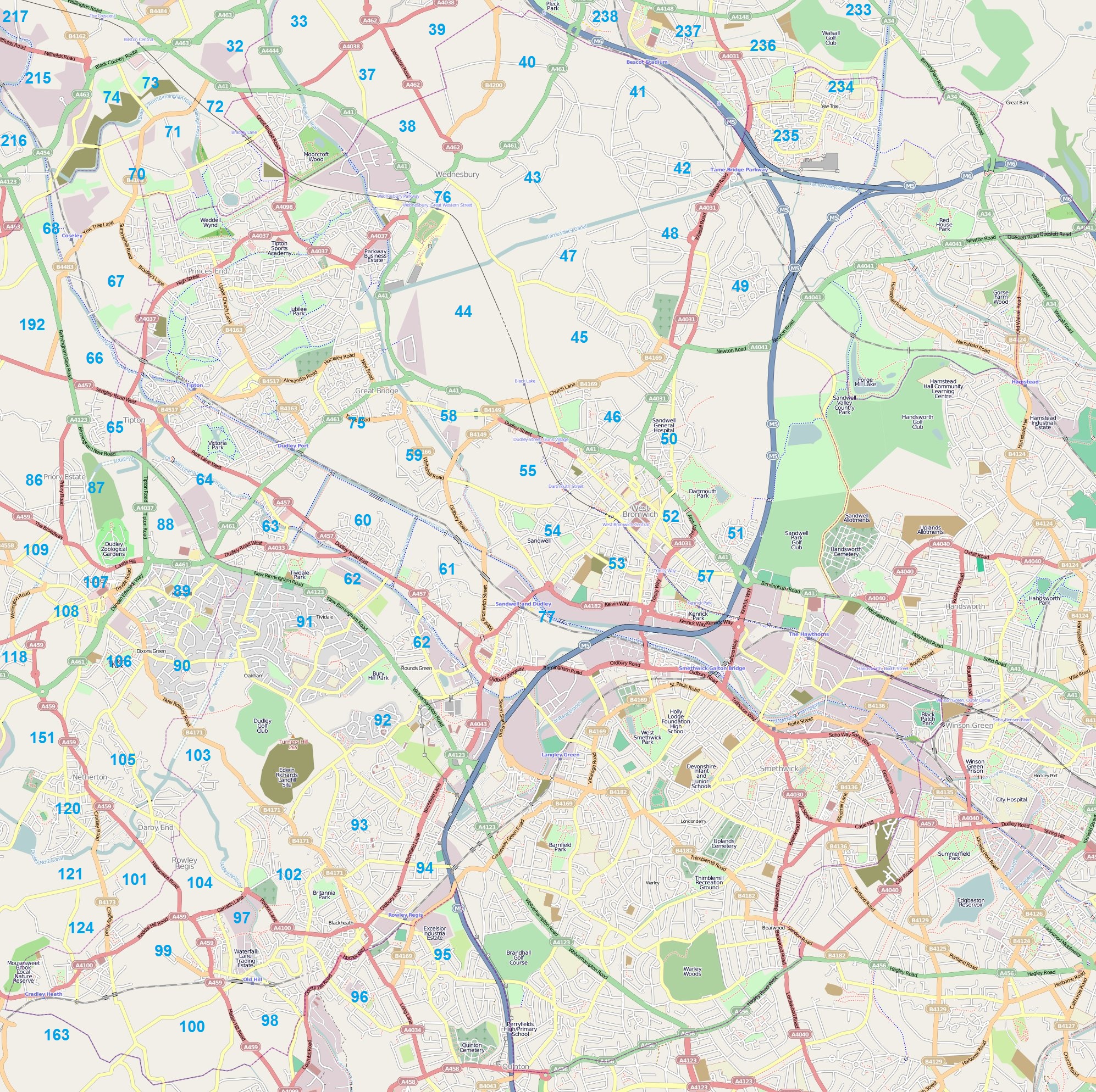 | 1,994 × 1,988 (1.63 MB) | EdLoach (talk | contribs) | Black Country Cake - Sandwell council area |
You cannot overwrite this file.
File usage
There are no pages that use this file.