File:Bangui Windmills.png
Jump to navigation
Jump to search
Size of this preview: 800 × 336 pixels. Other resolutions: 320 × 134 pixels | 1,044 × 438 pixels.
Original file (1,044 × 438 pixels, file size: 45 KB, MIME type: image/png)
Information
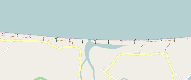
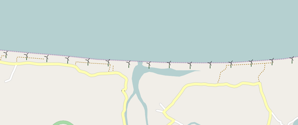
| Description | The Bangui Windmills as seen on OpenStreetMap. These windmills, the first of their kind in the Philippines, were mapped using Bing's aerial imagery. |
|---|---|
| Author | seav |
| Source | http://osm.org/go/42azbA7P-- |
| Date | 2011-05-28 |
| Permission | CC-BY-SA 2.0 |
Licensing
![]()
Contains map data © OpenStreetMap contributors, made available under the terms of the Creative Commons Attribution-ShareAlike 2.0 (CC-BY-SA-2.0).
File history
Click on a date/time to view the file as it appeared at that time.
| Date/Time | Thumbnail | Dimensions | User | Comment | |
|---|---|---|---|---|---|
| current | 06:52, 28 May 2011 | | 1,044 × 438 (45 KB) | Seav (talk | contribs) | ==Information== {{Information |Description = The Bangui Windmills as seen on OpenStreetMap. These windmills, the first of their kind in the Philippines, were mapped using Bing's aerial imagery. |Source = http://osm.org/go/42azbA7P-- |Author |
You cannot overwrite this file.
File usage
The following page uses this file: