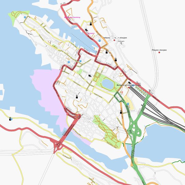
File:Bergen centre.jpg

Original file (1,200 × 1,200 pixels, file size: 207 KB, MIME type: image/jpeg)
This map image was created by Osmarender way back in 2007. It was a Featured_Images/2007 (August).
Historical note: At the time we were still debating whether it was a good idea to have coastline data in OpenStreetMap! Images like this, helped settle the argument, showing how the coastline in cities like Bergen really characterises the city, and is core to what a map database needs to offer. We no longer have a scaling issue when it comes to storing worldwide coastlines in the database, however coastlines do remain one of the trickier types of data to handle for mappers and data users.
This map and others like it, were created by OpenStreetmap contributors, and are licensed as Creative Commons CC-BY-SA 2.0 (https://creativecommons.org/licenses/by-sa/2.0/) (see OpenStreetMap licence).
Use {{mapof|PlaceName}} to add this template to your images.

Front-page image on 25 Aug 2007
![]()
File history
Click on a date/time to view the file as it appeared at that time.
| Date/Time | Thumbnail | Dimensions | User | Comment | |
|---|---|---|---|---|---|
| current | 12:15, 22 August 2007 | | 1,200 × 1,200 (207 KB) | Ojw (talk | contribs) | {{mapof|Bergen}} |
You cannot overwrite this file.
File usage
The following 4 pages use this file: