File:Bilingual Rendering Khon Kaen.png
Jump to navigation
Jump to search

Size of this preview: 800 × 580 pixels. Other resolutions: 320 × 232 pixels | 640 × 464 pixels | 1,024 × 743 pixels | 1,296 × 940 pixels.
Original file (1,296 × 940 pixels, file size: 423 KB, MIME type: image/png)
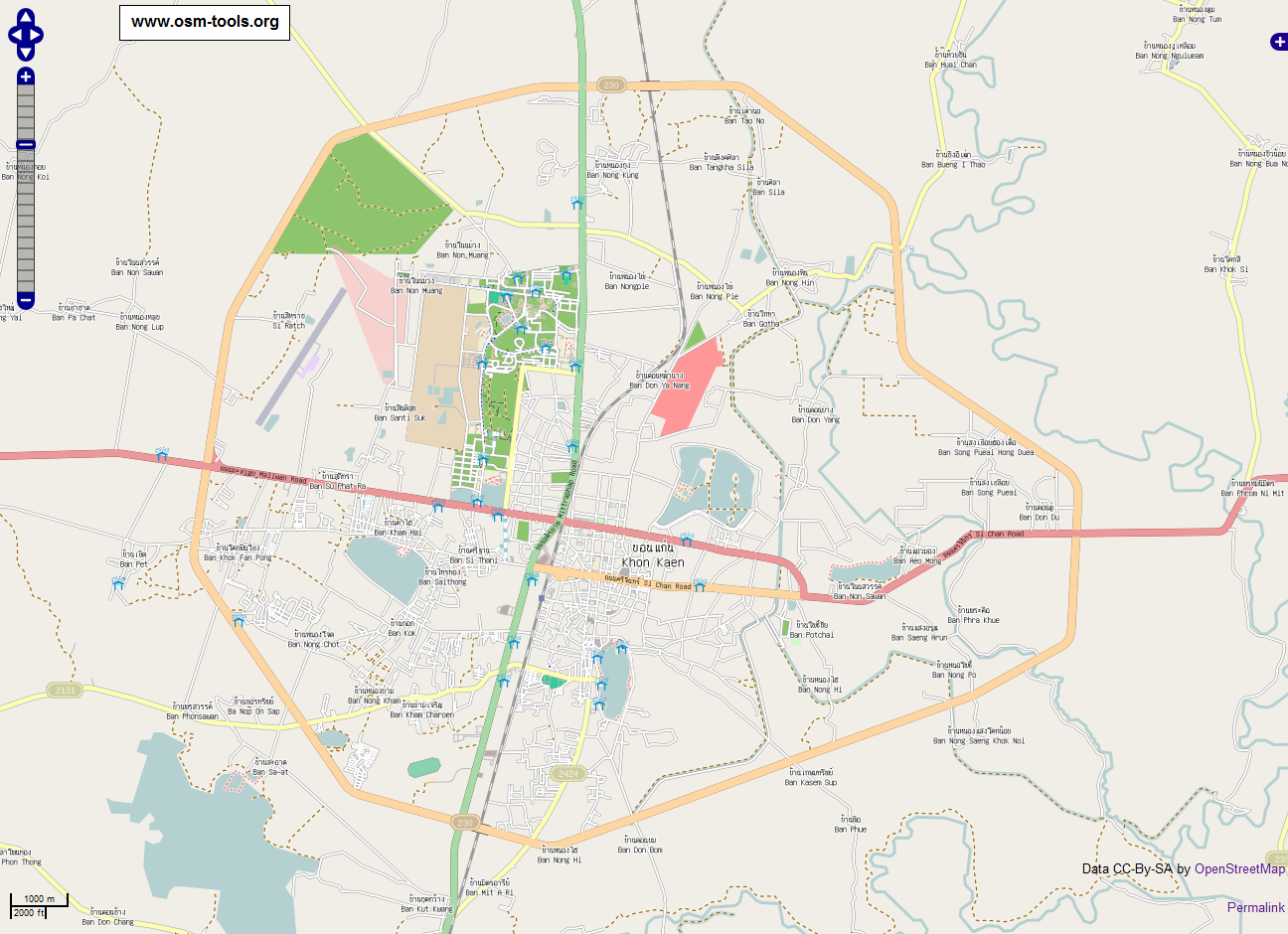
Picture shows Khon Kaen rendered with Thai/English labels. Image is CC-BY-SA.
Created from these coordinates: http://thaimap.osm-tools.org/?zoom=13&lat=16.44857&lon=102.84315&layers=B00
Licensing
![]()
![]()
![]()
This screenshot contains OpenStreetMap Carto rendering.
The OpenStreetMap Carto map style is made available under the Creative Commons CC-0 1.0 Universal Public Domain Dedication.
- Attribution to the map data:
![]()
Contains map data © OpenStreetMap contributors, made available under the terms of the Creative Commons Attribution-ShareAlike 2.0 (CC-BY-SA-2.0).
File history
Click on a date/time to view the file as it appeared at that time.
| Date/Time | Thumbnail | Dimensions | User | Comment | |
|---|---|---|---|---|---|
| current | 22:52, 27 August 2010 | | 1,296 × 940 (423 KB) | Stephankn (talk | contribs) | Picture shows Khon Kaen rendered with Thai/English labels. Image is CC-BY-SA. Created from these coordinates: http://thaimap.osm-tools.org/?zoom=13&lat=16.44857&lon=102.84315&layers=B00 |
You cannot overwrite this file.
File usage
The following 2 pages use this file: