File:Billericay scnshot20070315.jpg
Jump to navigation
Jump to search

No higher resolution available.
Billericay_scnshot20070315.jpg (617 × 499 pixels, file size: 130 KB, MIME type: image/jpeg)
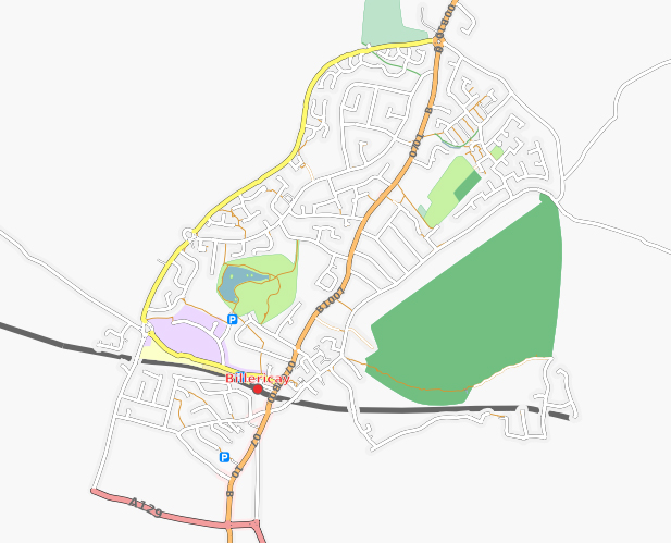
Screenshot of the Osmarender version of Billericay from the slippy map on 15 March 2007. The North is well mapped. Queens Park is missing, and streets to the south of the railway line are also missing as well as footpaths.
![]()
Contains map data © OpenStreetMap contributors, made available under the terms of the Creative Commons Attribution-ShareAlike 2.0 (CC-BY-SA-2.0).
File history
Click on a date/time to view the file as it appeared at that time.
| Date/Time | Thumbnail | Dimensions | User | Comment | |
|---|---|---|---|---|---|
| current | 21:47, 15 March 2007 | | 617 × 499 (130 KB) | Ksbrown (talk | contribs) | Screenshot of the Osmarender version of Billericay from the slippy map on 15 March 2007. The North is well mapped. Queens Park is missing, and streets to the south of the railway line are also missing as well as footpaths. |
You cannot overwrite this file.
File usage
There are no pages that use this file.