File:Bmms-gerhl-2012a.jpg
Jump to navigation
Jump to search


Size of this preview: 800 × 246 pixels. Other resolutions: 320 × 98 pixels | 640 × 197 pixels | 1,024 × 314 pixels | 1,280 × 393 pixels | 2,560 × 786 pixels | 8,460 × 2,598 pixels.
Original file (8,460 × 2,598 pixels, file size: 1.45 MB, MIME type: image/jpeg)
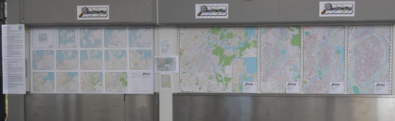
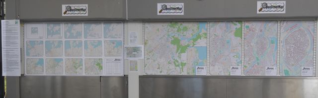
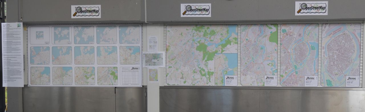
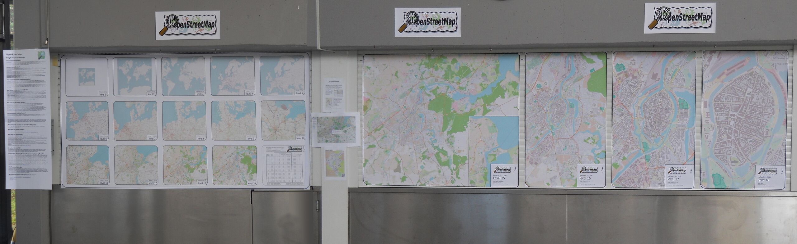
7-metre-long BIGMAP map set
This is a Featured image, which means that it has been identified as one of the best examples of OpenStreetMap mapping, or that it provides a useful illustration of the OpenStreetMap project. If you know another image of similar quality, you can nominate it on Featured image proposals.
Front-page image for week 17 of 2012 (23–29 Apr.).
- Image descriptions
- čeština : 18 různých přiblížení (1:250.000.000 - 1:2.000) města Lübeck
- Deutsch : 18 Vergrößerungsstufen (1:250.000.000 - 1:2.000) der Stadt Lübeck
- English : 18 zoom-levels (1:250.000.000 - 1:2.000) of Lübeck City
- français : La ville de Lübeck en 18 niveaux de zoom (1:250.000.000 - 1:2.000)
- italiano : 18 livelli di ingrandimento (1:250.000.000 - 1:2.000) della città di Lubecca
- 中文(简体) : 吕贝克市在缩放层级18 (1:250.000.000 - 1:2.000)
- 中文(繁體) : 盧貝克市在縮放層級18 (1:250.000.000 - 1:2.000)
File history
Click on a date/time to view the file as it appeared at that time.
| Date/Time | Thumbnail | Dimensions | User | Comment | |
|---|---|---|---|---|---|
| current | 07:53, 27 March 2012 | 8,460 × 2,598 (1.45 MB) | Projecter63 (talk | contribs) | 7-metre-long BIGMAP map set |
You cannot overwrite this file.
File usage
The following 7 pages use this file: