File:Brumcentremap.png
Jump to navigation
Jump to search


Size of this preview: 800 × 439 pixels. Other resolutions: 320 × 176 pixels | 640 × 351 pixels | 1,013 × 556 pixels.
Original file (1,013 × 556 pixels, file size: 207 KB, MIME type: image/png)
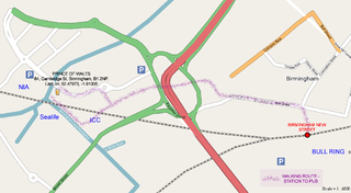
Basic map of central Birmingham for 16th Dec 06 pub meetup. Please note that the co-ordinates of the pub are a little off on this map. Its actually at 52.4796, -1.9117
![]()
Contains map data © OpenStreetMap contributors, made available under the terms of the Creative Commons Attribution-ShareAlike 2.0 (CC-BY-SA-2.0).
File history
Click on a date/time to view the file as it appeared at that time.
| Date/Time | Thumbnail | Dimensions | User | Comment | |
|---|---|---|---|---|---|
| current | 09:35, 7 December 2006 | | 1,013 × 556 (207 KB) | Blackadder (talk | contribs) | Basic map of central Birmingham for 16th Dec 06 pub meetup |
You cannot overwrite this file.
File usage
The following page uses this file: