File:Building heights strip.png
Jump to navigation
Jump to search

Size of this preview: 800 × 195 pixels. Other resolutions: 320 × 78 pixels | 989 × 241 pixels.
Original file (989 × 241 pixels, file size: 485 KB, MIME type: image/png)
Summary
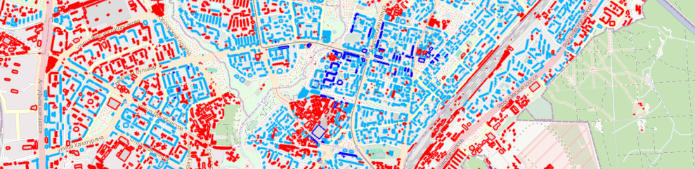
An map overlay for ITO Map showing the heights of buildings defined using the height tag or the building:levels tag.
Licensing
![]()
![]()
![]()
This work is licensed under the Creative Commons Attribution-ShareAlike 2.0 License.
Attribution not specified as a parameter! THIS LICENSE ALWAYS REQUIRES ATTRIBUTION! Use {{CC-BY-SA-2.0|Attribution, typically name of author}} See Template:CC-BY-SA-2.0 for full description how this template should be used.
Note, there is
There is also
Attribution not specified as a parameter! THIS LICENSE ALWAYS REQUIRES ATTRIBUTION! Use {{CC-BY-SA-2.0|Attribution, typically name of author}} See Template:CC-BY-SA-2.0 for full description how this template should be used.
Note, there is
{{CC-BY-SA-2.0 OpenStreetMap}} for files based on old OSM map data, before the license change made on 2012-09-12.There is also
{{OSM Carto screenshot||old_license}} for files based on old OSM map data, before the license change made on 2012-09-12, created using OSM Carto map style.
File history
Click on a date/time to view the file as it appeared at that time.
| Date/Time | Thumbnail | Dimensions | User | Comment | |
|---|---|---|---|---|---|
| current | 09:19, 12 April 2011 | 989 × 241 (485 KB) | PeterIto (talk | contribs) | An map overlay for ITO Map showing the heights of buildings defined using the height tag or the building:levels tag. |
You cannot overwrite this file.
File usage
The following 8 pages use this file: