File:Chile imagery JAXA-ALOS-AVNIR-2 2010-02-24.png
Jump to navigation
Jump to search


Size of this preview: 486 × 599 pixels. Other resolutions: 194 × 240 pixels | 497 × 613 pixels.
Original file (497 × 613 pixels, file size: 144 KB, MIME type: image/png)
File history
Click on a date/time to view the file as it appeared at that time.
| Date/Time | Thumbnail | Dimensions | User | Comment | |
|---|---|---|---|---|---|
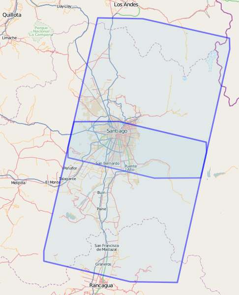
| current | 11:39, 1 March 2010 | | 497 × 613 (144 KB) | Ceyockey (talk | contribs) | depiction of {{relation|420909}} showing boundaries of north and south panels of imagery from JAXA, to be attributed with {{tag|source||JAXA/ALOS/AVNIR-2, 2009-02-24}} when used. |
You cannot overwrite this file.
File usage
The following page uses this file: