File:Compare-vercelli-tangenziale.jpg

Original file (1,910 × 838 pixels, file size: 672 KB, MIME type: image/jpeg)
Summary
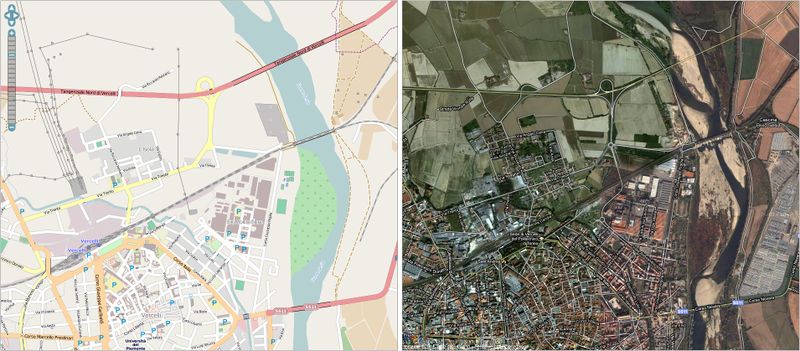
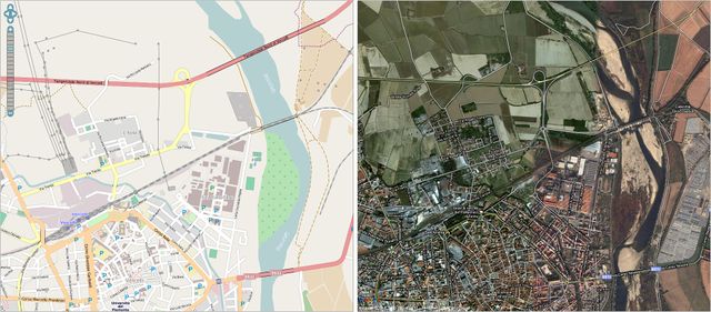
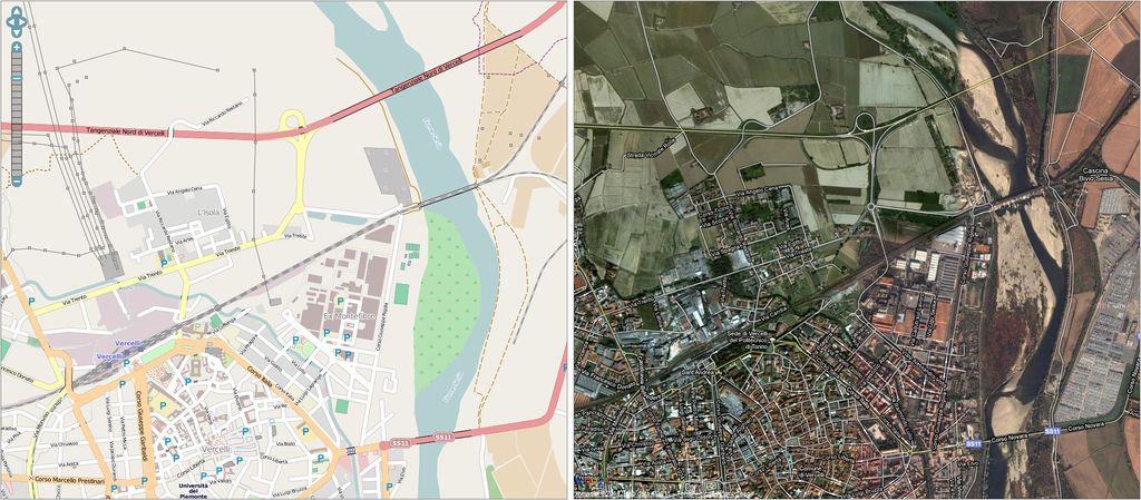
Confronto tra la mappa OSM e quella di Google Maps nella zona del nuovo svincolo della Tangenziale Nord di Vercelli.
Map compare between OSM and Google Maps in the northern part of Vercelli.
Licensing
Google Maps
![]()
Files without licences marked with this template are listed in Category:Media without a license or one of its subcategories. If the file is without a known open licence: ask its uploader to clarify situation or find a replacement and mark this file with {{Superseded by Commons}} and replace its uses.
If uploader was notified this month: use {{No licence|subcategory=uploader notified 2024, April}} - to put media into Category:Media without a license - uploader notified 2024, April and mark image as one where uploader was notified.
or rather: fully copyrighted, how to handle it
fair use for Google Maps, maybe? But it needs to be in use, right?
OSM
![]()
File history
Click on a date/time to view the file as it appeared at that time.
| Date/Time | Thumbnail | Dimensions | User | Comment | |
|---|---|---|---|---|---|
| current | 08:36, 20 April 2011 | | 1,910 × 838 (672 KB) | SimoneSVC (talk | contribs) | Confronto tra la mappa OSM e quella di Google Maps nella zona del nuovo svincolo della Tangenziale Nord di Vercelli. Map compare between OSM and Google Maps in the northern part of Vercelli. |
You cannot overwrite this file.
File usage
There are no pages that use this file.