File:Convento tomar portugal archc3d.jpg
Jump to navigation
Jump to search
Size of this preview: 800 × 445 pixels. Other resolutions: 320 × 178 pixels | 640 × 356 pixels | 1,024 × 569 pixels | 1,500 × 834 pixels.
Original file (1,500 × 834 pixels, file size: 329 KB, MIME type: image/jpeg)
Summary
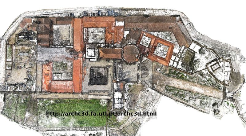
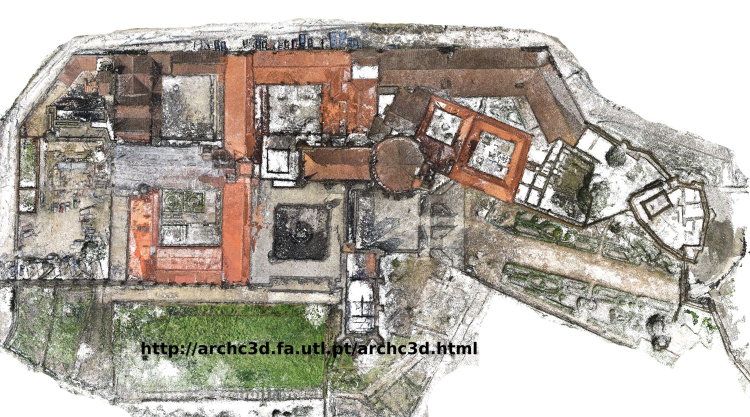
Ortho image of 3D point cloud made with VSFM software from aerial photos (taken with helium ballon and RC airplane). Made by Team Archc3D, FAUTL, Portugal.
Licensing
![]()
![]()
![]()
This work is licensed under the Creative Commons Attribution-ShareAlike 2.0 License.
Attribution: Attribution, Victor Ferreira
Attribution: Attribution, Victor Ferreira
File history
Click on a date/time to view the file as it appeared at that time.
| Date/Time | Thumbnail | Dimensions | User | Comment | |
|---|---|---|---|---|---|
| current | 00:36, 19 September 2011 | | 1,500 × 834 (329 KB) | Victorferreira (talk | contribs) | Ortho image of 3D point cloud made with VSFM software from aerial photos (taken with helium ballon and RC airplane). Made by Team Archc3D, FAUTL, Portugal. |
You cannot overwrite this file.
File usage
The following page uses this file: