File:Cubao Mapping Party Before and After.png
Jump to navigation
Jump to search

Size of this preview: 445 × 600 pixels. Other resolutions: 178 × 240 pixels | 356 × 480 pixels | 705 × 950 pixels.
Original file (705 × 950 pixels, file size: 137 KB, MIME type: image/png)
Summary
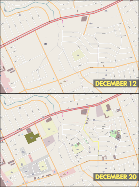
| Description | Mapnik rendering of Cubao, Quezon City in the Project 4 area before (December 12) and after (December 20) the Cubao Mapping Party last December 12, 2009. |
|---|---|
| Author | seav |
| Source | OSM (Mapnik layer) (permalink to map) |
| Date | 2010-01-29 |
| Permission | CC-BY-SA 3.0 |
Licensing
![]()
Contains map data © OpenStreetMap contributors, made available under the terms of the Creative Commons Attribution-ShareAlike 2.0 (CC-BY-SA-2.0).
File history
Click on a date/time to view the file as it appeared at that time.
| Date/Time | Thumbnail | Dimensions | User | Comment | |
|---|---|---|---|---|---|
| current | 05:01, 29 January 2010 | | 705 × 950 (137 KB) | Seav (talk | contribs) | ==Information== {{Information |Description = Mapnik rendering of Cubao, Quezon City in the Project 4 area before (December 12) and after (December 20) the Cubao Mapping Party last December 13, 2009. |Sour |
You cannot overwrite this file.
File usage
The following 3 pages use this file: