File:Dhaka College Project01.png
Jump to navigation
Jump to search
Size of this preview: 800 × 351 pixels. Other resolutions: 320 × 141 pixels | 922 × 405 pixels.
Original file (922 × 405 pixels, file size: 483 KB, MIME type: image/png)
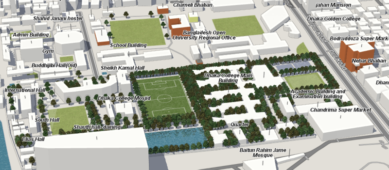
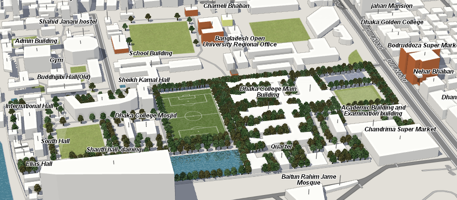
The Bangladesh OpenStreetMap community (facebook group)have been mapping the dense district Dhaka College in Dhaka.
"standard" OSM style view of here on the map:http://www.openstreetmap.org/#map=18/23.73497/90.38136
File history
Click on a date/time to view the file as it appeared at that time.
| Date/Time | Thumbnail | Dimensions | User | Comment | |
|---|---|---|---|---|---|
| current | 07:48, 5 September 2016 | | 922 × 405 (483 KB) | Atikur Rahman atik (talk | contribs) | The Bangladesh OpenStreetMap community ([https://www.facebook.com/groups/321220498214124/ facebook group])have been mapping the dense district Dhaka College in Dhaka. "standard" OSM style view of here on the map:http://www.openstreetmap.org/#map=18/2... |
You cannot overwrite this file.
File usage
The following 2 pages use this file: