File:Doublewayrail.png
Jump to navigation
Jump to search

No higher resolution available.
Doublewayrail.png (578 × 476 pixels, file size: 89 KB, MIME type: image/png)
Summary
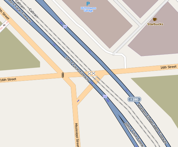
Mapnik rendering of a double-track railway represented as a pair of railway=rail ways with a pair of level crossings where both railways cross a single highway.
Licensing
![]()
![]()
This screenshot contains OpenStreetMap Carto rendering.
The OpenStreetMap Carto map style is made available under the Creative Commons CC-0 1.0 Universal Public Domain Dedication.
- Attribution to the map data:
| Contains map data © OpenStreetMap contributors, made available under the terms of the Open Database License (ODbL).
The ODbL does not require any particular license for maps produced from ODbL data, produced maps may be subject also to other licences. |
File history
Click on a date/time to view the file as it appeared at that time.
| Date/Time | Thumbnail | Dimensions | User | Comment | |
|---|---|---|---|---|---|
| current | 03:24, 11 April 2013 | | 578 × 476 (89 KB) | Mart (talk | contribs) | Mapnik rendering of a double-track railway represented as a pair of {{Tag|railway|rail}} ways with a pair of level crossings where both railways cross a single highway. |
You cannot overwrite this file.
File usage
The following page uses this file: