File:Drinking water southern africa overpass turbo.png
Jump to navigation
Jump to search


Size of this preview: 718 × 599 pixels. Other resolutions: 288 × 240 pixels | 575 × 480 pixels | 920 × 768 pixels | 1,076 × 898 pixels.
Original file (1,076 × 898 pixels, file size: 746 KB, MIME type: image/png)
Summary
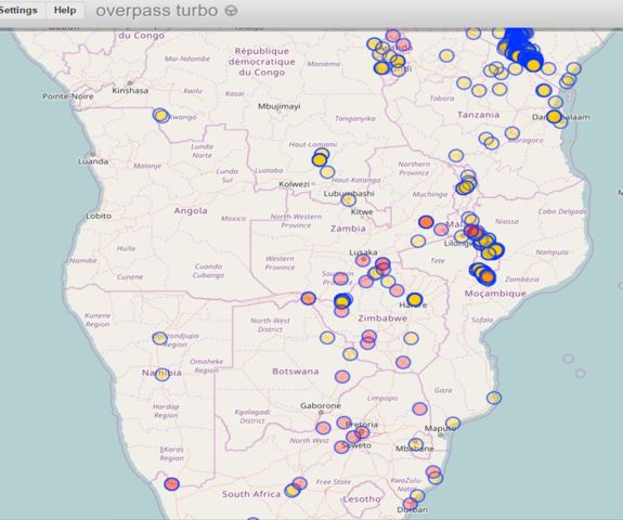
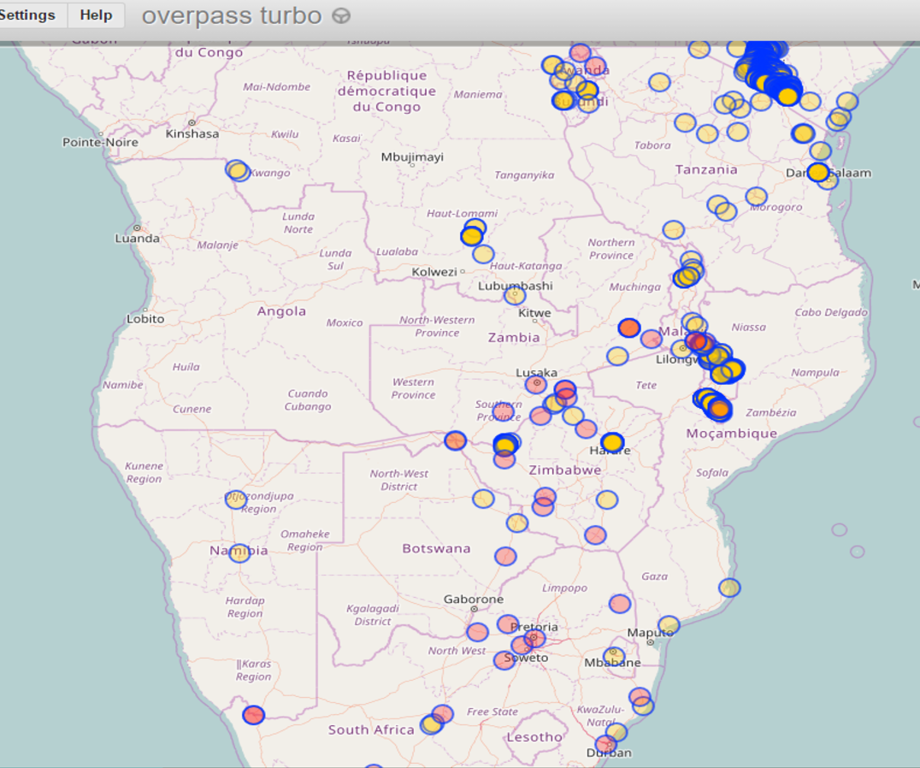
A map from Overpass Turbo showing the distribution of features with the tag amenity=drinking_water in southern Africa (1 degree South and below). February 2017
Licensing
| Contains map data © OpenStreetMap contributors, made available under the terms of the Open Database License (ODbL).
The ODbL does not require any particular license for maps produced from ODbL data, produced maps may be subject also to other licences. |
File history
Click on a date/time to view the file as it appeared at that time.
| Date/Time | Thumbnail | Dimensions | User | Comment | |
|---|---|---|---|---|---|
| current | 16:13, 19 February 2017 | | 1,076 × 898 (746 KB) | Thomas.hills (talk | contribs) | A map from Overpass Turbo showing the distribution of features with the tag amenity=drinking_water in southern Africa (1 degree South and below). February 2017 |
You cannot overwrite this file.
File usage
The following page uses this file: