File:Driving range.png
Jump to navigation
Jump to search

No higher resolution available.
Driving_range.png (684 × 471 pixels, file size: 463 KB, MIME type: image/png)
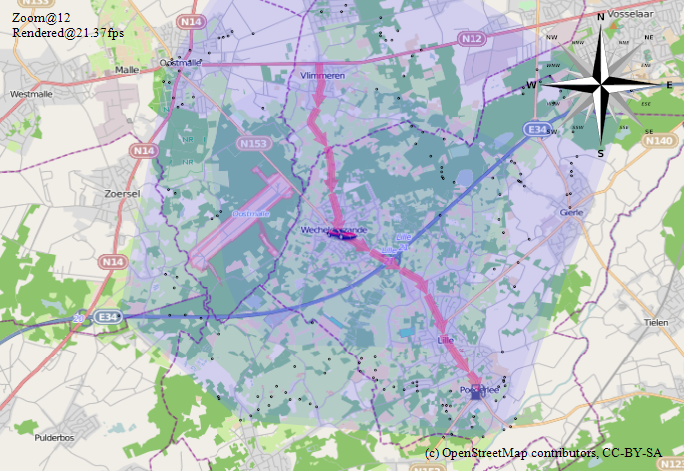
Screenshot of driving range calculation in the OsmSharp library.
File history
Click on a date/time to view the file as it appeared at that time.
| Date/Time | Thumbnail | Dimensions | User | Comment | |
|---|---|---|---|---|---|
| current | 14:05, 31 July 2011 | | 684 × 471 (463 KB) | Xivk (talk | contribs) | Screenshot of driving range calculation in the OsmSharp library. |
You cannot overwrite this file.
File usage
The following page uses this file: