File:Dupenode 20110130 1021EST.png
Jump to navigation
Jump to search
Size of this preview: 800 × 517 pixels. Other resolutions: 320 × 207 pixels | 640 × 414 pixels | 1,168 × 755 pixels.
Original file (1,168 × 755 pixels, file size: 236 KB, MIME type: image/png)
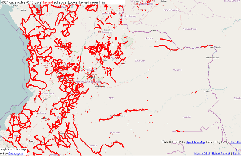
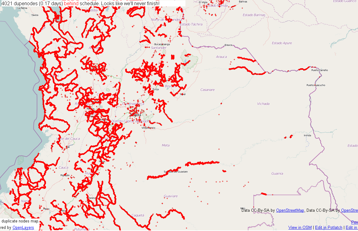
Central Colombia dupenode map from permalink http://matt.dev.openstreetmap.org/dupe_nodes/?zoom=7&lat=4.55938&lon=-73.20834&layers=BT collected on 01/30/2010 at 1023 AM EST.
Licensing
![]()
Contains map data © OpenStreetMap contributors, made available under the terms of the Creative Commons Attribution-ShareAlike 2.0 (CC-BY-SA-2.0).
File history
Click on a date/time to view the file as it appeared at that time.
| Date/Time | Thumbnail | Dimensions | User | Comment | |
|---|---|---|---|---|---|
| current | 15:23, 30 January 2011 | | 1,168 × 755 (236 KB) | Ceyockey (talk | contribs) | Central Colombia dupenode map from permalink http://matt.dev.openstreetmap.org/dupe_nodes/?zoom=7&lat=4.55938&lon=-73.20834&layers=BT collected on 01/30/2010 at 1023 AM EST. {{PD-creator|ceyockey}} Category:Screenshots [[Category:2010 Colombia floods] |
You cannot overwrite this file.
File usage
The following page uses this file: