File:Edinburgh-yahoo-coverage.png
Jump to navigation
Jump to search

No higher resolution available.
Edinburgh-yahoo-coverage.png (408 × 359 pixels, file size: 91 KB, MIME type: image/png)
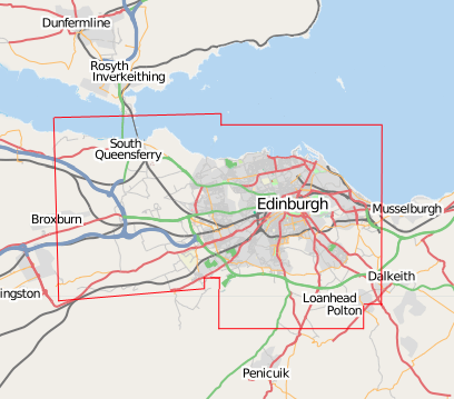
Map showing the limits Yahoo! Aerial Imagery imagery coverage of Edinburgh (as of 21st Aug 2007).
The red line is just drawn over the map image in photoshop, in roughly the right place, whilst I panned around the edges of the yahoo coverage e.g. southern edge of the coverage
The map underneath is a screenshot of the Mapnik layer, with blue sea area added (from the osmarender layer) using photoshop!
![]()
Contains map data © OpenStreetMap contributors, made available under the terms of the Creative Commons Attribution-ShareAlike 2.0 (CC-BY-SA-2.0).
File history
Click on a date/time to view the file as it appeared at that time.
| Date/Time | Thumbnail | Dimensions | User | Comment | |
|---|---|---|---|---|---|
| current | 22:08, 21 August 2007 | | 408 × 359 (91 KB) | Harry Wood (talk | contribs) | image showing the limits aerial imagery coverage |
You cannot overwrite this file.
File usage
There are no pages that use this file.