File:Electricity France.png
Jump to navigation
Jump to search

Size of this preview: 660 × 599 pixels. Other resolutions: 264 × 240 pixels | 529 × 480 pixels | 990 × 899 pixels.
Original file (990 × 899 pixels, file size: 703 KB, MIME type: image/png)
Summary
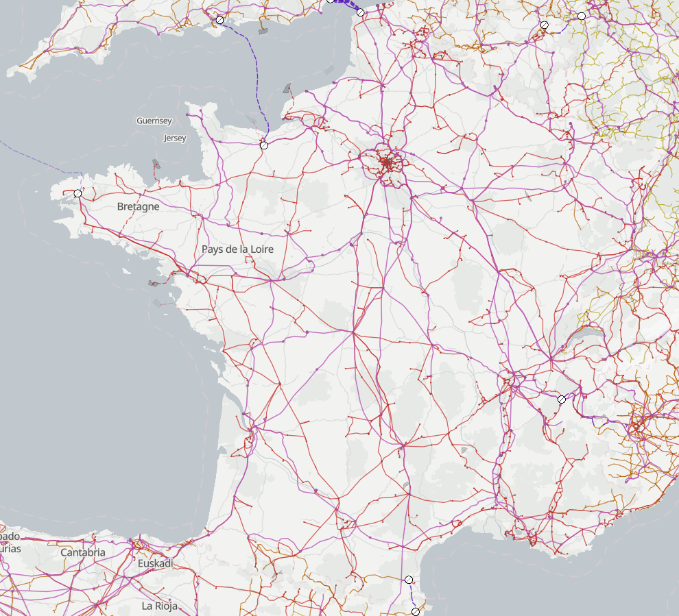
Map view of electrical power distribution and generation in France by OpenInfraMap
| Description | Render of Metropolitan France power networks using OpenInfraMap |
|---|---|
| Author | François Lacombe |
| Source | OpenInfraMap |
| Date | 2023-12-30 |
Licensing
![]()
![]()
![]()
This work is licensed under the Creative Commons Attribution-ShareAlike 2.0 License.
Attribution not specified as a parameter! THIS LICENSE ALWAYS REQUIRES ATTRIBUTION! Use {{CC-BY-SA-2.0|Attribution, typically name of author}} See Template:CC-BY-SA-2.0 for full description how this template should be used.
Note, there is
There is also
Attribution not specified as a parameter! THIS LICENSE ALWAYS REQUIRES ATTRIBUTION! Use {{CC-BY-SA-2.0|Attribution, typically name of author}} See Template:CC-BY-SA-2.0 for full description how this template should be used.
Note, there is
{{CC-BY-SA-2.0 OpenStreetMap}} for files based on old OSM map data, before the license change made on 2012-09-12.There is also
{{OSM Carto screenshot||old_license}} for files based on old OSM map data, before the license change made on 2012-09-12, created using OSM Carto map style.
File history
Click on a date/time to view the file as it appeared at that time.
| Date/Time | Thumbnail | Dimensions | User | Comment | |
|---|---|---|---|---|---|
| current | 23:12, 30 December 2023 | | 990 × 899 (703 KB) | Fanfouer (talk | contribs) | Change layout to OpenInfraMap twelve years later |
| 21:59, 29 June 2011 | 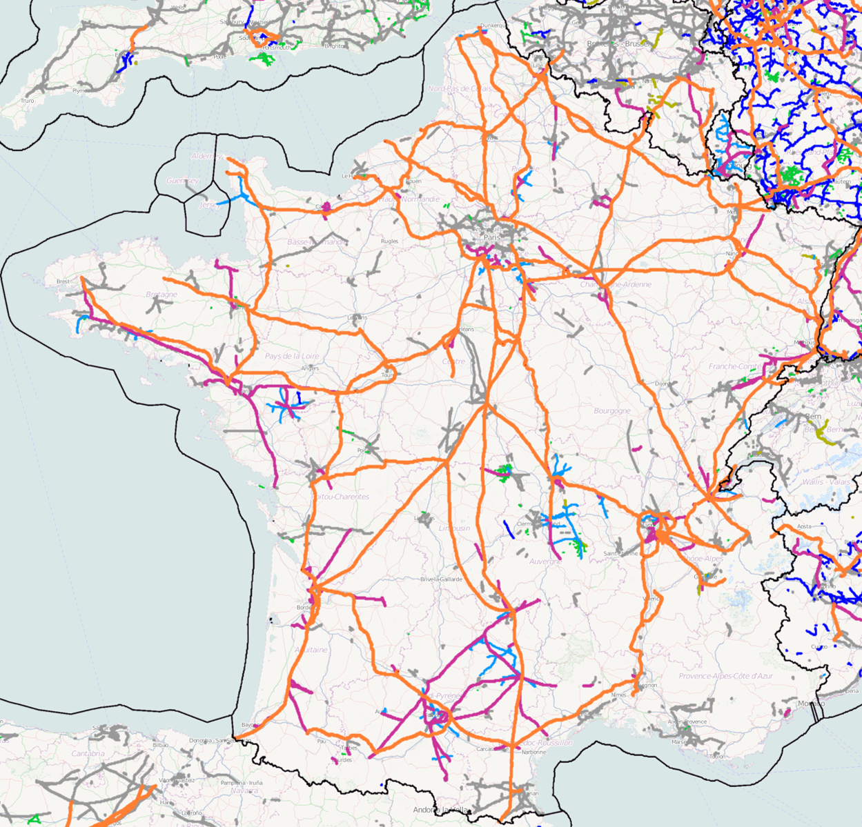 | 1,249 × 1,199 (1.62 MB) | Don-vip (talk | contribs) | ||
| 08:38, 6 June 2011 |  | 1,252 × 1,197 (1.04 MB) | Don-vip (talk | contribs) | Update (2011-06-06) | |
| 03:34, 21 May 2011 | 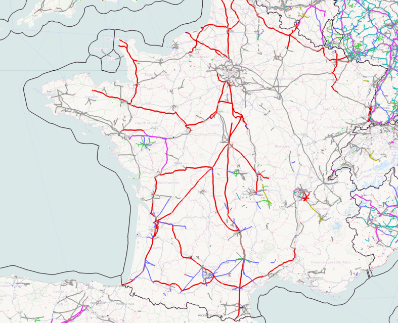 | 787 × 639 (741 KB) | PeterIto (talk | contribs) | Electrical power distribution network in France |
You cannot overwrite this file.
File usage
The following page uses this file: