File:ElevationProfile-Island.png
Jump to navigation
Jump to search

Size of this preview: 800 × 454 pixels. Other resolutions: 320 × 182 pixels | 640 × 363 pixels | 1,024 × 581 pixels | 1,280 × 727 pixels | 1,915 × 1,087 pixels.
Original file (1,915 × 1,087 pixels, file size: 234 KB, MIME type: image/png)
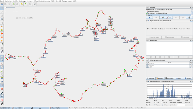
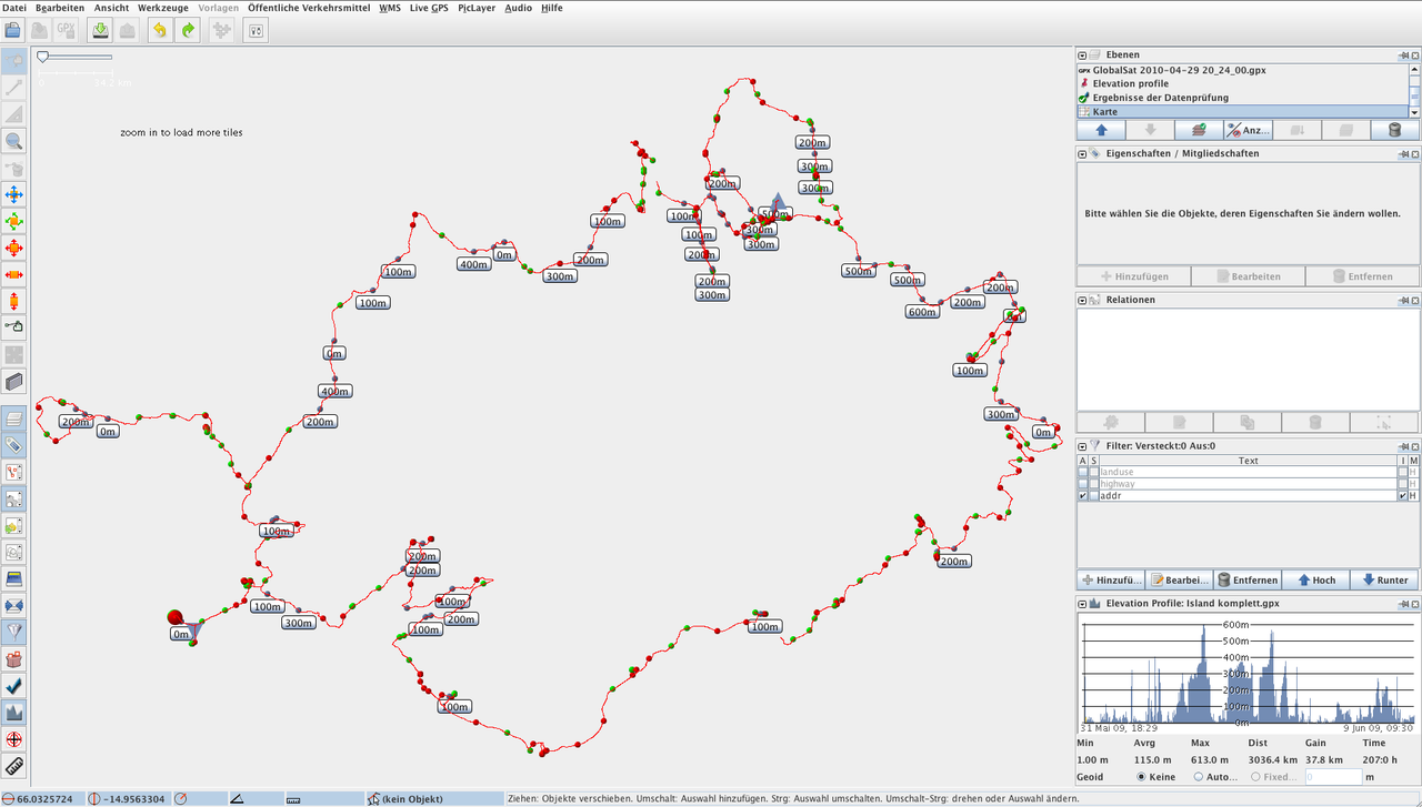
Elevation profile of my Island trip.
Licensing
![]()
This file is a JOSM screenshot, without imagery in a background.
![]()
"JOSM" (Java OpenStreetMap Editor – josm.openstreetmap.de) is free software released under the terms of the GNU General Public License as published by the Free Software Foundation; either version 2 of the license, or any later version.
File history
Click on a date/time to view the file as it appeared at that time.
| Date/Time | Thumbnail | Dimensions | User | Comment | |
|---|---|---|---|---|---|
| current | 12:32, 23 October 2010 | | 1,915 × 1,087 (234 KB) | OliverW (talk | contribs) | Elevation profile of my Island trip. |
You cannot overwrite this file.
File usage
There are no pages that use this file.