File:Esbjerg 20060605.png
Jump to navigation
Jump to search

Size of this preview: 569 × 600 pixels. Other resolutions: 228 × 240 pixels | 455 × 480 pixels | 728 × 768 pixels | 1,070 × 1,128 pixels.
Original file (1,070 × 1,128 pixels, file size: 254 KB, MIME type: image/png)
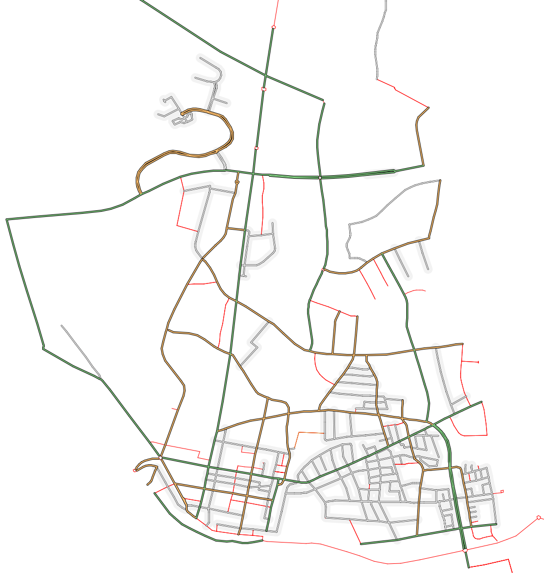
Rendered map of Esbjerg, Denmark as of 20060605. Rendered by osmarender with debug on (untagged segments are thin red lines)
![]()
Contains map data © OpenStreetMap contributors, made available under the terms of the Creative Commons Attribution-ShareAlike 2.0 (CC-BY-SA-2.0).
File history
Click on a date/time to view the file as it appeared at that time.
| Date/Time | Thumbnail | Dimensions | User | Comment | |
|---|---|---|---|---|---|
| current | 00:58, 5 June 2006 | | 1,070 × 1,128 (254 KB) | Miki (talk | contribs) | Rendered map of Esbjerg, Denmark as of 20060605. Rendered by osmarender with debug on (untagged segments are thin red lines) |
You cannot overwrite this file.
File usage
The following page uses this file: