File:EuropeGPSpoints.png
Jump to navigation
Jump to search


Size of this preview: 552 × 600 pixels. Other resolutions: 221 × 240 pixels | 442 × 480 pixels | 916 × 995 pixels.
Original file (916 × 995 pixels, file size: 563 KB, MIME type: image/png)
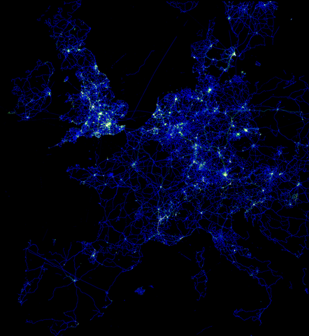
Central European GPS points currently in OSM.
Interesting, I always thought that Central Europe is a bit more central --- [1]
This is a Featured image, which means that it has been identified as one of the best examples of OpenStreetMap mapping, or that it provides a useful illustration of the OpenStreetMap project. If you know another image of similar quality, you can nominate it on Featured image proposals.
Front-page image on 26 Jan 2008
File history
Click on a date/time to view the file as it appeared at that time.
| Date/Time | Thumbnail | Dimensions | User | Comment | |
|---|---|---|---|---|---|
| current | 16:36, 9 January 2008 | | 916 × 995 (563 KB) | Randomjunk (talk | contribs) | Central European GPS points currently in OSM. |
You cannot overwrite this file.
File usage
The following 4 pages use this file: