File:European Central Bank - building under construction - Frankfurt - Germany - 01.jpg
Jump to navigation
Jump to search


Size of this preview: 397 × 599 pixels. Other resolutions: 159 × 240 pixels | 318 × 480 pixels | 508 × 768 pixels | 678 × 1,024 pixels | 1,356 × 2,048 pixels | 3,042 × 4,593 pixels.
Original file (3,042 × 4,593 pixels, file size: 8.24 MB, MIME type: image/jpeg)
This file and its description are from Wikimedia Commons.
Summary
| Camera location | | View this and other nearby images on: OpenStreetMap |
|---|
| Description |
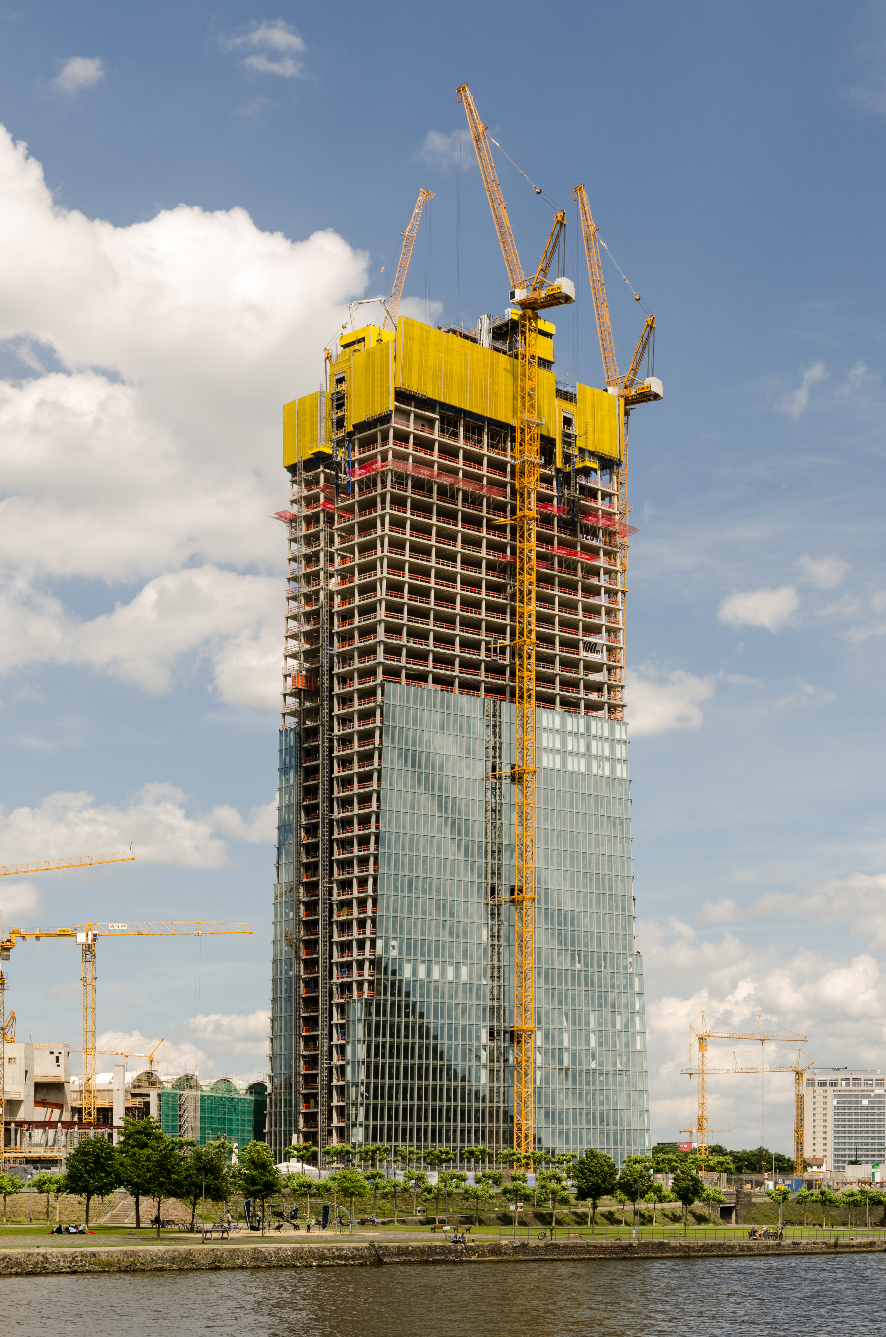
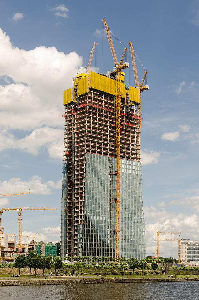
Deutsch: Neubau der Europäischen Zentralbank in Frankfurt am Main.
English: New building of the European Central Bank in Frankfurt Main, Germany. |
| Date | |
| Source | Own work |
| Author | Norbert Nagel |
Licensing
I, the copyright holder of this work, hereby publish it under the following license:
This file is licensed under the Creative Commons Attribution-Share Alike 3.0 Unported license.
- You are free:
- to share – to copy, distribute and transmit the work
- to remix – to adapt the work
- Under the following conditions:
- attribution – You must give appropriate credit, provide a link to the license, and indicate if changes were made. You may do so in any reasonable manner, but not in any way that suggests the licensor endorses you or your use.
- share alike – If you remix, transform, or build upon the material, you must distribute your contributions under the same or compatible license as the original.
This image has been assessed using the Quality image guidelines and is considered a Quality image.
|
File history
Click on a date/time to view the file as it appeared at that time.
| Date/Time | Thumbnail | Dimensions | User | Comment | |
|---|---|---|---|---|---|
| current | 17:38, 6 July 2012 | | 3,042 × 4,593 (8.24 MB) | wikimediacommons>NorbertNagel |
File usage
The following page uses this file: