File:Expansion de Cartagena en zona de inundación.png
Jump to navigation
Jump to search

Size of this preview: 776 × 600 pixels. Other resolutions: 311 × 240 pixels | 621 × 480 pixels | 994 × 768 pixels | 1,280 × 989 pixels | 1,650 × 1,275 pixels.
Original file (1,650 × 1,275 pixels, file size: 2.86 MB, MIME type: image/png)
Summary
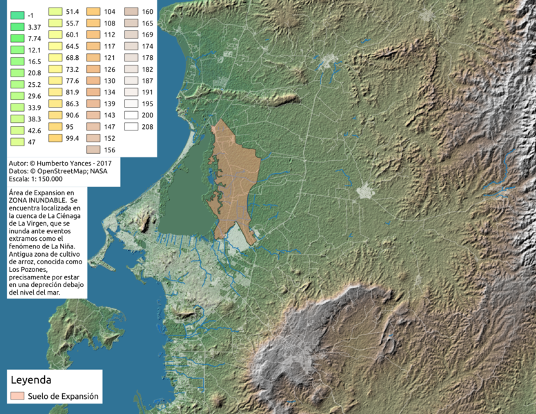
Ensayos en QGIS con datos OSM y SRTM
Licensing

The copyright holder of this file allows anyone to use it for any purpose, provided that the copyright holder is properly attributed. Redistribution, derivative work, commercial use, and all other use is permitted.
If you are the uploader, please provide proper attribution including source and name of author.
If you are the uploader, please provide proper attribution including source and name of author.
File history
Click on a date/time to view the file as it appeared at that time.
| Date/Time | Thumbnail | Dimensions | User | Comment | |
|---|---|---|---|---|---|
| current | 20:50, 15 September 2017 | | 1,650 × 1,275 (2.86 MB) | Hyances (talk | contribs) | Ensayos en QGIS con datos OSM y SRTM |
You cannot overwrite this file.
File usage
There are no pages that use this file.