File:Factory of National Cement Share Company.jpg
Jump to navigation
Jump to search


Size of this preview: 800 × 533 pixels. Other resolutions: 320 × 213 pixels | 640 × 427 pixels | 1,024 × 683 pixels | 1,280 × 853 pixels | 2,560 × 1,707 pixels | 5,616 × 3,744 pixels.
Original file (5,616 × 3,744 pixels, file size: 12.31 MB, MIME type: image/jpeg)
This file and its description are from Wikimedia Commons.
Summary
| Description |
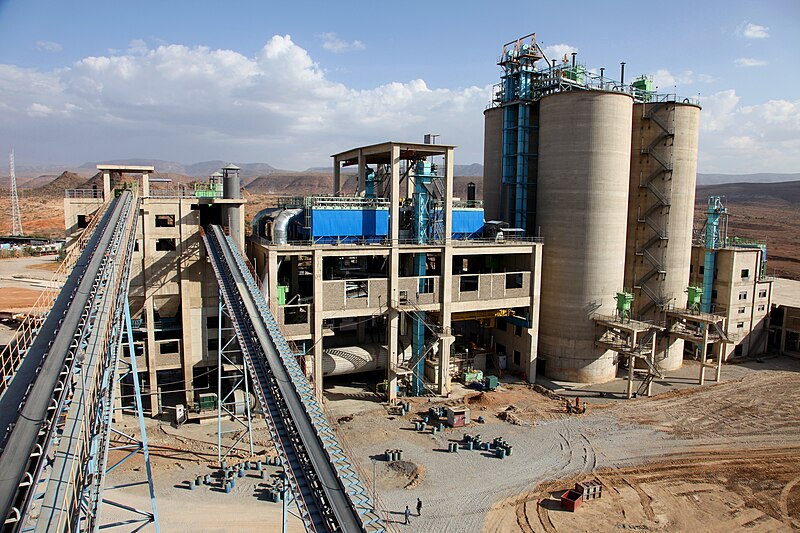
As the need for concrete in Ethiopia's construction industry grows, so too has the National Cement Share Company. Its new plant in the east of the country will increase its production by six times. British investment – through the UK's development finance firm CDC – has helped the company to build the new factory, supporting its ambitions to expand. |
| Date | |
| Source | A factory fit for the future |
| Author | DFID - UK Department for International Development |
| Camera location | | View this and other nearby images on: OpenStreetMap |
|---|
Licensing
This file is licensed under the Creative Commons Attribution 2.0 Generic license.
Attribution: Gavin Houtheusen/Department for International Development
- You are free:
- to share – to copy, distribute and transmit the work
- to remix – to adapt the work
- Under the following conditions:
- attribution – You must give appropriate credit, provide a link to the license, and indicate if changes were made. You may do so in any reasonable manner, but not in any way that suggests the licensor endorses you or your use.
This file is licensed under the Creative Commons Attribution 3.0 Unported license.
Attribution: Gavin Houtheusen/Department for International Development
- You are free:
- to share – to copy, distribute and transmit the work
- to remix – to adapt the work
- Under the following conditions:
- attribution – You must give appropriate credit, provide a link to the license, and indicate if changes were made. You may do so in any reasonable manner, but not in any way that suggests the licensor endorses you or your use.
.svg)
|
This file is licensed under the Open Government Licence version 1.0 (OGL v1.0).
|
|---|---|
| Attribution:Gavin Houtheusen/Department for International Development | |
|
You are free to:
See the Open Government Licence page on Meta-Wiki for more information.
|
| This image, originally posted to Flickr, was reviewed on 25 January 2014 by the administrator or reviewer File Upload Bot (Magnus Manske), who confirmed that it was available on Flickr under the stated license on that date. |
File history
Click on a date/time to view the file as it appeared at that time.
| Date/Time | Thumbnail | Dimensions | User | Comment | |
|---|---|---|---|---|---|
| current | 04:24, 25 January 2014 | | 5,616 × 3,744 (12.31 MB) | wikimediacommons>File Upload Bot (Magnus Manske) | Transferred from Flickr by User:russavia |
File usage
The following 3 pages use this file: