File:Figur Ludwig IX. (Frankreich).jpg
Jump to navigation
Jump to search

Size of this preview: 354 × 599 pixels. Other resolutions: 142 × 240 pixels | 283 × 480 pixels | 454 × 768 pixels | 605 × 1,024 pixels | 2,080 × 3,520 pixels.
Original file (2,080 × 3,520 pixels, file size: 2.64 MB, MIME type: image/jpeg)
This file and its description are from Wikimedia Commons.
Object
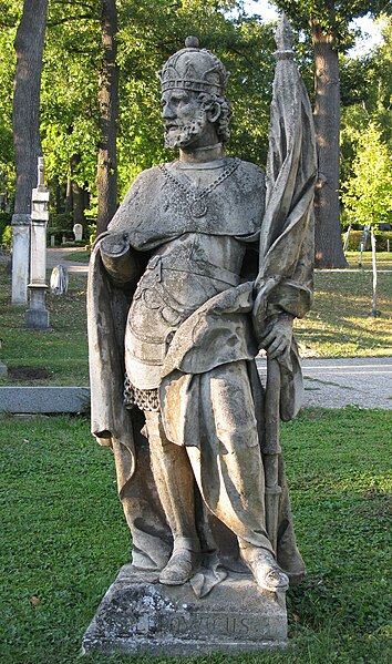
| Description |
Deutsch: Figur hl. Ludwig |
| Date | 1759 |
| Current location |
Hütteldorf |
| Inscriptions | ST. LUDOWICUS |
Photograph
| Date | |||
| Source | Own work | ||
| Author | Alfie↑↓© | ||
| Permission (Reusing this file) |
I, the copyright holder of this work, hereby publish it under the following licenses: This file is licensed under the Creative Commons Attribution-Share Alike 3.0 Austria license.

You may select the license of your choice. |

| Camera location | | View this and other nearby images on: OpenStreetMap |
|---|
.jpg¶ms=048.204766_N_0016.245164_E_globe:Earth_type:camera_alt:246_source:exif_heading:350.65&language=en)
| Object location | | View this and other nearby images on: OpenStreetMap |
|---|
.jpg¶ms=048.204767_N_0016.245164_E_globe:Earth_class:object_type:object_region:AT-9_scale:2500_&language=en)
File history
Click on a date/time to view the file as it appeared at that time.
| Date/Time | Thumbnail | Dimensions | User | Comment | |
|---|---|---|---|---|---|
| current | 23:40, 2 October 2011 | | 2,080 × 3,520 (2.64 MB) | wikimediacommons>Alfie66 | {{Information |Description={{de|Figur hl. Ludwig (Inschrift: „ST. LUDOWICUS“}} <!--{{en|Hier englische Beschreibung einfügen}}--> {{Denkmalgeschütztes Objekt Österreich|1=26821}} |Source={{own}} |Date=2011-10-02 |Author=[[User:Alfie66|<span style=" |
File usage
The following page uses this file:
.jpg)