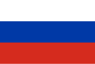
File:Flag of Russia.svg

Original file (SVG file, nominally 900 × 600 pixels, file size: 265 bytes)
Summary
| Description |
Русский: Государственный флаг Российской Федерации.
Авар: Россиялъул байрахъ
Azərbaycanca: Русија бајрағы
Башҡортса: Рәсәй флагы
Беларуская: Сцяг Расіі
Беларуская (тарашкевіца): Сьцяг Расеі
Brezhoneg: Banniel Rusia
Буряад: Ородой Холбооной Улас гyрэнэй туг
Нохчийн: Байракх Россе
Qırımtatarca: Rusiye bayrağı
Къырымтатарджа (Кирилл): Русие байрагъы
Чӑвашла: Раҫҫей ялавӗ
Cymraeg: Baner Rwsia
Deutsch: Flagge Russlands
English: Flag of Russia
Ελληνικά: Σημαία της Ρωσίας
Esperanto: Flago de Rusio
Español: Bandera de Rusia
فارسی: پرچم روسیه
Suomi: Venäjän lippu
Français : Drapeau de Russie
𐌲𐌿𐍄𐌹𐍃𐌺: 𐍆𐌰𐌽𐌰 𐍂𐌿𐍃𐌰𐌻𐌰𐌽𐌳𐌹𐍃
Ἀρχαία ἑλληνικὴ: Τὸ τῆς Ρωσσικῆς Ὁμοσπονδίας σημεῖον
Hrvatski: Zastava Rusije
Հայերեն: Ռուսաստանի դրոշը
Interlingua: Bandiera de Russia
Interlingue: Flagga de Russia
Ido: Standardo di Rusia
Italiano: Bandiera della Russia
日本語: ロシアの国旗
La .lojban.: lanci be la rukygu'e
ქართული: რუსეთის დროშა
Қазақша: Ресей байрағы
한국어: 러시아의 국기
Къарачай-малкъар: Эресейни байрагъы
Коми: Рочму дӧрапасыс
Кыргызча: Орусия туусу
Latina: Vexillum Russiae vel Rossiae
Лакку: Аьрасатнал ттугь
Лезги: Урусатдин пайдах
Lingua Franca Nova: Bandera de Rusia
文言:俄羅斯之旗
Мокшень: Рузмасторонь котфоц
Олык марий: Российын тистыже
Молдовеняскэ: Стягул Русией
Кырык мары: Российн йолажы
Эрзянь: Россиянь коцтось
Nederlands: Vlag van Rusland
Norrǿna: Þjóðfáni Garða
Novial: Flage de Rusia
Ирон: Уӕрӕсе тырыса
Давнѣрусскiй: Знамя Росii
Polski: Flaga Rosji
Ποντιακά: Το ρουσικόν η σημαία
Português: Bandeira da Rússia
Română: Drapelul Rusiei
Кӣллт са̄мь кӣлл: Рӯшш фла̄гк
Svenska: Rysslands flagga
Татарча / tatarça: Русия флагы
Тоҷикӣ: Парчами Русия
Türkmençe: Russiýa baýdagy
Удмурт: Россилэн флагез
Українська: Прапор Росії
Oʻzbekcha / ўзбекча: Rossiya bayrogʻi
Vepsän kel’: Venäman flag
Volapük: Stän Rusäna
Хальмг/ᡆᡕᡅᠷᠠᡑ: Туг Әрәсә
ייִדיש: פאן רוסלאנד'ס
中文(简体):俄罗斯国旗
中文(繁體):俄羅斯國旗 |
||||||||||||
| Date | 1696-1918, 1993-12-11 | ||||||||||||
| Source | Государственный флаг Российской Федерации. Цвета флага: (Blue - Pantone 286 C, Red - Pantone 485 C) взяты из [1][2][3][4] | ||||||||||||
| Author | Zscout370 | ||||||||||||
| Permission (Reusing this file) |
|
||||||||||||
| SVG development | This flag was created with a text editor. Please do not replace the simplified code of this file with a version created with Inkscape or any other vector graphics editor | ||||||||||||
| Source code | SVG code<svg xmlns="http://www.w3.org/2000/svg" viewBox= "0 0 9 6" width="900" height="600">
<path d="m0 0h9v2H0" fill="#fff"/>
<path d="m0 2h9v2H0" fill="#0039a6"/>
<path d="m0 4h9v2H0" fill="#d52b1e"/>
</svg>
|
||||||||||||


Licensing
This work is not an object of copyright according to article 1259 of Book IV of the Civil Code of the Russian Federation No. 230-FZ of December 18, 2006.
Shall not be objects of copyright:
|
 | |
|
Comment – This license tag is also applicable to official documents, state symbols and signs of the Russian Soviet Federative Socialist Republic and the Union of Soviet Socialist Republics (union level[1]).
Warning – This license tag is not applicable to drafts of official documents, proposed official symbols and signs, which can be copyrighted. Warning – This Russian official document, state symbol or sign (postage stamps, coins and banknotes mainly) may incorporate one or more works that can be copyrightable if separated from this document, symbol or sign. In such a case, this work is not an object of copyright if reused in its entirety but, at the same time, extracting specific portions from this work could constitute copyright infringement. For example, the denomination and country name must be preserved on postage stamps.
|
Colors
| Scheme | White | Blue | Red |
|---|---|---|---|
| RAL | 9016 | 5005 | 3028 |
| Pantone | White | 286 C | 485 C |
| RGB | 255–255–255 | 0–50–160[1] | 218–41–28[2] |
| CMYK | 0–0–0–0 | 100–80–0–12[1] | 0–95–100–00[2] |
| HTML | #FFFFFF | #0032A0 | #DA291C |
| Flag colors: | ||
| white | rendered as RGB 255 255 255 | Pantone Clear white |
| blue | rendered as RGB 0 57 166 | Pantone 286 C |
| red | rendered as RGB 213 43 30 | Pantone 485 C |
SVG source (version of 01:15, 12 August 2012; 229 bytes):
<svg xmlns="http://www.w3.org/2000/svg" viewBox="0 0 9 6" width="900" height="600">
<rect fill="#fff" width="9" height="3"/>
<rect fill="#D52B1E" y="3" width="9" height="3"/>
<rect fill="#0039A6" y="2" width="9" height="2"/>
</svg>
Derivative Works
Derivative works of this file:
- Flag of Canada and Russia.svg
- Flag of Russia and Germany.svg
- Flag of Russia with border.svg
- Flag of Sweden and Russia.png
- ↑ a b Pantone 286 C archive copy at the Wayback Machine
- ↑ a b Pantone 485 C archive copy at the Wayback Machine
File history
Click on a date/time to view the file as it appeared at that time.
| Date/Time | Thumbnail | Dimensions | User | Comment | |
|---|---|---|---|---|---|
| current | 01:15, 12 August 2012 | | 900 × 600 (265 bytes) | wikimediacommons>Zscout370 | from http://commons.wikimedia.org/wiki/File:Flag_of_Russia_%28GOST%29.svg (see talk page for the color discussion and also using the colors from the Pantone color finder, which is on the talk page). |
File usage
More than 100 pages use this file. The following list shows the first 100 pages that use this file only. A full list is available.
- 2nd 3D Workshop Garching
- Asia
- Contributors
- Cs:Jednoduché 3D budovy
- Et:Key:highway
- Europe
- F3DB Workshop Erlangen
- Foundation/Local Chapters
- Google+
- Highway:International equivalence
- How do you map in
- How do you map in/Russia
- Key:isced:level
- Key:payment:*
- Key:protect class
- Ko:Tag:highway=motorway
- List of territory based projects
- OSM tags for routing/Maxspeed
- OpenStreetMap in the media/2008
- OpenStreetMap in the media/2011
- Past Events 2012
- Past Events 2013
- Past Events 2014
- Past Events 2015
- Perm Group
- Pl:Schemat tagowania budynków 3D
- Planet.osm
- Press Contacts
- Pt:Highway:International equivalence
- Pt:Tag:boundary=administrative
- Servers
- Sq:Key:highway
- State of the Map Europe 2011/Who's going?
- Tag:bicycle road=yes
- Tag:boundary=administrative
- Tag:highway=motorway
- Tag:route=train
- Taginfo/Sites
- WikiProject Metro systems
- WikiProject Piste Maps
- User:ALexeyAL1
- User:Alexey.noskov
- User:AquaGen
- User:Canabis
- User:CupIvan
- User:Danidin9
- User:Dr&mx
- User:E asphyx
- User:Emsch
- User:Eugene
- User:FinWonder
- User:Grin
- User:Guanchzhou
- User:Ivansanchez/sandbox
- User:Kudrdima
- User:Lzhl
- User:Magomogo
- User:Marek kleciak
- User:Miroff
- User:Mtikhomirov
- User:Otnow
- User:OverQuantum
- User:Pokakukam
- User:Positron96
- User:Ruuvi
- User:Scondo
- User:Shurik
- User:Skippern/World
- User:Tago/Key:protected nature
- User:Tornado89
- User:UR3IRS
- User:Vadimi
- User:Vanyok
- User:Xande
- User:Zverik
- User:Зелёный Кошак
- Template:Countries of Asia
- Template:Countries of Europe
- Template:Highway:International equivalence
- Template:RU:проект Роcсия
- Template:TaginfoLinks
- Template:TaginfoLinks/doc
- Template:User Russia
- DE:Simple 3D Buildings
- DE talk:Tag:historic=castle
- FR:Contacts pour la presse
- FR:Highway:International equivalence
- ES:Fundación/Capítulos locales
- IT:Contributors
- IT:Key:boundary
- IT:Key:highway
- RU:Key:highway
- RU:OpenStreetMap in the media
- RU:State of the Map Europe 2011
- RU:Tag:boundary=protected area
- RU:WikiProject Piste Maps
- RU:Дорожные знаки России
- RU:Россия
- RU:Россия/Карты России
- JA:Key:payment
View more links to this file.