File:Fontaines Salees thermae 01.jpg
Jump to navigation
Jump to search


Size of this preview: 800 × 534 pixels. Other resolutions: 320 × 213 pixels | 640 × 427 pixels | 1,024 × 683 pixels.
Original file (1,024 × 683 pixels, file size: 211 KB, MIME type: image/jpeg)
This file and its description are from Wikimedia Commons.
|
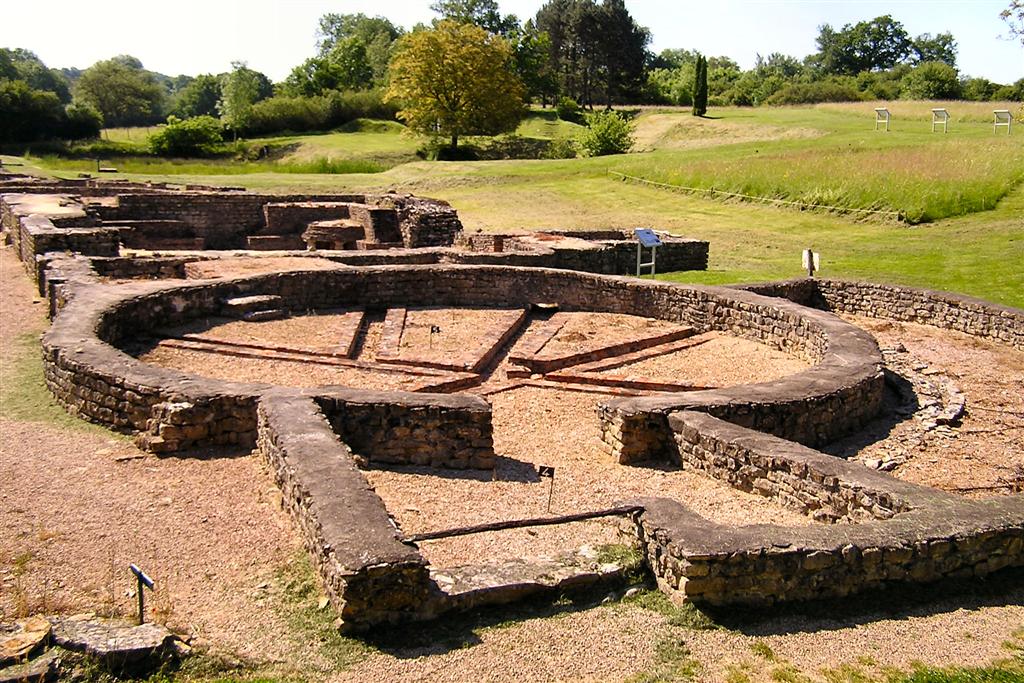
This building is indexed in the base Mérimée, a database of architectural heritage maintained by the French Ministry of Culture, under the reference PA00113837
|
| Description |
English: Fontaines Salées archeological site, shared between Saint-Père (Nièvre) and Foissy-lès-Vézelay (Yonne), Bourgogne, France. Thermae ruins, view towards the south-east. Français : Le site archéologique des Fontaines salées, à cheval entre Foissy-lès-Vézelay et le sud de la commune de Saint-Père, Yonne, Bourgogne, France. Ruines des thermes. Vue vers le sud-est. La rivière Cure coule derrière les arbres du côté gauche de la photo. |
| Date | |
| Source | Own work |
| Author | Emmanuel Brunner |
| Camera location | | View this and other nearby images on: OpenStreetMap |
|---|
| Object location | | View this and other nearby images on: OpenStreetMap |
|---|
This file is licensed under the Creative Commons Attribution-Share Alike 1.0 Generic license.
- You are free:
- to share – to copy, distribute and transmit the work
- to remix – to adapt the work
- Under the following conditions:
- attribution – You must give appropriate credit, provide a link to the license, and indicate if changes were made. You may do so in any reasonable manner, but not in any way that suggests the licensor endorses you or your use.
- share alike – If you alter, transform, or build upon this work, you must distribute the resulting work under the same license as the original.
Original upload log
The original description page was here. All following user names refer to fr.wikipedia.
- 2006-06-18 18:04 Manu25 1024×683×8 (215780 bytes) BRUNNER Emmanuel
File history
Click on a date/time to view the file as it appeared at that time.
| Date/Time | Thumbnail | Dimensions | User | Comment | |
|---|---|---|---|---|---|
| current | 17:36, 18 July 2008 | | 1,024 × 683 (211 KB) | wikimediacommons>Methos31 | {{Information| |Description={{fr|Ruines des thermes, Site archéologique des Fontaines Salées, Saint-Père (Yonne), France}} {{en|Thermae ruins, Fontaines Salées archeological site, Saint-Père (Yonne), France}} |Source=own work |Date=June 2006 |Author= |
File usage
The following page uses this file: